
TerraMosaic Daily Digest: September 23, 2026
Daily Summary
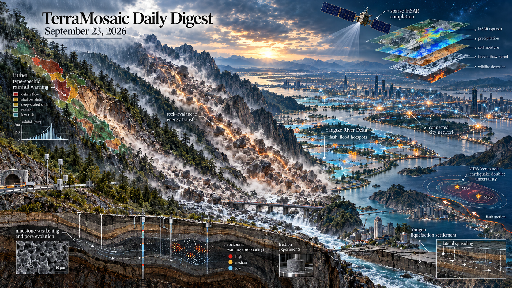
Landslide studies move from regional averages toward mechanism- and type-specific warning. A Hubei framework predicts the likely landslide type within each slope unit before applying type-specific rainfall thresholds, improving the effectiveness index by 9.6% and reducing missed alarms by 11.4%. Field-constrained simulations of three rock avalanches show that repeated collisions transfer kinetic energy from the rear toward the front, where 62.4% of peak kinetic energy is concentrated. Complementary work links red-bed mudstone weakening to mineral dissolution, clay transformation and pore evolution, while seismic records and discrete-element modeling reconstruct the three-stage motion of the catastrophic 2025 Junlian failures.
Flood research expands from local susceptibility to connected exposure and decision structure. Analysis of 89,468 US flash-flood records separates persistent county-level backbones from annually activated hotspots and adjacent transition zones. In the Yangtze River Delta, a city interaction network adds predictive information beyond local attributes and identifies structurally critical cities without treating connectivity as proof of causal flood propagation. Henan flood-loss estimation combines historical damage and social-media signals, while national exposure assessment, crop-specific flood-regulation modeling and real-time spectral discharge estimation connect hazard intensity to populations, ecosystem services and operations.
Earthquake and ground-failure studies increasingly quantify uncertainty across source, site and consequence. Four-track Sentinel-1 data, catalog relocation and conditional stress calculations constrain the 2026 Venezuela earthquake doublet while retaining source non-uniqueness. Deep-fault friction experiments resolve stress-dependent stick-slip in Tanlu granitic gneiss; shaking-table tests bound liquefaction of repository backfill; and a Yangon assessment combines 154 boreholes, probabilistic seismic hazard and geostatistics to map settlement of 0.3-0.7 m and lateral displacement locally exceeding 1 m. Acoustic-emission and imaging data further convert rockburst warning from deterministic indicators to spatiotemporal probabilities.
Observation systems are being designed around missing coverage and deployment constraints. Sparse InSAR activity is completed as a relative, environmentally conditioned score before being fused with landslide susceptibility, increasing the number of affected slope units captured by moderate-to-high classes from 12 to 17 of 25. A 75-year multilayer freeze-thaw dataset, a 45-year station-assimilating precipitation analysis and satellite soil-moisture calibration extend process records beyond individual events. Terrain-gated landslide segmentation, satellite-edge wildfire detection, MT-InSAR stabilization, crevasse mapping and physics-guided environmental retrievals broaden the monitoring stack while preserving sensor geometry and environmental context.
Key Trends
The collection is defined by explicit heterogeneity: hazard type, material state, network position and observation coverage are becoming model variables rather than residual uncertainty.
- Regional warnings are being stratified by failure mechanism: Landslide type, rock-avalanche collision pathways, mudstone deterioration and fault-damage history determine thresholds and mobility more directly than a single regional susceptibility score.
- Risk is being modeled as a connected system: City interaction networks, county hotspot backbones, national exposure layers and multi-disaster governance frameworks treat spatial dependence and institutional response as part of the hazard problem.
- Observational gaps are becoming explicit model components: Sparse InSAR completion, macroseismic source reconstruction, ambient-noise groundwater sensing and multi-track deformation inversion make missing geometry and incomplete records visible in the inference.
- Uncertainty is moving into operational outputs: Early-warning effectiveness, missed alarms, source non-uniqueness, probabilistic rockburst location and post-liquefaction deformation are reported in forms that support decisions rather than only model comparison.
- Long records are linking events to changing baselines: Freeze-thaw, precipitation, typhoon-wave and sediment datasets extend hazard forcing across decades while retaining vertical, temporal or event-level structure.
Selected Papers
The 23 September selection is led by landslide-type-specific rainfall warning, collision-mediated energy transfer in rock avalanches, seismic reconstruction of the Junlian long-runout failures, water-rock deterioration of red-bed mudstone and InSAR-conditioned susceptibility enhancement. Companion studies address flash-flood hotspot persistence, networked urban flood risk, earthquake-doublet source trade-offs, probabilistic rockburst warning, urban liquefaction, freeze-thaw data, subsidence, storm surges and deployable Earth-observation methods.
1. Differentiated landslide early warning in geologically complex regions: Integrating deep learning-based type prediction with type-specific rainfall thresholds
Core Problem: Uniform rainfall thresholds ignore type-dependent triggering, while type-specific thresholds cannot be operationalized without predicting the likely failure type of each slope unit.
Key Innovation: Links deep-learning type prediction for 12,677 Hubei landslides with type-specific rainfall thresholds, improving the effectiveness index by 9.6% and reducing missed alarms by 11.4%.
2. Investigation of collision mechanism and energy transfer during rock avalanches failure process
Core Problem: The particle-scale mechanism sustaining high mobility and long runout in rock avalanches remains incompletely understood.
Key Innovation: Field-constrained DEM simulations of three events show progressive rear-to-front collision transfer, valley-confinement effects and a frontal-zone contribution of 62.4% of peak kinetic energy.
3. Failure mechanism analysis of the catastrophic Junlian landslide in Southwestern China based on seismic signal analysis and numerical simulation
Core Problem: Sudden long-runout failures rarely have continuous observations sufficient to reconstruct their movement stages and initiation mechanics.
Key Innovation: Combines landslide seismic signals, DEM simulation and limit-equilibrium analysis for the 2025 Junlian events, resolving three motion stages and rear-crack/friction controls with explicit velocity uncertainty.
4. Interpretable Spatial Completion of Sparse InSAR-Derived Activity for Enhanced Landslide Susceptibility Zonation
Core Problem: Mountainous terrain produces discontinuous InSAR coverage, limiting the use of recent deformation in otherwise static susceptibility maps.
Key Innovation: Completes sparse slope-oriented activity with repeated proxy-reference sampling and integrates the relative activity score into slope-unit susceptibility, increasing captured affected units from 12 to 17 of 25.
5. The 24 June 2026 Earthquake Doublet in Northwestern Venezuela: Joint Hypocentral Determination, Fault-Zone Tomography and Four-Track Sentinel-1 Constraints on Rupture Geometry, Slip and Stress Transfer
Core Problem: Rapidly spaced earthquakes create source non-uniqueness that cannot be resolved from a single geodetic or seismic constraint.
Key Innovation: Combines catalog relocation, fault-zone tomography, four-track Sentinel-1 inversion and conditional stress scenarios to constrain the 2026 Venezuela doublet while quantifying unresolved source trade-offs.
6. Multiscale deterioration mechanism of red-bed mudstone under water-rock interaction and its implications for landslide failure
Core Problem: Water–rock reactions progressively weaken red-bed mudstone, but the link from mineral reactions and pore evolution to macroscopic strength loss is poorly resolved.
Key Innovation: Integrates microscopy, mineralogy, ion chemistry and mechanical tests to connect dissolution, clay transformation and pore-shape evolution with soaking-time strength decay and landslide failure.
7. Flood damage estimation and disaster perception using multi-source data: a case study of Henan, China
Core Problem: Rapid flood-loss estimation and public-perception attribution are usually treated separately and remain costly to update.
Key Innovation: Combines a price-adjusted GA–BP loss model with social-media extraction and sentiment attribution; the Henan case reduces reported loss-estimation error substantially.
8. Flash-flood clustering and hotspot dynamics in the contiguous United States, 2000-2024
Core Problem: Long-term flash-flood burden and annually shifting hotspots are not resolved consistently at county scale across the United States.
Key Innovation: Analyzes 89,468 events across 3,100 counties from 2000–2024, separating persistent backbones, annual activation and adjacent transition zones for tiered management.
9. Urban flood risk and the structural importance of cities in a spatial interaction network: evidence from the Yangtze River Delta Urban Agglomeration
Core Problem: City-level flood assessments overlook dependencies created by adjacency and upstream–downstream connectivity.
Key Innovation: Builds a spatial interaction network and staged XGBoost models for the Yangtze River Delta, showing incremental predictive value from network structure without claiming causal propagation.
10. Spatiotemporal Probabilistic Early Warning of Rockburst Based on Acoustic Emission and Visual Imaging Data from True Triaxial Experiments
Core Problem: Deterministic indicators do not quantify when and where rockburst failure is most likely.
Key Innovation: Fuses acoustic-emission timing with image-based spatial probabilities in true-triaxial tests, issuing a warning 408.5 s before failure and reaching 90% maximum spatial accuracy.
11. Liquefaction Hazard Assessment of Yangon, Myanmar, Based on Probabilistic Seismic Analysis and Evaluation of Liquefaction Induced by the 28 March 2025 Mw 7.7 Earthquake
Core Problem: Yangon requires spatially continuous liquefaction and post-liquefaction deformation estimates tied to both probabilistic hazard levels and the 2025 Mandalay earthquake.
Key Innovation: Combines 154 boreholes, 3D Bayesian kriging, PSHA and SPT procedures to map settlement of 0.3–0.7 m and local lateral displacement exceeding 1 m.
12. MTGF-SAM: Multi-Level Terrain-Gated Fusion of Segment Anything Model for Landslide Detection in Remote Sensing Imagery
Core Problem: Optical ambiguity, small targets and irregular boundaries cause SAM-based landslide masks to confuse bare soil, roads and shadows.
Key Innovation: Adapts SAM3 with four terrain-aware modules and DEM-derived cues, raising Bijie IoU from 0.6146 to 0.7458 and reporting consistent gains across three landslide datasets.
13. Invited Perspectives: Science for Comprehensive Disaster and Climate Risk Management
Core Problem: Fragmented risk practice struggles to represent interacting climatic and non-climatic hazards and risk drivers.
Key Innovation: Organizes five scientific and governance challenges for comprehensive disaster and climate risk management and proposes routes for overcoming them.
14. A methodological workflow for the identification of earthquake sources from macroseismic data
Core Problem: Historical and early-instrumental earthquakes often lack direct source constraints needed for realistic shaking scenarios.
Key Innovation: Combines macroseismic-field preprocessing with earthquake-parameter revision and demonstrates source identification across instrumental and historical cases.
15. A knowledge-guided daily multi-layer soil freeze-thaw dataset for the Northern Hemisphere during 1950-2025
Core Problem: Satellite-era records are too short to resolve multidecadal freeze–thaw change and its propagation with soil depth.
Key Innovation: Publishes daily 0.1° freeze–thaw states for 1950–2025 at 10, 30 and 50 cm using a knowledge-guided neural network evaluated at 86–90% accuracy.
16. The Canadian Surface Reanalysis (CaSR) v3.2 precipitation dataset: a 45-year high-resolution analysis for North America (1980-2024)
Core Problem: Long, high-resolution precipitation fields remain unreliable in measurement-sparse parts of North America.
Key Innovation: Provides a 45-year station-assimilating North American precipitation analysis that improves on the prior version and common reanalyses, especially in sparse regions.
17. Modelling storm-induced coastal exposure using hindcast wave data in a densely urbanised coastal area
Core Problem: Dense urban coasts can shift abruptly between exposure states under small run-up changes, requiring detailed morphology and long storm records.
Key Innovation: Combines a 43-year wave hindcast, high-resolution terrain and 40 simulated extreme storms to derive site-specific coastal-exposure thresholds for the Ligurian Riviera.
18. Frictional Properties of Granite Gneiss Recovered from Deep Drilling in Tanlu Fault Zone: Effect of Normal Stress and Implications for Seismicity
Core Problem: Frictional stability of the Xinyi–Sihong segment of the Tanlu Fault Zone is poorly constrained despite evidence of stress accumulation.
Key Innovation: Deep-drilling samples exhibit stick–slip at 60 MPa and a localized cone-shaped slip zone, supplying laboratory constraints on stress-dependent instability nucleation.
19. Shaking Table Tests on Liquefaction Potential of a Saturated Sand-Claystone Backfill for Radioactive Waste Repository
Core Problem: Low-confinement seismic response of full-granulometry sand–claystone backfill is uncertain for the early operational stage of a deep radioactive-waste repository.
Key Innovation: Metric-scale shaking-table tests show negligible liquefaction under the investigated site hazard but failure under amplified shaking, exposing scale and strain-history effects for constitutive calibration.
20. Typhoon-Driven Near-Surface Groundwater Dynamics Revealed by Ambient Noise in the Mountain Watershed
Core Problem: Typhoon-driven shallow groundwater transients in mountain watersheds are difficult to observe continuously at slope-relevant scales.
Key Innovation: Uses ambient-noise observations to resolve near-surface groundwater dynamics during typhoon forcing.
21. North Sea Storm Surges Amplified by Oscillations Triggered by Preceding Storms
Core Problem: Successive storms can leave basin oscillations that alter the surge generated by a later storm.
Key Innovation: Quantifies how oscillations triggered by preceding storms amplify subsequent North Sea storm surges.
22. Combined Agro-Hydrological and Flood Modeling Highlights Seasonal and Crop-Specific Flood Regulating Ecosystem Services
Core Problem: Abstract Flood‐Regulating Ecosystem Services (FRES) are widely used to assess the capacity of ecosystems in retaining water during a storm and mitigating hydrological extremes.
Key Innovation: This study presents an approach to assess the seasonality of crop‐specific FLOod Regulating Agro‐Ecosystem Services (FLORAES).
23. Detecting and assessing salt dissolution-induced subsidence in an urban area using open-access remote-sensed data (Monóvar, SE Spain)
Core Problem: Title-level focus: identifies the need to detect and assess salt-dissolution subsidence using accessible remote-sensing observations.
Key Innovation: Title-signalled approach or contribution: The title reports an open-data urban case study in Monóvar, Spain; public metadata did not expose methods, validation or quantitative results. Methods, data and results could not be assessed because no reliable abstract was available.
24. Multi-scale controls of cumulative fault damage on the formation and spatio-temporal distribution of landslides in the Qinling-Daba Mountains, China
Core Problem: Title-level focus: identifies how accumulated fault damage controls landslide formation and its spatial and temporal organization across mountain scales.
Key Innovation: Title-signalled approach or contribution: The title reports a Qinling–Daba Mountains analysis; public metadata did not expose methods, validation or quantitative results. Methods, data and results could not be assessed because no reliable abstract was available.
25. Protective role of Mediterranean vegetation in rainfall-induced shallow landslide initiation: Insights from Gioiosa Marea (Sicily, Italy)
Core Problem: Title-level focus: identifies how Mediterranean vegetation modifies rainfall-induced shallow-landslide initiation.
Key Innovation: Title-signalled approach or contribution: The title reports a Sicily case study of vegetation's protective role; public metadata did not expose methods or quantitative results. Methods, data and results could not be assessed because no reliable abstract was available.
26. Evaluating National Population and Built-Environment Exposure to Fluvial and Pluvial Flooding
Core Problem: Title-level focus: identifies the need to jointly quantify population and built-environment exposure to fluvial and pluvial flooding.
Key Innovation: Title-signalled approach or contribution: The title reports a national exposure evaluation; public metadata did not expose country, methods or quantitative results. Methods, data and results could not be assessed because no reliable abstract was available.
27. DKF-YOLO: Dynamic Kernel Fusion with Attention-Guided Feature Interaction for Landslide Detection in Complex Terrains
Core Problem: Title-level focus: identifies complex-terrain landslide detection under variable spatial context as the target problem.
Key Innovation: Title-signalled approach or contribution: The title reports dynamic-kernel fusion with attention-guided feature interaction; public metadata did not expose datasets or quantitative validation. Methods, data and results could not be assessed because no reliable abstract was available.
28. Remote sensing of hydrothermal alteration in active volcanic environments: A critical review and integrated analysis of Lastarria volcano
Core Problem: Title-level focus: identifies the need to distinguish hydrothermal alteration patterns in active volcanic environments.
Key Innovation: Title-signalled approach or contribution: The title reports a critical review and an integrated Lastarria-volcano analysis; the acquired abstract did not match the bibliographic title, so no methods or results are inferred. Methods, data and results could not be assessed because no reliable abstract was available.
29. Mixed Scanning as a Heuristic Framework for Knowledge Co-Production in Multiple-Disaster Contexts: Application in a rapidly developing city, Semarang, Indonesia
Core Problem: Title-level focus: identifies the problem signaled by: Mixed Scanning as a Heuristic Framework for Knowledge Co-Production in Multiple-Disaster Contexts: Application in a rapidly developing city, Semarang, Indonesia.
Key Innovation: Title-signalled approach or contribution: The title identifies the study direction, but the available public metadata do not expose methods, validation or quantitative results. Methods, data and results could not be assessed because no reliable abstract was available.
30. Dynamic risk assessment of water inrush from coal seam roof by coupling numerical modeling of groundwater flow and static risk model: a case study in Southwest China
Core Problem: Title-level focus: identifies the problem signaled by: Dynamic risk assessment of water inrush from coal seam roof by coupling numerical modeling of groundwater flow and static risk model: a case study in Southwest China.
Key Innovation: Title-signalled approach or contribution: The title identifies the study direction, but the available public metadata do not expose methods, validation or quantitative results. Methods, data and results could not be assessed because no reliable abstract was available.
31. Lightweight Hierarchical Multimodal AI for Satellite-Edge Earth Observation: A Wildfire Detection Use Case
Core Problem: Title-level focus: identifies the problem signaled by: Lightweight Hierarchical Multimodal AI for Satellite-Edge Earth Observation: A Wildfire Detection Use Case.
Key Innovation: Title-signalled approach or contribution: The title identifies the study direction, but the available public metadata do not expose methods, validation or quantitative results. Methods, data and results could not be assessed because no reliable abstract was available.
32. Modality-Semantic Reliability in VLM-Based Temporal Landslide Explanation: A Rule-Constrained and DEM-Aware Alignment Framework
Core Problem: Title-level focus: identifies the risk of unreliable multimodal explanations for temporal landslide evolution.
Key Innovation: Title-signalled approach or contribution: The title reports rule-constrained, DEM-aware alignment for vision-language explanations; public metadata did not expose evaluation evidence. Methods, data and results could not be assessed because no reliable abstract was available.
33. PR-Smoother: Simulator-Preserving Non-Gaussian Smoothing for Data Assimilation
Core Problem: Many physical data assimilation (DA) workflows require smoothing methods that represent non-Gaussian posteriors over physical state variables, scale to high-dimensional simulators, train from observation windows alone, and remain compatible with calibration of the prescribed simulator.
Key Innovation: We introduce PR-Smoother, a simulator-preserving amortized smoother designed for this prescribed-simulator DA regime.
34. SatUnreal: A High-Precision Synthetic Dataset for Satellite Stereo Matching via Unreal Engine
Core Problem: 3D reconstruction from satellite imagery is essential for large-scale topographic analysis, yet the lack of high-fidelity training datasets with accurate occlusion labels remains a primary bottleneck.
Key Innovation: In this paper, we propose SatUnreal, a high-precision synthetic dataset designed to fundamentally overcome these limitations through an Unreal Engine-based simulation pipeline.
35. PhyMo: A Physical-Field Modality for Multimodal AI4Physics
Core Problem: However, existing approaches typically represent physical quantities and governing equations as generic numerical or textual tokens, overlooking the physical constraints that determine their spatiotemporal interactions.
Key Innovation: To address this limitation, we introduce the \textbf{physical-field modality} and propose \textbf{PhyMo}, a physics-grounded multimodal framework that organizes heterogeneous measurements through PDE-associated operators.
36. 3-D thermomechanical geodynamic modelling of heating and volcanism in the Massif Central (France) and Eifel Volcanic Region (Germany)
Core Problem: The French Massif Central and the Eifel Volcanic Field represent two of the enigmatic features in France and Germany, respectively.
Key Innovation: Both areas have been affected by Cenozoic volcanism whose origin is still debated.
37. A comparative assessment of global building and settlement datasets across geographic and settlement contexts
Core Problem: Evidence on global building and settlement products is fragmented across regions, reference data, resolutions and evaluation protocols.
Key Innovation: Benchmarks seven products across 135 study areas with detection, geometry and aggregate-quantity metrics, exposing resolution, density and temporal-alignment effects relevant to exposure mapping.
38. Benchmarking Hyperspectral Foundation Models for Hyperspectral Unmixing
Core Problem: This might partly be due to the fact that most of them rely on vision transformer backbones, including patchification, leading to a feature resolution problem.
Key Innovation: These models are trained on large unlabeled datasets and exhibit strong performance on many hyperspectral imaging tasks, such as classification or denoising.
39. Shape matters: DEM investigation of geometry-controlled mechanical response in irregular rock fragments under static and dynamic loading
Core Problem: Mechanical characterization of subsurface rock formations typically requires standardized cylindrical core specimens, which are often unavailable from fractured or unconventional reservoir sequences.
Key Innovation: Results show that force-based quantities are strongly controlled by the surface-area-to-volume (SA/V) ratio under static loading (Adj.
40. VLM2GeoVec: Toward Universal Multimodal Embeddings for Remote Sensing
Core Problem: Satellite imagery differs from natural images in viewpoint, resolution, scale variation, and the prevalence of small objects -- demanding both region-level spatial reasoning and holistic scene understanding.
Key Innovation: To bridge this gap, we introduce \textbf{RSMEB}, a unified remote sensing benchmark that evaluates cross-modal and interleaved retrieval across 21 tasks under a single ranking protocol, enabling comprehensive comparison of retrieval models on region- and geo-aware capabilities as well as conventional retrieval.
41. A novel experimental method designed for direct measurement of the critical buckling load of piles in liquefied ground
Core Problem: Accurately measuring the critical buckling load (Pcr) of piles in fully liquefied ground remains a significant challenge, as existing dynamic tests can only observe the buckling phenomenon rather than provide a direct and quantitative load threshold.
Key Innovation: This study proposes a novel experimental method for the direct measurement of critical buckling load under coupled axial and lateral loading.
42. Italian Fluvial Sediment Transport Database: a comprehensive hub for archiving and analyzing hydrological data
Core Problem: Italian sediment-transport observations are dispersed, methodologically heterogeneous and difficult to compare through time.
Key Innovation: Creates a national database and online platform that binds measurements to where, when and how they were collected, supporting consistent exploration of river and coastal sediment dynamics.
43. SCS-TCWave: an event-based hindcast dataset of typhoon waves and reconstructed wind fields for the South China Sea (1979-2025)
Core Problem: Existing open wave products underresolve the largest waves near typhoon centers in the South China Sea.
Key Innovation: Reconstructs winds and hindcasts waves for 480 typhoons from 1979–2025, validating against satellite and buoy observations and releasing storm-resolved extreme-wave fields.
44. Calibration using downscaled and bias-corrected satellite soil-moisture data can improve watershed model representation of soil-moisture variability
Core Problem: Calibration using downscaled and bias-corrected satellite soil-moisture data can improve watershed model representation of soil-moisture variability Binyam Workeye Asfaw, Siam Maksud, Daniel R.
Key Innovation: White, and Zachary M.
45. A New Multiscale Deep Learning Model for Daily Runoff Prediction in Snow-Influenced Alpine Catchments
Core Problem: However, runoff prediction in snow-influenced alpine catchments remains challenging because complex hydrometeorological and cryospheric interactions generate strongly seasonal and nonstationary runoff dynamics.
Key Innovation: However, runoff prediction in snow-influenced alpine catchments remains challenging because complex hydrometeorological and cryospheric interactions generate strongly seasonal and nonstationary runoff dynamics.
46. Enhancing Photogrammetric Digital Surface Models with Pretrained Diffusion Models and Multimodal Conditioning
Core Problem: However, the resulting 3D maps are often contaminated by noise, outliers, and voids.
Key Innovation: We introduce a modified Stable Diffusion 3 architecture with a pruned text stream and a patch-wise normalization strategy, enabling stable training on LiDAR data and transfer from natural images to elevation maps.
47. Background Suppression in EnMAP Methane Retrieval Maps with a Gated U-Net Denoiser
Core Problem: High-resolution imaging spectrometers such as EnMAP can map methane point-source plumes, but retrieval maps often contain plume-like background artifacts associated with surface reflectance, snow, water, built surfaces, terrain-dependent optical paths, residual clouds and haze, and instrument effects.
Key Innovation: We present a gated U-Net denoiser that post-processes a single-band, ppm-equivalent methane enhancement map.
48. A Mission-Programmable Onboard Decision Layer for Earth-Observation CubeSats: Scene Triage and Vegetation-Loss Alerting from 68-Byte Classifier Weights
Core Problem: An Earth-observation CubeSat cannot downlink every scene, so what to send must be decided in orbit, yet existing onboard systems either fix their priority logic before launch or make it reprogrammable through a heavy encoder an operator cannot inspect.
Key Innovation: This work presents a mission-programmable triage system whose contribution is architectural: sixteen spectral–textural Sentinel-2 features feed a classifier-agnostic decision layer mapping each patch to four land-cover classes and driving two orbit-reconfigurable modes with no retraining.
49. Enhancing EGMS Products for Local-Scale Ground Deformation Analysis: Ascending-Descending Data Integration and Geostatistical Modelling
Core Problem: The European Ground Motion Service (EGMS) provides freely available Sentinel-1 InSAR products for large-scale ground-deformation monitoring, although the spatial resolution of the standard combined product limits its use for detailed investigations of localized phenomena.
Key Innovation: This study presents a workflow for enhancing the spatial characterization achievable from EGMS Calibrated products by integrating ascending and descending observations at the local scale, combining temporal harmonization with ground-based monitoring, site-specific geometric co-registration, spatial aggregation on regular grids, ascending–descending decomposition, and geostatistical modelling through variogram analysis and Ordinary Kriging.
50. Supercooled Water Cloud Identification by Himawari-8, Its Validation by CALIPSO and Application to the Northeast China Cold Vortex
Core Problem: However, SWC detection is frequently missed in the current official satellite products.
Key Innovation: However, SWC detection is frequently missed in the current official satellite products.
51. Effects of Fines Content and Initial Static Shear on Pore Pressure Response and Liquefaction Resistance of Silty Sands
Core Problem: The liquefaction behaviour of silty sand is strongly influenced by fines content and initial static shear stress, yet their combined effects under cyclic loading remain inadequately understood.
Key Innovation: This study investigates liquefaction behaviour and generation of pore water pressure (PWP) in sand–fines mixtures using 24 strain-controlled cyclic triaxial tests.
52. Competing Geographic Controls on Low-Level Jets and Regional Precipitation in North and South America
Core Problem: However, Great Plains LLJs are at least as strong as South American LLJs, despite the Rockies being only half the Andes' height.
Key Innovation: These winds are known to intensify with elevated terrain.
53. Open Ocean Biogeochemical Impacts of Extreme Terrestrial Precipitation
Core Problem: Abstract Extreme events reshape ocean ecosystems with significant implications for nutrient and carbon cycling.
Key Innovation: Here, we demonstrate that flooding on land can be a significant driver of biogeochemical variability in the open ocean, even in relatively dry climates.
54. Impact of Transported Wildfire Emissions on Urban PM 2.5 and O 3 in Queensland, Australia
Core Problem: Abstract Wildfires degrade urban air quality by transporting fine particulate matter () and ozone () precursors.
Key Innovation: Such impacts are seldom quantified in the Southern Hemisphere.
55. Polygon-Based Spectral Reflectance Sampling for Real-Time River Discharge Estimation
Core Problem: Most studies also lack proper uncertainty assessment, which is essential for reliable water management decisions.
Key Innovation: This study proposes a machine learning (ML) approach for RDE that overcomes traditional limitations due to geometry, shadows and vegetated banks.
56. Retrieval of nighttime oceanic liquid cloud optical and microphysical parameters from VIIRS observations: a physics-informed machine learning approach
Core Problem: Title-level focus: identifies the problem signaled by: Retrieval of nighttime oceanic liquid cloud optical and microphysical parameters from VIIRS observations: a physics-informed machine learning approach.
Key Innovation: Title-signalled approach or contribution: The title identifies the study direction, but the available public metadata do not expose methods, validation or quantitative results. Methods, data and results could not be assessed because no reliable abstract was available.
57. Geoelectrical reconstruction of microbially induced calcium carbonate bridging in rock fractures for micromechanical assessment
Core Problem: Title-level focus: identifies the need to image microbially induced calcium-carbonate bridges within rock fractures.
Key Innovation: Title-signalled approach or contribution: The title reports geoelectrical reconstruction for micromechanical assessment; public metadata did not expose methods, validation or quantitative results. Methods, data and results could not be assessed because no reliable abstract was available.
58. A dual-scale optimization framework linking annual assessment with event-based erosion risk for watershed conservation
Core Problem: Title-level focus: identifies the problem signaled by: A dual-scale optimization framework linking annual assessment with event-based erosion risk for watershed conservation.
Key Innovation: Title-signalled approach or contribution: The title identifies the study direction, but the available public metadata do not expose methods, validation or quantitative results. Methods, data and results could not be assessed because no reliable abstract was available.
59. Effect of principal stress rotation on liquefaction resistance of anisotropic granular materials with different densities and Vs-based characterization framework
Core Problem: Title-level focus: identifies density- and anisotropy-dependent liquefaction resistance under principal stress rotation.
Key Innovation: Title-signalled approach or contribution: The title reports a Vs-based characterization framework; public metadata did not expose methods or quantitative results. Methods, data and results could not be assessed because no reliable abstract was available.
60. An accelerated recursive decomposition algorithm for dynamic seismic reliability analysis of large-scale networks with complex component dependencies
Core Problem: Title-level focus: identifies the problem signaled by: An accelerated recursive decomposition algorithm for dynamic seismic reliability analysis of large-scale networks with complex component dependencies.
Key Innovation: Title-signalled approach or contribution: The title identifies the study direction, but the available public metadata do not expose methods, validation or quantitative results. Methods, data and results could not be assessed because no reliable abstract was available.
61. Atmospheric restoration is a prerequisite for sub-pixel fire mapping: A smoke-robust protocol across five fire regions
Core Problem: Title-level focus: identifies the problem signaled by: Atmospheric restoration is a prerequisite for sub-pixel fire mapping: A smoke-robust protocol across five fire regions.
Key Innovation: Title-signalled approach or contribution: The title identifies the study direction, but the available public metadata do not expose methods, validation or quantitative results. Methods, data and results could not be assessed because no reliable abstract was available.
62. The decisive mechanism through which lithological differences influence the mechanical properties and failure characteristics of anchored rock masses
Core Problem: Title-level focus: identifies the problem signaled by: The decisive mechanism through which lithological differences influence the mechanical properties and failure characteristics of anchored rock masses.
Key Innovation: Title-signalled approach or contribution: The title identifies the study direction, but the available public metadata do not expose methods, validation or quantitative results. Methods, data and results could not be assessed because no reliable abstract was available.
63. AnytimeHydroTwin: A deployment-valid inference-orchestration layer for AI-driven hydrological digital twins
Core Problem: Title-level focus: identifies the problem signaled by: AnytimeHydroTwin: A deployment-valid inference-orchestration layer for AI-driven hydrological digital twins.
Key Innovation: Title-signalled approach or contribution: The title identifies the study direction, but the available public metadata do not expose methods, validation or quantitative results. Methods, data and results could not be assessed because no reliable abstract was available.
64. Seamless High-Resolution Terrain Reconstruction: A Prior-Based Vision Transformer Approach
Core Problem: Title-level focus: identifies the problem signaled by: Seamless High-Resolution Terrain Reconstruction: A Prior-Based Vision Transformer Approach.
Key Innovation: Title-signalled approach or contribution: The title identifies the study direction, but the available public metadata do not expose methods, validation or quantitative results. Methods, data and results could not be assessed because no reliable abstract was available.
65. Integrating DInSAR and Ice-Penetrating Radar for Assessing Grounding Line Consistency and Varia-tions in Contrasting Antarctic Ice Shelves
Core Problem: Title-level focus: identifies the problem signaled by: Integrating DInSAR and Ice-Penetrating Radar for Assessing Grounding Line Consistency and Varia-tions in Contrasting Antarctic Ice Shelves.
Key Innovation: Title-signalled approach or contribution: The title identifies the study direction, but the available public metadata do not expose methods, validation or quantitative results. Methods, data and results could not be assessed because no reliable abstract was available.
66. Multi-Sensor Crevasse Mapping in Antarctica: A Comparative Study Using Landsat, Sentinel-1, and UAV Imagery
Core Problem: Title-level focus: identifies the problem signaled by: Multi-Sensor Crevasse Mapping in Antarctica: A Comparative Study Using Landsat, Sentinel-1, and UAV Imagery.
Key Innovation: Title-signalled approach or contribution: The title identifies the study direction, but the available public metadata do not expose methods, validation or quantitative results. Methods, data and results could not be assessed because no reliable abstract was available.
67. Spaceborne Passive Microwave Signatures of Volcanic Eruptions: Hunga, Fukutoku-Oko-no-Ba, and Raikoke
Core Problem: Title-level focus: identifies the problem signaled by: Spaceborne Passive Microwave Signatures of Volcanic Eruptions: Hunga, Fukutoku-Oko-no-Ba, and Raikoke.
Key Innovation: Title-signalled approach or contribution: The title identifies the study direction, but the available public metadata do not expose methods, validation or quantitative results. Methods, data and results could not be assessed because no reliable abstract was available.
68. River Surface Velocity Estimation Using UAS-Borne Doppler Radar and Continuous Wavelet Transform
Core Problem: Title-level focus: identifies the problem signaled by: River Surface Velocity Estimation Using UAS-Borne Doppler Radar and Continuous Wavelet Transform.
Key Innovation: Title-signalled approach or contribution: The title identifies the study direction, but the available public metadata do not expose methods, validation or quantitative results. Methods, data and results could not be assessed because no reliable abstract was available.
69. Physics-Data-Coupled Network for Typhoon Satellite Cloud Image Sequence Prediction
Core Problem: Title-level focus: identifies the problem signaled by: Physics-Data-Coupled Network for Typhoon Satellite Cloud Image Sequence Prediction.
Key Innovation: Title-signalled approach or contribution: The title identifies the study direction, but the available public metadata do not expose methods, validation or quantitative results. Methods, data and results could not be assessed because no reliable abstract was available.
70. Temporally Ordered Region-Token Mamba with Logit-Space Diffusion for Remote Sensing Change Detection
Core Problem: However, dense attention is computationally expensive for high-resolution imagery, while conventional feature fusion and coarse decoding may inadequately separate genuine changes from appearance variations or preserve object boundaries.
Key Innovation: We present Bitemporal Mamba-Diffusion for Change Detection (BMD-CD), which combines temporally structured state-space modeling with logit-space diffusion refinement.
71. Breaking Weather-Content Coupling: Type-Severity Guided Progressive Disentanglement for All-in-One Infrared Restoration
Core Problem: However, adverse weather may introduce fake structural responses that are entangled with real thermal structures.
Key Innovation: To address these issues, we propose TSGPD-IR, a type-severity guided progressive disentanglement network for all-in-one infrared restoration that factorizes restoration guidance into task-level weather semantics and region-level degradation severity.
72. Geometry-Conditioned Visual Place Recognition in Natural Environments
Core Problem: Visual Place Recognition (VPR) in natural environments remains challenging due to repetitive vegetation, sparse distinctive landmarks, and substantial appearance and viewpoint variation across traversals.
Key Innovation: These results show that GFM-derived geometry can provide a persistent structural prior for VPR when visual appearance becomes unreliable.
73. Active Learning for Biodiversity Monitoring: From Label Efficiency to Reliable Ecological Inference
Core Problem: Limited expert annotation capacity is a pervasive constraint in biodiversity monitoring.
Key Innovation: Passive acoustic recorders and camera traps generate data faster than experts can analyse them.
74. Beyond Balanced Accuracy: A Resolution and Parity-Controlled Benchmark for Vision-Language and Vision-Only Defect Assessment in UAV Power-Line Inspection
Core Problem: Vision-language models (VLMs) are often reported to outperform task-specific vision backbones for unmanned aerial vehicle (UAV) power-line defect assessment.
Key Innovation: We test that claim on ElecVQA-Bench, a 56,972-item benchmark derived from the public InsPLAD dataset, across six evaluation choices: partition, evaluated item set, label space, replication, input resolution, and side information.
75. Groundbench: Multi-Resolution Polygon Grounding Exposes the Geometry Gap in Vision-Language Models
Core Problem: Bounding-box scores on RefCOCO-family grounding leave little room to distinguish frontier vision-language systems, yet boxes discard object shape.
Key Innovation: We introduce GroundingBench, a matched benchmark that re-targets the same 1,500 image-expression-referent triples to exact-N polygons at five vertex budgets.
76. Semantic-Guided Fusion Network for Multi-Source Remote Sensing Image Classification
Core Problem: However, existing methods still suffer from two limitations: insufficient semantic contextual modeling and unreliable feature fusion caused by slight spatial misalignment.
Key Innovation: To address these issues, we propose a Semantic-Guided Fusion Network (SGFNet) for multi-source remote sensing image classification.
77. AstraLOD3: Zero-shot multimodal agentic reconstruction of LOD3 building models
Core Problem: Automated LOD3 building modeling typically relies on purpose-built geometric or learning-based pipelines, limiting flexibility across heterogeneous buildings and input evidence conditions.
Key Innovation: This study investigates whether Astra, a general-purpose multimodal foundation model, can address these limitations through zero-shot reconstruction of LOD3 building models within an agentic framework under bounded autonomy.
78. From Change Captions to Change Detection: Semantic-Appearance Agreement Framework for Remote Sensing Change Detection
Core Problem: However, most methods demand pixel-level change masks, which are costly and time-consuming to annotate.
Key Innovation: Therefore, we introduce change-caption-guided RSCD, using change captions as the sole task-specific supervision to learn change masks without manually annotated change masks.
79. Geospatial embeddings detect old-growth forests but buffered spatial validation narrows their advantage over Sentinel features
Core Problem: At a 10 km buffer, however, this advantage narrows to +0.04 [-0.01 to +0.11] and +0.03 [-0.04 to +0.10], intervals consistent with no difference.
Key Innovation: We construct high-confidence, expert-informed reference labels for old-growth and non-old-growth parcels.
80. A Unified Framework and Dataset for Oriented Object Visual Grounding in Remote Sensing
Core Problem: Visual grounding in remote sensing images aims to locate objects described by referring expressions.
Key Innovation: To address this limitation, we introduce O$^2$-VG, a family of models for oriented object visual grounding with three complementary designs.
81. PBLH Estimation from Satellite Radiances via a Dual-Encoder Transformer
Core Problem: Estimating the Planetary Boundary Layer Height (PBLH) from satellite observations is a challenging regression problem due to the indirect relationship between top-of-atmosphere radiances and near-surface atmospheric structure.
Key Innovation: Third, we present the best-performing architecture found: a dual-encoder Transformer whose masked-input handling lets it operate in all weather conditions.
82. Noise-Induced Predictability Redistribution Across Forecast Horizons of Extreme Events in Chaotic Dynamics
Core Problem: Extreme events (EEs) in chaotic dynamics are rare broad excursions whose forecastability can be altered by dynamical noise.
Key Innovation: We investigate how noise changes EE occurrence and prediction skill across forecast horizons in a third-order autonomous chaotic flow.
83. Improving Ensemble Filters with Flow Matching
Core Problem: Data assimilation estimates a dynamical state from partial and noisy observations.
Key Innovation: We introduce the Flow Ensemble Filter (FlowEF), which uses conditional flow matching to transport the forecast ensemble from a classical baseline filter to an analysis ensemble.
84. Tackling fluffy clouds: robust agricultural field boundary delineation from Sentinel-1 and Sentinel-2 satellite image time series
Core Problem: However, competing methodologies often face significant challenges, particularly in their reliance on extensive manual efforts for cloud-free data curation and limited adaptability to diverse global conditions.
Key Innovation: In this paper, we introduce PTAViT3D, a deep learning architecture specifically designed for processing three-dimensional time series of satellite imagery from either Sentinel-1 (S1) or Sentinel-2 (S2).
85. A hybrid method for winter road surface temperature prediction using improved LSTMs and stacking-based ensemble learning
Core Problem: Existing methods either need rare pavement parameters or miss local weather patterns and long‑term trends.
Key Innovation: Model Dev., 19, 9035–9061, https://doi.org/10.5194/gmd-19-9035-2026, 2026 Accurate winter road surface temperature prediction prevents icy‑road accidents.
86. Natural methane emissions feedbacks in MAGICC v. 7.6
Core Problem: Natural methane emissions feedbacks in MAGICC v.
Key Innovation: 7.6 Trevor Sloughter, Zebedee Nicholls, Gang Tang, Thomas Kleinen, Zhen Zhang, and Joeri Rogelj Geosci.
87. Radiometric Retrieval of LWP and COD in Radiation Fog Using Dual-Height Observations, and the Observability of Reff
Core Problem: A two-station radiometer configuration, vertically separated by 185 m, allows the retrieval of fog liquid water path (LWP) and cloud optical depth of fog (CODf) within an optimal estimation framework coupled with the Fu–Liou radiative transfer model.
Key Innovation: LWP is the only reliably retrieved parameter, whereas the effective radius (Reff) remains prior-dominated, because both broadband fluxes respond mainly to the LWP of the layer.
88. Multi-Teacher Divergence Perception Network for Semi-Supervised Semantic Segmentation of Remote Sensing Images
Core Problem: These results demonstrate that jointly modeling teacher disagreement and student evidential uncertainty improves the reliable use of unlabeled remote sensing images, particularly for difficult regions and small objects.
Key Innovation: To address these limitations, we propose a Multi-Teacher Divergence Perception Network (MTDPNet).
89. Satellite Embeddings Improve GEDI-Based Forest Aboveground Biomass Mapping Across Sampling Designs in the Greater Khingan Mountains
Core Problem: Mapping forest aboveground biomass typically relies on sparse spaceborne lidar measurements combined with spatially continuous optical and radar data, involving substantial preprocessing and feature engineering.
Key Innovation: Biomass models also frequently compress predictions toward intermediate values, leading to overestimation at low biomass and underestimation at high biomass.
90. Experimental and Theoretical Research on Mechanical Behaviors and Pendulum-Type Wave Characteristics of Multi-Fractured Blocky Rock Masses
Core Problem: Deep rock masses exist in the high geostress environment and form complex internal structures, which results in significant discreteness and blocky structures.
Key Innovation: With increasing depth of underground construction, the unique pendulum-type waves emerge in deep blocky rock masses under dynamic disturbances from mining and blasting.
91. A multi-sensor and multi-temporal GeoAI framework for resolving ecological scale mismatch in Antarctica
Core Problem: Title-level focus: identifies ecological scale mismatch across sensors and observation times in Antarctica.
Key Innovation: Title-signalled approach or contribution: The title reports a multi-sensor, multi-temporal GeoAI framework; public metadata did not expose methods, validation or quantitative results. Methods, data and results could not be assessed because no reliable abstract was available.
92. Path-dependent mechanical behavior of frozen coarse-grained soil under coupled temperature-stress histories
Core Problem: Title-level focus: identifies the problem signaled by: Path-dependent mechanical behavior of frozen coarse-grained soil under coupled temperature–stress histories.
Key Innovation: Title-signalled approach or contribution: The title identifies the study direction, but the available public metadata do not expose methods, validation or quantitative results. Methods, data and results could not be assessed because no reliable abstract was available.
93. Three-dimensional imaging of induced fracture network by joint inversion of microseismic and tracer test data: Field application and validation
Core Problem: Title-level focus: identifies the problem signaled by: Three-dimensional imaging of induced fracture network by joint inversion of microseismic and tracer test data: Field application and validation.
Key Innovation: Title-signalled approach or contribution: The title identifies the study direction, but the available public metadata do not expose methods, validation or quantitative results. Methods, data and results could not be assessed because no reliable abstract was available.
94. 3D numerical analysis of ground settlement considering nonuniform tail-grouting pressure in large diameter slurry shield tunnelling
Core Problem: Title-level focus: identifies the problem signaled by: 3D numerical analysis of ground settlement considering nonuniform tail-grouting pressure in large diameter slurry shield tunnelling.
Key Innovation: Title-signalled approach or contribution: The title identifies the study direction, but the available public metadata do not expose methods, validation or quantitative results. Methods, data and results could not be assessed because no reliable abstract was available.
95. Hydrodynamic pressure analysis of dam-reservoir systems using a scaling center surface based scaled boundary finite element method
Core Problem: Title-level focus: identifies the problem signaled by: Hydrodynamic pressure analysis of dam–reservoir systems using a scaling center surface based scaled boundary finite element method.
Key Innovation: Title-signalled approach or contribution: The title identifies the study direction, but the available public metadata do not expose methods, validation or quantitative results. Methods, data and results could not be assessed because no reliable abstract was available.
96. Experimental and numerical investigations on compression-shear fracture behavior and asperity shearing mechanisms of 3D printed rock like specimens with fissure-hole and sawtooth joints
Core Problem: Title-level focus: identifies the problem signaled by: Experimental and numerical investigations on compression-shear fracture behavior and asperity shearing mechanisms of 3D printed rock like specimens with fissure–hole and sawtooth joints.
Key Innovation: Title-signalled approach or contribution: The title identifies the study direction, but the available public metadata do not expose methods, validation or quantitative results. Methods, data and results could not be assessed because no reliable abstract was available.
97. Dynamic cyclic shear behavior of jointed rock mass anchored by a novel high-strength and high-toughness steel
Core Problem: Title-level focus: identifies the problem signaled by: Dynamic cyclic shear behavior of jointed rock mass anchored by a novel high-strength and high-toughness steel.
Key Innovation: Title-signalled approach or contribution: The title identifies the study direction, but the available public metadata do not expose methods, validation or quantitative results. Methods, data and results could not be assessed because no reliable abstract was available.
98. ParSL Accelerated Parallel Grid Plane Fitting for Near Real-Time LiDAR Road Segmentation of Arctic Roads
Core Problem: Title-level focus: identifies the problem signaled by: ParSL Accelerated Parallel Grid Plane Fitting for Near Real-Time LiDAR Road Segmentation of Arctic Roads.
Key Innovation: Title-signalled approach or contribution: The title identifies the study direction, but the available public metadata do not expose methods, validation or quantitative results. Methods, data and results could not be assessed because no reliable abstract was available.
99. Physics-Guided Adaptive Ocean Wave Clutter Suppression in SAR Imagery
Core Problem: Title-level focus: identifies the problem signaled by: Physics-Guided Adaptive Ocean Wave Clutter Suppression in SAR Imagery.
Key Innovation: Title-signalled approach or contribution: The title identifies the study direction, but the available public metadata do not expose methods, validation or quantitative results. Methods, data and results could not be assessed because no reliable abstract was available.
100. The High Accuracy InSAR PWV Retrieval Methods Based on Machine Learning Fusing Multisource Data
Core Problem: Title-level focus: identifies the problem signaled by: The High Accuracy InSAR PWV Retrieval Methods Based on Machine Learning Fusing Multisource Data.
Key Innovation: Title-signalled approach or contribution: The title identifies the study direction, but the available public metadata do not expose methods, validation or quantitative results. Methods, data and results could not be assessed because no reliable abstract was available.
101. Identification and classification of wet snow using time series Sentinel-1 data
Core Problem: Title-level focus: identifies the problem signaled by: Identification and classification of wet snow using time series Sentinel-1 data.
Key Innovation: Title-signalled approach or contribution: The title identifies the study direction, but the available public metadata do not expose methods, validation or quantitative results. Methods, data and results could not be assessed because no reliable abstract was available.
102. DSG-Net: A Dual Semantic Guidance Network for Optical-SAR Image Registration
Core Problem: Title-level focus: identifies the problem signaled by: DSG-Net: A Dual Semantic Guidance Network for Optical-SAR Image Registration.
Key Innovation: Title-signalled approach or contribution: The title identifies the study direction, but the available public metadata do not expose methods, validation or quantitative results. Methods, data and results could not be assessed because no reliable abstract was available.
103. Constraint-Enhanced MT-InSAR Time Series with Stable and Quasi-Stable Datums
Core Problem: Title-level focus: identifies the problem signaled by: Constraint-Enhanced MT-InSAR Time Series with Stable and Quasi-Stable Datums.
Key Innovation: Title-signalled approach or contribution: The title identifies the study direction, but the available public metadata do not expose methods, validation or quantitative results. Methods, data and results could not be assessed because no reliable abstract was available.
104. Toward Practical and Reliable Electromagnetic Inversion: A Semi-stochastic Lévy Gradient Descent Approach with Trajectory-Based Model Assessment
Core Problem: Title-level focus: identifies the problem signaled by: Toward Practical and Reliable Electromagnetic Inversion: A Semi-stochastic Lévy Gradient Descent Approach with Trajectory-Based Model Assessment.
Key Innovation: Title-signalled approach or contribution: The title identifies the study direction, but the available public metadata do not expose methods, validation or quantitative results. Methods, data and results could not be assessed because no reliable abstract was available.
105. 3D MT Forward Modeling Using Finite-Element Method Based on Unstructured Geometric Multigrid
Core Problem: Title-level focus: identifies the problem signaled by: 3D MT Forward Modeling Using Finite-Element Method Based on Unstructured Geometric Multigrid.
Key Innovation: Title-signalled approach or contribution: The title identifies the study direction, but the available public metadata do not expose methods, validation or quantitative results. Methods, data and results could not be assessed because no reliable abstract was available.
106. A Sentinel-3 Foundation Model for Ocean Color
Core Problem: Title-level focus: identifies the problem signaled by: A Sentinel-3 Foundation Model for Ocean Color.
Key Innovation: Title-signalled approach or contribution: The title identifies the study direction, but the available public metadata do not expose methods, validation or quantitative results. Methods, data and results could not be assessed because no reliable abstract was available.
107. Bathymetric Reconstruction using Time-series Satellite Images and Minimal In-situ Data
Core Problem: Title-level focus: identifies the problem signaled by: Bathymetric Reconstruction using Time-series Satellite Images and Minimal In-situ Data.
Key Innovation: Title-signalled approach or contribution: The title identifies the study direction, but the available public metadata do not expose methods, validation or quantitative results. Methods, data and results could not be assessed because no reliable abstract was available.
108. Physically constrained machine learning retrieval of turbulence dissipation rate from radar wind profiler
Core Problem: Title-level focus: identifies the problem signaled by: Physically constrained machine learning retrieval of turbulence dissipation rate from radar wind profiler.
Key Innovation: Title-signalled approach or contribution: The title identifies the study direction, but the available public metadata do not expose methods, validation or quantitative results. Methods, data and results could not be assessed because no reliable abstract was available.
109. A Simplified Analysis of Full-Waveform Inversion (FWI) with Optimal Transport
Core Problem: Title-level focus: identifies the problem signaled by: A Simplified Analysis of Full-Waveform Inversion (FWI) with Optimal Transport.
Key Innovation: Title-signalled approach or contribution: The title identifies the study direction, but the available public metadata do not expose methods, validation or quantitative results. Methods, data and results could not be assessed because no reliable abstract was available.
110. DFS-Mamba: A Dual-Frequency Synergistic Mamba for Cloud Removal in Optical Remote Sensing Images
Core Problem: Title-level focus: identifies the problem signaled by: DFS-Mamba: A Dual-Frequency Synergistic Mamba for Cloud Removal in Optical Remote Sensing Images.
Key Innovation: Title-signalled approach or contribution: The title identifies the study direction, but the available public metadata do not expose methods, validation or quantitative results. Methods, data and results could not be assessed because no reliable abstract was available.
111. Three-Dimensional Inversion of Loop-Source Semi-Airborne Transient Electromagnetic Data Incorporating Topographic Effects
Core Problem: Title-level focus: identifies the problem signaled by: Three-Dimensional Inversion of Loop-Source Semi-Airborne Transient Electromagnetic Data Incorporating Topographic Effects.
Key Innovation: Title-signalled approach or contribution: The title identifies the study direction, but the available public metadata do not expose methods, validation or quantitative results. Methods, data and results could not be assessed because no reliable abstract was available.
112. Multi-Dictionary Learning for Efficient Attenuation of Random and Erratic Noise in Seismic Data
Core Problem: Title-level focus: identifies the problem signaled by: Multi-Dictionary Learning for Efficient Attenuation of Random and Erratic Noise in Seismic Data.
Key Innovation: Title-signalled approach or contribution: The title identifies the study direction, but the available public metadata do not expose methods, validation or quantitative results. Methods, data and results could not be assessed because no reliable abstract was available.
113. LightGBM-Based Bias Correction of ERA5 Upper-Tropospheric Temperature Profiles and Its Differential Impacts on Cloud Top Height Retrievals over East Asia
Core Problem: Title-level focus: identifies the problem signaled by: LightGBM-Based Bias Correction of ERA5 Upper-Tropospheric Temperature Profiles and Its Differential Impacts on Cloud Top Height Retrievals over East Asia.
Key Innovation: Title-signalled approach or contribution: The title identifies the study direction, but the available public metadata do not expose methods, validation or quantitative results. Methods, data and results could not be assessed because no reliable abstract was available.
114. Scale-Consistent Multispectral Reconstruction from UAV and Satellite Observations for Coastal Bathymetric Inversion
Core Problem: Title-level focus: identifies the problem signaled by: Scale-Consistent Multispectral Reconstruction from UAV and Satellite Observations for Coastal Bathymetric Inversion.
Key Innovation: Title-signalled approach or contribution: The title identifies the study direction, but the available public metadata do not expose methods, validation or quantitative results. Methods, data and results could not be assessed because no reliable abstract was available.
115. Time-Series Transformers for Zero-Shot Ground-Penetrating Radar-Based Subsurface Material Characterization
Core Problem: Title-level focus: identifies the problem signaled by: Time-Series Transformers for Zero-Shot Ground-Penetrating Radar-Based Subsurface Material Characterization.
Key Innovation: Title-signalled approach or contribution: The title identifies the study direction, but the available public metadata do not expose methods, validation or quantitative results. Methods, data and results could not be assessed because no reliable abstract was available.
116. G-SIR: Gaussian Semantic Inverse Rendering for Scaling Open-Vocabulary 3D Understanding to City-Scale Scenes
Core Problem: Title-level focus: identifies the problem signaled by: G-SIR: Gaussian Semantic Inverse Rendering for Scaling Open-Vocabulary 3D Understanding to City-Scale Scenes.
Key Innovation: Title-signalled approach or contribution: The title identifies the study direction, but the available public metadata do not expose methods, validation or quantitative results. Methods, data and results could not be assessed because no reliable abstract was available.
117. An improved periodic activation for PINNs reconstructing convective flows
Core Problem: Architectures with periodic activation functions have already been shown to be beneficial in comparison to monotonic counterparts for a wide range of applications of physics-informed neural networks.
Key Innovation: Here, we investigate a network architecture which uses the complex exponential function, generating pairs of sine and cosine outputs as activation functions.
118. Evaluation and correction of the axial bearing capacity design methods for large-diameter steel pipe piles
Core Problem: However, most existing design methods for their axial bearing capacities are derived from studies on closed-ended piles or small-diameter pipe piles.
Key Innovation: However, most existing design methods for their axial bearing capacities are derived from studies on closed-ended piles or small-diameter pipe piles.
119. Coupling grid microindentation and progressively homogenized method to infer the mechanical properties of sand with bio-cementation
Core Problem: However, the quantitative relationship between microscale characteristics of carbonate precipitation and the macroscopic mechanical response remains insufficiently understood.
Key Innovation: The theoretical analysis results show that the elastic modulus of CaCO 3 precipitation is strongly governed by crystal composition and internal porosity, while the imperfect interface between CaCO 3 and sand particles plays a critical role in controlling the upscaled mechanical response.
120. Self-healing in saturated sand: mechanical response and rupture behavior of polymeric core-shell capsules
Core Problem: However, existing capsule-based solutions face limitations in saturated soils, such as immiscibility of water with oil-based healing agents or the inability to encapsulate alkaline agents such as sodium silicate.
Key Innovation: This study develops core-shell sodium silicate-ethyl cellulose capsules via extrusion-spheronization, specifically engineered for saturated soil conditions.
121. Microwave-Induced Degradation of Mixed-Mode Fracture Behavior in Cracked Straight-Through Brazilian Disk (CSTBD) Granite
Core Problem: However, uncertainty, scale dependence, and mechanistic boundaries governing microwave-induced fracture degradation remain insufficiently constrained.
Key Innovation: However, uncertainty, scale dependence, and mechanistic boundaries governing microwave-induced fracture degradation remain insufficiently constrained.
122. Fracture-Seepage Coupling in CO₂-Foam Fractured Coal Boreholes: Experimental Characterization of Acidification-Induced Roughness Effects
Core Problem: This study focuses on the fracture–seepage coupling mechanism in coal boreholes treated by CO₂ foam fracturing, aiming to address the bottleneck of weak permeability and unclear fracture–roughness–seepage coupling laws in low-permeability coal seams, which is critical for safe and efficient coalbed methane extraction.
Key Innovation: Experimental results show that the 2D fractal dimension ranges from 1.321 to 1.442, the 3D fractal dimension from 2.321 to 2.442, and the JRC varies between 14.87 and 19.61.
123. Experimental Investigation of Failure Characteristics of Bitumen Coated Piles
Core Problem: Negative skin friction (NSF) frequently develops along pile shafts in soft soil foundations of nuclear power facilities, significantly reducing the load-bearing capacity of piles.
Key Innovation: Bitumen-coated piles mitigate NSF by lowering pile–soil interface resistance, but coating thickness remains empirically selected.
124. Data-Driven Prediction of Axial Load Transfer in Bored Piles: Benchmarking XGBoost, LightGBM, and Random Forest
Core Problem: Predicting the axial shaft load transfer in bored piles is a fundamental yet complex challenge in geotechnical engineering, primarily due to the highly non-linear nature of soil-pile interaction and the inherent heterogeneity of subsurface profiles.
Key Innovation: Conventional empirical and analytical approaches often fail to capture these complexities, necessitating more advanced predictive frameworks.
125. A PDE-free solution to generalized density evolution equation via a probability preservation constrained probability flow tube method
Core Problem: The probability density evolution method provides a theoretical foundation for uncertainty propagation in stochastic dynamical systems and is important for reliability assessment and safety evaluation of engineering structures.
Key Innovation: Results show that the proposed method captures complex distributional features with accuracy comparable to Monte Carlo simulation, while requiring only algebraic operations instead of partial differential equation solvers.
126. SparseMamba: Efficient Long-Range Context Modeling for LiDAR Semantic Segmentation with State Space Models
Core Problem: Title-level focus: identifies the problem signaled by: SparseMamba: Efficient Long-Range Context Modeling for LiDAR Semantic Segmentation with State Space Models.
Key Innovation: Title-signalled approach or contribution: The title identifies the study direction, but the available public metadata do not expose methods, validation or quantitative results. Methods, data and results could not be assessed because no reliable abstract was available.
127. Multi-Stage Uncertainty-Aware Feature Fusion Framework for Semantic Segmentation of High-Resolution Remote Sensing Imagery
Core Problem: Title-level focus: identifies the problem signaled by: Multi-Stage Uncertainty-Aware Feature Fusion Framework for Semantic Segmentation of High-Resolution Remote Sensing Imagery.
Key Innovation: Title-signalled approach or contribution: The title identifies the study direction, but the available public metadata do not expose methods, validation or quantitative results. Methods, data and results could not be assessed because no reliable abstract was available.
128. Memory-Efficient Georeferencing of Segmented Satellite Imagery
Core Problem: Title-level focus: identifies the problem signaled by: Memory-Efficient Georeferencing of Segmented Satellite Imagery.
Key Innovation: Title-signalled approach or contribution: The title identifies the study direction, but the available public metadata do not expose methods, validation or quantitative results. Methods, data and results could not be assessed because no reliable abstract was available.
129. SRBNet: Selective Reconstruction Bypass for Edge-Robust Hyperspectral Anomaly Detection
Core Problem: Title-level focus: identifies the problem signaled by: SRBNet: Selective Reconstruction Bypass for Edge-Robust Hyperspectral Anomaly Detection.
Key Innovation: Title-signalled approach or contribution: The title identifies the study direction, but the available public metadata do not expose methods, validation or quantitative results. Methods, data and results could not be assessed because no reliable abstract was available.
130. Three-stage Cross-scale Relative Geological Time Estimation for 3D Seismic Data via Deep Learning
Core Problem: Title-level focus: identifies the problem signaled by: Three-stage Cross-scale Relative Geological Time Estimation for 3D Seismic Data via Deep Learning.
Key Innovation: Title-signalled approach or contribution: The title identifies the study direction, but the available public metadata do not expose methods, validation or quantitative results. Methods, data and results could not be assessed because no reliable abstract was available.
131. Native Sparse Attention for Optical Remote Sensing Spectral Images
Core Problem: Title-level focus: identifies the problem signaled by: Native Sparse Attention for Optical Remote Sensing Spectral Images.
Key Innovation: Title-signalled approach or contribution: The title identifies the study direction, but the available public metadata do not expose methods, validation or quantitative results. Methods, data and results could not be assessed because no reliable abstract was available.
132. 3-D Full-Waveform Modeling of Semi-Airborne Time-domain Electromagnetic method with Induced Polarization Effect Based on Adaptive Sum-of-Exponentials Finite Volume Method
Core Problem: Title-level focus: identifies the problem signaled by: 3-D Full-Waveform Modeling of Semi-Airborne Time-domain Electromagnetic method with Induced Polarization Effect Based on Adaptive Sum-of-Exponentials Finite Volume Method.
Key Innovation: Title-signalled approach or contribution: The title identifies the study direction, but the available public metadata do not expose methods, validation or quantitative results. Methods, data and results could not be assessed because no reliable abstract was available.
133. Improved Polarized Scheimpflug Lidar Signal Recovery for Complex Water Bodies: Combining Non-Local Means Denoising and Statistical Adaptive Masking
Core Problem: Title-level focus: identifies the problem signaled by: Improved Polarized Scheimpflug Lidar Signal Recovery for Complex Water Bodies: Combining Non-Local Means Denoising and Statistical Adaptive Masking.
Key Innovation: Title-signalled approach or contribution: The title identifies the study direction, but the available public metadata do not expose methods, validation or quantitative results. Methods, data and results could not be assessed because no reliable abstract was available.
134. An interaction-aware framework for ICESat-2 elevation control point extraction using photon-level distribution metrics and joint threshold optimization
Core Problem: Title-level focus: identifies the problem signaled by: An interaction-aware framework for ICESat-2 elevation control point extraction using photon-level distribution metrics and joint threshold optimization.
Key Innovation: Title-signalled approach or contribution: The title identifies the study direction, but the available public metadata do not expose methods, validation or quantitative results. Methods, data and results could not be assessed because no reliable abstract was available.
135. Transient Matching Extracting Transform and Its Application in Deep Carbonate Reflection Structure Identification
Core Problem: Title-level focus: identifies the problem signaled by: Transient Matching Extracting Transform and Its Application in Deep Carbonate Reflection Structure Identification.
Key Innovation: Title-signalled approach or contribution: The title identifies the study direction, but the available public metadata do not expose methods, validation or quantitative results. Methods, data and results could not be assessed because no reliable abstract was available.
136. Hierarchical Progressive Distillation for Image Super-Resolution of Remote Sensing
Core Problem: Title-level focus: identifies the problem signaled by: Hierarchical Progressive Distillation for Image Super-Resolution of Remote Sensing.
Key Innovation: Title-signalled approach or contribution: The title identifies the study direction, but the available public metadata do not expose methods, validation or quantitative results. Methods, data and results could not be assessed because no reliable abstract was available.