
TerraMosaic Daily Digest: October 6, 2026
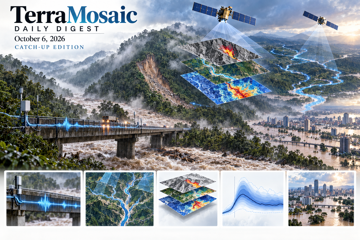
This catch-up issue is part 3 of a three-issue series allocated from the October 8, 2026 collection. Each issue reviews 429 input records. October 4–6 are editorial issue dates rather than exact paper-publication windows.
Daily Summary
The October 6 catch-up issue links useful predictions to the conditions under which they remain reliable. Landslide metric learning exploits labeled instances and unlabeled background, improving several detectors without adding inference cost. Georgia forecasting combines stationary susceptibility with rainfall accumulation over multiple windows, but its balanced retrospective sample does not establish real-world event probabilities. A hydropower waste-dump study links three-dimensional stability and runout while retaining drainage-failure scenarios and configuration-dependent friction calibration.
Extreme-weather forecasting requires a similarly precise interpretation of generalization. Analysis of the unprecedented Dubai storm attributes successful AI forecasts to transfer from stronger dynamically comparable events elsewhere, with no demonstrated extrapolation into the global tail. HydroDiffusion improves probabilistic streamflow forecasting most clearly in storage-dominated humid basins. PLUME refines short-duration rainfall warnings with gauge support that remains distinct from its gridded rainfall background, while snowmelt-versus-rainfall benchmarks reveal timing differences hidden by aggregate streamflow scores.
Observation consistency matters as much as prediction architecture. SWOT-fitted river beds sharply reduce water-level bias with little change in discharge skill. A global bifurcation audit finds that river topology and branch identifiers can undermine discharge closure. Traffic-excited bridges and roadside fiber supply repeatable seismic illumination of flood-affected river sediments. These results show why improved datum agreement, conservation and physical interpretation should be checked alongside conventional accuracy metrics.
The transferable methods remain bounded by their evidence. Prithvi crop-model performance can fail under phenological mismatch despite high confidence, and specialized remote-sensing detector adaptation can erode open-vocabulary capability. SAR–optical representations and a multimodal UAV dataset offer useful tools without yet proving disaster-specific generalization. Compound subsidence–flood projections and drought–flood adaptation portfolios connect prediction to consequences and decisions. A reproducible seismic-contact benchmark and an offshore-foundation review examine how soil response and demand assumptions alter infrastructure assessment; supporting underground and cold-region records retain their modelling limits.
Key Trends
Across mapping and forecasting, deployment value depends on event prevalence, physical consistency, transfer conditions and the decisions a model can support.
- Forecast generalization needs a mechanism: Dubai rainfall transfer, catchment-specific diffusion skill and phenological model failure expose when broader training data help and where confidence remains unreliable.
- Warning metrics need deployment context: Balanced landslide samples, process-specific flood timing and gauge-loss experiments measure distinct aspects of operational reliability.
- River observations must satisfy geometry and continuity: SWOT bathymetry corrections improve level agreement, while bifurcation checks reveal topology-driven discharge inconsistencies that point metrics can hide.
- Hazard intelligence is becoming multimodal: Metric learning, SAR–optical fusion, UAV label transfer and roadside acoustic sensing expand observation pathways, with hazard-specific validation still necessary for general methods.
- Compound-risk decisions vary with state: Subsidence can deepen localized flooding even as the footprint shrinks, and drought–flood portfolios depend on changing risk, coordination costs and forecast uncertainty.
Selected Papers
This selection combines direct landslide detection and dynamic forecasting with calibrated waste-dump mechanics, extreme-weather AI evaluation and probabilistic hydrology. Rainfall warnings, SWOT river consistency and distributed acoustic sensing connect forecasts to observation quality. The supporting methods emphasize transfer limits, cross-sensor information and forecast uncertainty, with seismic-contact and offshore-foundation studies linking soil response to infrastructure consequences. Title-level records preserve coverage of monsoon landslides, flood-state inversion, outburst sediments and underground hazards without attributing unavailable results.
1. Learning Discriminative Representations of Landslides via Deep Metric Learning Under Limited Supervision
Core Problem: Low-contrast landslide instances need discrimination from unlabeled background.
Key Innovation: Online contrastive-pair generation and uncertainty-aware hard-negative mining improve AP across several detectors and transfer to Bijie, adding training computation while avoiding additional inference cost.
2. Evaluating pre- and post-failure behavior of a large waste dump by combining LEM and DEM approach: a case study from a hydropower station, China
Core Problem: A stable-looking waste dump still needs downstream failure consequences assessed.
Key Innovation: Three-dimensional LEM and calibrated DEM link winding topography to pre-failure stability and post-failure deposition; friction calibration is configuration-specific, and drainage failure remains a critical scenario.
3. Bridge Vibrations as Persistent Seismic Sources for Time-lapse Imaging of River Corridors with Distributed Acoustic Sensing
Core Problem: Continuous imaging of flood-softened river corridors lacks persistent seismic sources.
Key Innovation: A 430 m bridge illuminates surrounding sediments through traffic-driven 3–6 Hz waves; roadside fiber resolves velocity reductions up to 1% during a monsoon flood, consistent with hydrological softening rather than a uniquely diagnosed failure precursor.
4. Predicting regional gray swans via translocation: AI weather models and Dubai’s unprecedented 2024 rainfall
Core Problem: Strong forecasts of unprecedented regional storms do not imply global-tail extrapolation.
Key Innovation: GraphCast and AIFS predict the Dubai storm up to eight days ahead; analyses attribute skill to transfer of stronger dynamically similar events from other regions and expose poor performance at the global tail.
5. Stationary Susceptibility and Dynamic Landslide Hazard Forecasting System for Georgia Using ERA5, Fuzzy Logic, and Hybrid Machine Learning
Core Problem: Stationary susceptibility alone cannot represent changing rainfall triggers.
Key Innovation: Georgia susceptibility maps are extended with hourly rainfall and several accumulation windows; retrospective discrimination uses 309 events and matched controls, so natural-prevalence forecasting still requires independent evaluation.
6. To zone or not to zone? A paired multi-model evaluation of geographic partitioning in positive-unlabeled landslide susceptibility modeling
Core Problem: The verified study compares geographic partitioning strategies across paired positive-unlabeled landslide models.
Key Innovation: Not assessed: a reliable abstract matching the verified record was unavailable. Findings and validation performance cannot be established from bibliographic evidence alone.
7. Recent satellite-based radar and optical monitoring of the activity of retrogressive slow-moving landslides in Nepal during monsoon
Core Problem: The verified study tracks retrogressive slow-moving landslides in Nepal with satellite radar and optical observations.
Key Innovation: Not assessed: a reliable abstract matching the verified record was unavailable. Findings and validation performance cannot be established from bibliographic evidence alone.
8. Integrating multidimensional factors through Bayesian Belief Networks for landslide risk reduction in Vietnam
Core Problem: The verified study integrates multidimensional factors in a Bayesian belief network for landslide risk reduction in Vietnam.
Key Innovation: Not assessed: a reliable abstract matching the verified record was unavailable. Findings and validation performance cannot be established from bibliographic evidence alone.
9. Full-scale in-situ experiments on mass-damper-enhanced guiding flexible rockfall barriers for rockfall mitigation
Core Problem: The verified study tests guiding flexible barriers enhanced with mass dampers under in-situ rockfall loading.
Key Innovation: Not assessed: a reliable abstract matching the verified record was unavailable. Findings and validation performance cannot be established from bibliographic evidence alone.
10. SWOT‐Fitted River Bathymetry for Global Hydrodynamic Models
Core Problem: Water-surface bias can originate in riverbed elevation rather than discharge dynamics.
Key Innovation: Global bed corrections reduce median absolute water-level bias from 3.10 to 0.18 m, while correlation and discharge skill change little; improved datum agreement should not be interpreted as improved flood timing.
11. Global Assessment of SWOT River Discharge Representation at Channel Bifurcations
Core Problem: Single-thread reach topology can violate discharge closure at bifurcations.
Key Innovation: A roughly 65,000-bifurcation audit finds distinct branch IDs are rare and summed branch discharge commonly exceeds the upstream value; width redistribution enforces closure but still needs an upstream anchor.
12. HydroDiffusion: Diffusion‐Based Probabilistic Streamflow Forecasting With a State Space Backbone
Core Problem: Probabilistic runoff models need to retain long hydrological memory.
Key Innovation: HydroDiffusion combines continuous-time diffusion with a state-space backbone across 531 CAMELS catchments, improving over its LSTM counterpart particularly in humid storage-dominated basins, with smaller advantages in arid and complex settings.
13. A SARIMA-Kalman Graph-Transformer Framework for Spatiotemporal Prediction of SBAS-InSAR Acquired Surface Deformation in Tianjin Metropolitan Area
Core Problem: Noise and nonstationarity can induce drift in long-horizon deformation forecasts.
Key Innovation: A SARIMA–Kalman trend branch and graph-transformer residual branch achieve 1.42–1.57 mm test RMSE in Tianjin monitoring zones; posterior covariance is an input feature, not an explicit loss or attention regularizer.
14. Building-level exposure asset value modelling for Germany: an Ahrweiler case study
Core Problem: Risk models need transparent object-level economic exposure data.
Key Innovation: Ahrweiler benchmark comparisons favor national accounts disaggregated onto cadastral buildings, while emphasizing regional validation and rejecting a universal claim that one workflow fits every building stock.
15. The ability of LSTM to model snowmelt versus rainfall generated floods
Core Problem: Aggregate streamflow scores can conceal differences among flood-generating processes.
Key Innovation: Across 103 catchments, LSTM often outperforms HBV for both event types but correctly dates rainfall peaks more often than snowmelt peaks, supporting process-specific service evaluation.
16. Engineering-scale thermo-hydraulic modelling of surrounding-rock temperature in a high-geothermal tunnel with fault-controlled groundwater and non-Darcy fault seepage
Core Problem: Connected faults can carry cooling anomalies beyond locally mapped fault intersections.
Key Innovation: Validated Darcy–Forchheimer modelling contrasts isolated and connected faults, finding broader cooling in connected zones and flow-dependent non-Darcy relevance for thermal-hazard zoning.
17. Disintegration mechanism and characteristics of water-sensitive red-bed mudstone affected by multi-factor via a self-developed test apparatus
Core Problem: Clay content and initial moisture alter how red-bed mudstone breaks down.
Key Innovation: A dedicated test apparatus distinguishes progressive erosion, fragmentation and spalling, showing nonmonotonic moisture sensitivity in high-clay material and a weaker ultimate influence of pressure and temperature.
18. PLUME: Staged Fusion of FY-4A AGRI and Rain-Gauge Observations for Bidirectional Refinement of Short-Duration Heavy-Rainfall Warnings
Core Problem: Gridding sparse gauges can hide whether local warning probabilities have adequate observational support.
Key Innovation: PLUME adds point-origin residual updates to satellite–grid forecasts and improves 0–3 h warning CSI, including under simulated gauge loss; gains shift from false-alarm suppression to missed-event recovery with lead time.
19. TC-RadiiFormer: Current-Time Quadrant Wind-Radius Estimation from Multispectral Satellite Sequences
Core Problem: Wind extent is poorly observed offshore despite its importance for exposure.
Key Innovation: TC-RadiiFormer estimates geographically ordered quadrant radii from timed multispectral sequences and improves over matched baselines on held-out 2024 storms; this is current-state retrieval rather than future track forecasting.
20. Linking Data Modalities and Deep Learning Architectures for Urban Flood Modeling
Core Problem: Data representations determine what deep flood models can preserve and learn.
Key Innovation: A 289-study review identifies preprocessing loss, cross-modal alignment and regional variation as major barriers, arguing for physical consistency rather than treating network architecture alone as the source of robustness.
21. Damaged Building Identification in Earthquake-Stricken Areas Based on Multi-Feature Fusion of Optical and SAR Imagery
Core Problem: Background land cover contaminates single-sensor damage inference.
Key Innovation: Building extraction is followed by fusion of radar change and coherence features, reaching reported damage accuracy of 81.75% in the evaluated earthquake setting without claiming broader cross-event transfer.
22. Climate change amplifies surface fire hazard in the tropical Andes: high-resolution FlamMap simulations in southern Ecuador
Core Problem: Cold high-elevation regions still need climate-sensitive surface-fire screening.
Key Innovation: 20 m FlamMap scenarios increase high-hazard surface-fire area in southern Ecuador, while mean burn probability changes little and crown-fire response remains limited; scenario dependence is retained.
23. Extreme climate and land subsidence: flood vulnerability projection in the Bandung Basin by 2045 and its socio-economic implications
Core Problem: Future terrain change can deepen inundation even when total flooded area contracts.
Key Innovation: Bandung scenarios combine projected InSAR subsidence, future elevation and land-use change; high-depth inundation grows in localized depressions, emphasizing scenario-specific depth rather than footprint alone.
24. Gas Evolution Characteristics and Mechanisms from Granite in Deeply Buried Tunnels
Core Problem: Excavation unloading can mobilize gases previously retained in deep granite.
Key Innovation: Chromatography, acoustic emission and NMR connect thermal microfracturing and pore growth with CO₂/CH₄ release, providing a coupled mechanism for tunnel-face gas risk rather than a site-wide concentration prediction.
25. Seismic Performance of Offshore Wind Turbine Monopiles: A Comprehensive Review
Core Problem: Offshore monopile assessment must consider earthquakes together with soil response, scour and environmental loading.
Key Innovation: The review integrates site response, soil–structure interaction, liquefaction, vertical seismic components and fragility methods, identifying design and validation gaps; it synthesizes existing evidence rather than introducing new experimental performance results.
26. A water-potential-semantic coupled state-field inversion method for continuous perception and semantic expression of urban flooding
Core Problem: The verified study couples water potential and semantic information for continuous urban-flood perception.
Key Innovation: Not assessed: a reliable abstract matching the verified record was unavailable. Findings and validation performance cannot be established from bibliographic evidence alone.
27. A multi-measure adaptation method for temporal coordination under drought–flood transition risks
Core Problem: Drought mitigation and flood control can conflict during rapid transitions.
Key Innovation: Forecast-conditioned portfolio comparisons in Huangshan favor temporal coordination under tested costs, while sensitivity to switching and coordination expense limits universal decision rules.
28. Hydrodynamic controls and sedimentary responses of eddy bars during outburst floods
Core Problem: The verified study examines hydrodynamic controls on eddy-bar formation during outburst floods.
Key Innovation: Not assessed: a reliable abstract matching the verified record was unavailable. Findings and validation performance cannot be established from bibliographic evidence alone.
29. Seismic performance and fragility for a shallow-buried subway station under horizontal and three-dimensional isolation
Core Problem: Horizontal and three-dimensional isolation differ under pulse-like and vertical demands.
Key Innovation: Shaking-table-validated analyses reduce severe-damage probability under a tested near-fault 0.60 g input from 12.97% to 1.42% with 3D isolation; benefits depend on motion type and intensity.
30. Flood modeling incorporating spatially heterogeneous rainfall and nonlinear routing mechanisms
Core Problem: The verified study combines spatially varying rainfall with nonlinear flood-routing mechanisms.
Key Innovation: Not assessed: a reliable abstract matching the verified record was unavailable. Findings and validation performance cannot be established from bibliographic evidence alone.
31. A fixed-mesh finite element framework for backward erosion piping evolution with anisotropic resistance and pseudo-porosity transition
Core Problem: The verified study models piping evolution on a fixed mesh with anisotropic resistance and a porosity transition.
Key Innovation: Not assessed: a reliable abstract matching the verified record was unavailable. Findings and validation performance cannot be established from bibliographic evidence alone.
32. A reproducible SSI-contact benchmark and amplification index for seismic pounding of adjacent buildings
Core Problem: Fixed-base models may miss amplification caused by foundation flexibility, relative phasing and contact-law choice.
Key Innovation: A reproducible reduced-order benchmark compares five SSI/contact configurations under 21 recorded-motion pairs; the reported force amplification applies to the tested gap and foundation stiffness, supporting screening rather than universal impact factors.
33. Centrifuge shaking table tests on overflow-based pressure control system for seismic response and uplift control of underground structures
Core Problem: The verified study tests overflow-based pressure control for underground seismic response and uplift.
Key Innovation: Not assessed: a reliable abstract matching the verified record was unavailable. Findings and validation performance cannot be established from bibliographic evidence alone.
34. Hydro‐Sedimentological Dynamics in a Compound Bifurcating System of a Large Anabranching River: A Case Study of the Paraná River
Core Problem: Water partitioning does not necessarily predict which branch receives the sediment load.
Key Innovation: Multi-decadal Paraná observations, field measurements and hydrodynamic tests reveal persistent upstream sediment asymmetry and downstream-diversion feedback, supporting network-aware treatment of aggradation and routing.
35. Transferability and operational reliability of a Prithvi crop classification foundation model under phenological and geographic shift across three continents
Core Problem: High confidence can conceal failure when a satellite model encounters different phenology.
Key Innovation: Prithvi evaluation across 37 events in 12 countries links confident crop misclassification to observation-window mismatch; calendar alignment and class consolidation recover some accuracy without retraining, informing cautious transfer to hazard mapping.
36. SAREO-FM: Decoupled Semantic Supervision for SAR-EO Foundation Models
Core Problem: Semantic supervision and sensor-specific reconstruction can conflict within one representation.
Key Innovation: SAREO-FM separates semantic queries from reconstruction tokens during million-scale SAR–EO pretraining and reports unimodal and joint transfer; direct disaster-monitoring performance remains to be established.
37. PoreML: A Data-Driven Framework for Learning Multiphase Flow in Porous Media
Core Problem: Learning transient porous-media flow requires reproducible, physically checked trajectories.
Key Innovation: PoreML combines a validated GPU lattice-Boltzmann solver with 560 simulations and 3.3 TB of data, testing both autoregressive physical consistency and transfer to larger or micro-CT-derived domains.
38. MultiFly: A Real-World Multimodal Aerial Dataset with Annotation-Efficient Label Transfer and Cross-Modal Semantic Consistency
Core Problem: Independent sensor labels are expensive and may be semantically inconsistent.
Key Innovation: MultiFly synchronizes RGB, thermal, LiDAR and radar observations, transfers labels from 115 RGB images and reports about 90% held-out agreement; four suburban scenes limit direct claims about mountainous disaster transfer.
39. Deep Unfolding for Heterogeneous Change Detection: A Latent Calibration and Structured Separation Approach
Core Problem: Cross-sensor discrepancy can be mistaken for actual surface change.
Key Innovation: Latent calibration and unfolded low-rank/sparse separation suppress modality-induced interference on three benchmarks; relevance to disaster mapping is prospective and should be tested on hazard-specific inventories.
40. Open-Vocabulary Forgetting in the Downstream Adaptation of Remote Sensing Vision–Language Detectors
Core Problem: Specialized fine-tuning can erode a detector's original open vocabulary.
Key Innovation: A retention-aware benchmark shows held-out adaptation loses 23–36% of initial retention, and tested mitigations do not meaningfully restore it at matched target accuracy; target gains therefore need a separate capability audit.
41. CRAD: A China Reservoir Attribute Database for Hydrological and Water Resources Applications
Core Problem: Incomplete reservoir attributes limit basin modelling and operational context.
Key Innovation: CRAD compiles more than 20 attributes for 5,142 Chinese reservoirs and captures 87.5% of national storage; hydrological improvements are reported at nearly 70% of evaluated gauges, without making it a dam-safety dataset.
42. Improved seasonal hydrological forecasting for Great Britain
Core Problem: The value of improved rainfall forecasts depends on catchment memory.
Key Innovation: Great Britain hindcasts combine weather analogues with hydrology and show strongest skill in winter; finer rainfall resolution does not automatically raise skill, and initial conditions dominate long-memory basins.
43. Coupling Effect of Joint Dip and Bolt Inclination on the Failure Mechanism of En-echelon Jointed Rock Masses
Core Problem: Reinforcement effectiveness depends on the interaction of joint dip and bolt angle.
Key Innovation: Laboratory loading and coupled continuum–particle simulations resolve nonlinear angle interactions and NPR-bolt response, showing how alignment changes force-chain pathways and strength under tested configurations.
44. Cation Specific Swelling Mechanisms in Weakly Expansive Red-Bed Soft Rock: Insights from Experiment and Molecular Dynamics Simulation
Core Problem: Chemical stabilization depends on mineral content and ion-specific hydration.
Key Innovation: Macroscopic testing and molecular dynamics distinguish cation mechanisms and high- versus low-clay responses, providing lithology-dependent ion-selection guidance rather than one universal swelling inhibitor.
45. Underwater topographic mapping using a fusion of Airborne LiDAR bathymetry and multibeam Echo sounding
Core Problem: Different point densities and measurement ranges hinder seamless underwater terrain mapping.
Key Innovation: Airborne LiDAR and multibeam soundings are fused through geometry-aware registration, reducing regional RMSE to 0.035–0.078 m in three tests; downstream hazard-model improvement is not evaluated.
46. From fracture control to interface control: a combined experimental, DEM and FEM study on grouted fractured limestone under hydro-mechanical coupling
Core Problem: The verified study contrasts fracture- and interface-controlled behavior in grouted limestone under hydromechanical coupling.
Key Innovation: Not assessed: a reliable abstract matching the verified record was unavailable. Findings and validation performance cannot be established from bibliographic evidence alone.
47. A hybird computational framework for long-term nonlinear consolidation for tunnels in soft soil with depth-dependent initial stress
Core Problem: Depth-dependent initial stress and nonlinear permeability alter operational settlement.
Key Innovation: A split implicit scheme accelerates the tested two-dimensional consolidation calculations about ninefold with lower memory demand and checks results against numerical, laboratory and field references.
48. Reinforcement mechanism of 2G-NPR bolts for large deformation in soft rock tunnels based on FDEM
Core Problem: The verified study examines reinforcement of large-deformation tunnels using 2G-NPR bolts and FDEM.
Key Innovation: Not assessed: a reliable abstract matching the verified record was unavailable. Findings and validation performance cannot be established from bibliographic evidence alone.
49. Biaxial response of buried pipelines to arbitrary excavation-induced ground-movement fields: A pipe–soil interaction solution with Bayesian updating from sparse field settlement monitoring
Core Problem: The verified study updates biaxial buried-pipeline response using sparse field settlement observations.
Key Innovation: Not assessed: a reliable abstract matching the verified record was unavailable. Findings and validation performance cannot be established from bibliographic evidence alone.
50. The Tricky Water Energy Budget of Freezing Soil: A Thermodynamic Framework for Understanding Phase Changes
Core Problem: Freezing curves and heat balances need mutually consistent pore-water energetics.
Key Innovation: A chemical-potential framework links freezing-point depression, retention and enthalpy closure under local equilibrium; new measurements and rate-dependent phase-change validation are explicitly deferred.