
TerraMosaic Daily Digest: October 7, 2026
Daily Summary
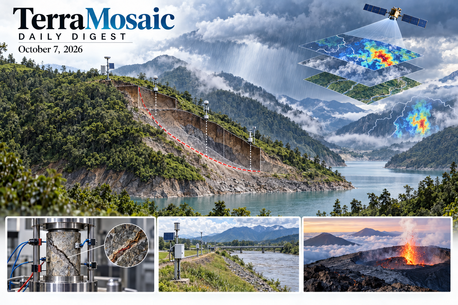
The October 7 issue connects observed slope deformation with the hidden states that control failure. At Wangzang on the Bailong River, a deforming reservoir-bank landslide is identified through remote sensing and InSAR, then investigated using field mapping, UAV surveys, monitoring, geomechanical tests and simulation. A southern California comparison of twelve precipitation products shows that post-fire debris-flow threshold exceedance can change with the rainfall estimate used. Updated evidence from the infiltration-paradox study resolves a complementary modelling limit: compressed pore gas can accelerate failure under rapid hydraulic loading even while wetting is slowed. The effect depends on loading and venting conditions rather than a universal pressure threshold.
Hydraulic infrastructure assessment requires attention to transient states and temporal scale. A field-instrumented levee study improves transient pore-pressure prediction by combining finite-element calibration with learned residual corrections. Swiss reservoir comparisons find that hourly flood peaks can be damped much more strongly than daily peaks, making daily-to-hourly proxies conditional on upstream regulation. Nonlinear earthfill-dam analysis and a repeating-earthquake railway framework show how site response, motion propagation and component coupling create localized demand that an aggregate structural indicator can conceal.
Rock-failure monitoring and volcanic observations add time-dependent evidence. True-triaxial fault-slip experiments connect electric-potential patterns with asymmetric tunnel damage and laboratory warning precursors; mineral-controlled shear-creep tests distinguish local crack barriers from pathways. A multiparameter record of Kīlauea's episodic lava fountaining links summit inflation to eruption cycles. Global fire-radiative-power forecasts improve over persistence across one- to seven-day leads but still underestimate large-fire intensity. Palisades severity mapping and earthquake-region vegetation analysis separate regional or demographic context from the localized physical effects actually observed.
The methods papers expose how apparent performance gains can be misread. A building-safety VLM raises hazard recall through activation steering while worsening discrimination, wildfire LLM evaluation finds strong simple baselines and dataset shortcuts, and a delay-aware forecast audit removes access to labels that would not yet exist in operation. Supporting work addresses satellite rainfall merging, GNSS storage inversion, moisture retrieval, radar clutter and river altimetry. A global petrophysical discussion preprint provides broad modelling inputs, while probabilistic spatial disaggregation supports exposure estimation. These studies connect bias, scale and data availability to the physical quantities and exposure information used in hazard assessment.
Key Trends
This selection emphasizes water–air coupling, observational uncertainty, state-dependent damage and the difference between useful forecasting evidence and isolated accuracy gains.
- Rainfall inputs can change a triggering conclusion: Debris-flow thresholds depend on precipitation-product choice, while tensor merging and retrieval quality-control methods address different scales of rainfall uncertainty.
- Hydraulic states extend beyond the wetting front: Gas compression influences slope timing, levee pressure retains transient model discrepancy, and reservoir regulation changes the relation between hourly and daily flood peaks.
- Monitoring signals require mechanism and scale: Fault-slip rockburst, mineral-controlled creep and volcanic inflation illustrate distinct physical pathways; laboratory lead times and localized damage cannot be transferred directly to field-wide warning rules.
- Deployment evaluation needs available data and balanced errors: Hazard recall, discrimination, label latency, grounding and simple baselines measure different aspects of forecast or decision reliability.
- Infrastructure consequences depend on coupled systems: Repeated-earthquake railway fragility, deteriorating water networks and title-level restoration studies extend assessment from individual components to spatial and service-level performance.
Selected Papers
Reservoir-bank landslides, debris-flow rainfall estimates, gas-coupled slope failure and fault-related rockburst anchor this selection. Field-calibrated levee pressure, regulated flood peaks, dam deformation and railway fragility connect mechanisms to infrastructure consequences. Volcanic and wildfire studies broaden the hazard view. The supporting methods address rainfall and subsurface measurements, fine-scale exposure information, forecast evaluation and changing material states.
1. The deforming and failing Wangzang reservoir bank landslide in the upper–middle reaches of the Bailong River, China
Core Problem: Ongoing bank deformation requires identification of weak material, forcing and failure consequences.
Key Innovation: Wangzang investigation combines InSAR, field mapping, UAV surveys, on-site monitoring, geomechanical testing and simulation to interpret a large deforming reservoir-bank slope in the Bailong River corridor.
2. Uncertainty in Precipitation Estimates Warrants Greater Consideration in Debris‐Flow Research
Core Problem: Different precipitation products can change whether an operational debris-flow threshold appears to be exceeded.
Key Innovation: Twelve QPE products are compared across seven southern California storms, revealing large timing and intensity disagreement against gauges; product uncertainty must be carried into trigger analysis rather than treated as known rainfall.
3. The infiltration paradox: Pore-gas pressure controls on early slope failure during rapid hydraulic loading
Core Problem: Fixing pore-gas pressure at atmospheric levels can distort failure timing under rapid hydraulic loading.
Key Innovation: Three-phase MPM predicts earlier failure despite a shallower wetting front when gas pressure evolves; the roughly six-second difference at 2.5 m head is an upper bound for the tested loading and venting configuration.
4. Fault-Slip-Induced Rockburst Failure of Rock Tunnels Under True Triaxial Loading: Insights from Electric Potential Monitoring and DEM Analysis
Core Problem: Nearby fault slip can redistribute stress and accelerate asymmetric tunnel damage.
Key Innovation: Electric-potential patterns, camera observations and DEM resolve asperity-controlled cracking and shape effects, with roughly 1.5-minute precursor lead times in the laboratory rather than demonstrated field warning capability.
5. A Hybrid Model Calibration Framework for Transient Seepage Prediction in Levees Using Field Monitoring Data
Core Problem: Transient pore-pressure errors can persist after finite-element parameter calibration.
Key Innovation: Sensitivity-guided calibration and an additive LSTM residual reduce field pore-pressure RMSE by about 70%; a retained physical baseline does not itself prove that every corrected output satisfies its governing equations.
6. The influence of lakes and reservoirs on estimated flood peaks at hourly vs. daily timescale in the Alps
Core Problem: Daily discharge may represent subdaily flood peaks differently in regulated and natural basins.
Key Innovation: Swiss case studies and catchment comparisons show stronger reservoir attenuation of hourly than daily peaks, reaching 70% in tested 10-year events; proxy validity depends on the extent of upstream water-body influence.
7. Insights from more than a year of ongoing episodic lava fountaining at Kīlauea
Core Problem: Episodic eruption onset depends on interacting pressure, permeability and volatile processes.
Key Innovation: A modern record of 54 Kīlauea fountaining episodes links summit inflation to eruption cycles and supports quantitative forecasting constraints; the retrieved abstract does not establish transferable forecast accuracy for other volcanoes.
8. Performance-based seismic assessment of earth-fill dams on ophiolitic foundations using nonlinear dynamic finite element modelling
Core Problem: Site conditions and nonlinear soil response affect dam-crest demands and residual displacement.
Key Innovation: Twenty compatible ground-motion records drive a Kayı dam model that identifies crest amplification and localized deformation without global instability in the tested scenarios; the result is not a guarantee for untested earthquakes.
9. Magnitude-Based Fragility and Regional Seismic Response Distribution of High-Speed Railway Track-Bridge System under Repeating Earthquake Scenario
Core Problem: Source, propagation and topographic effects create nonuniform railway seismic demand.
Key Innovation: Spectral-element motion simulation is coupled with magnitude-based system fragility and spatial interpolation, identifying component differences and damage clusters within the investigated repeating-earthquake scenarios.
10. Fractal Analysis, Morpho‐Sedimentary Aspects and Coastal Vulnerability in Mediterranean Islands: A Novel Approach
Core Problem: Shoreline geometry alone does not represent exposure to waves and extreme events.
Key Innovation: Procida and Mykonos are compared using fractal geometry, beach sediments and effective fetch; their contrasting complexity and sediment conditions support differentiated vulnerability interpretation rather than a universal fractal risk threshold.
11. FearCaut-Qwen: Affective Steering in a Vision-Language Model Shifts the Decision Criterion for Hazard Assessment
Core Problem: Low hazard recall may reflect a decision criterion rather than insufficient visual evidence.
Key Innovation: Fear-direction steering raises unsafe-building recall from 27.0% to 75.7% but worsens discrimination; the study demonstrates control of decision bias, not improved overall safety assessment or validated deployment.
12. AI4Fire: Evaluating Large Language Models on Wildfire Tasks
Core Problem: Model rankings can conceal whether grounding, simple baselines and dataset shortcuts explain apparent skill.
Key Innovation: AI4Fire compares paired grounded and bare task settings, finding large retrieval benefits but weak staffing forecasts and release-label shortcuts; the benchmark exposes evaluation limits rather than endorsing autonomous fire management.
13. A Graph Neural Network for Global Daily Fire Radiative Power Prediction at Medium-Range Lead Times
Core Problem: Delayed satellite fire observations and persistence assumptions limit medium-range fire inputs.
Key Innovation: A spatiotemporal graph model predicts FRP one to seven days ahead and improves over persistence in 2023–2024; large-fire intensity is still underestimated and FRP is not a direct prediction of fire perimeter or damage.
14. Interpretability-enhanced temporal surrogate modeling for wave-induced scour vulnerability assessment of vertical-wall structures
Core Problem: The verified study addresses interpretable temporal prediction of wave-induced scour vulnerability at vertical walls.
Key Innovation: Not assessed: a reliable abstract matching the verified record was unavailable. Quantitative findings and validation cannot be established from the title alone.
15. A numerical study on scaling relations for field-scale scour development at pile foundations
Core Problem: Laboratory-to-prototype scaling can distort scour depth and development time.
Key Innovation: A large-eddy erosion model reproduces experimental time development and compares prototype scaling; pile Froude number and grain-size ratio help explain differences but their effects cannot be fully separated.
16. Scalable and Physics-Aware Graph Neural Network for Emulating Peak Storm Surge Over Large Geo-Spatial Domains
Core Problem: The verified study develops a scalable graph emulator for peak storm surge across large geographical domains.
Key Innovation: Not assessed: a reliable abstract matching the verified record was unavailable. Quantitative findings and validation cannot be established from the title alone.
17. Spatiotemporal Reconstruction of Groundwater Depletion in India’s Oldest Coalfield Using Machine Learning and GIS, With InSAR and Fractal Analysis Insights
Core Problem: Sparse wells and satellite gaps limit long-term groundwater interpretation in industrial terrain.
Key Innovation: Raniganj reconstruction combines GRACE, hydro-environmental predictors and field observations, with depletion patterns spatially corresponding to InSAR subsidence; correspondence does not isolate a causal subsidence mechanism.
18. Spatiotemporal Patterns of Wildfire Severity and Demographic Characteristics in the 2025 Palisades Fire, Los Angeles, California
Core Problem: Burn-severity patterns and census context measure different dimensions of fire consequences.
Key Innovation: Palisades Sentinel-2 severity agrees moderately with a field-informed USGS product, while tract demographics are descriptive rather than population-weighted vulnerability or causal social attribution.
19. Ecological Indicators Reveal Contrasting Post-Earthquake Recovery Trajectories and Resilience Across Mountain Ecosystems
Core Problem: Regional vegetation trends can hide persistent degradation within landslide zones.
Key Innovation: Jiuzhaigou and Milin NPP trajectories are compared with co-seismic landslide overlays, separating regional productivity recovery from localized degradation; SHAP associations do not demonstrate causal controls or renewed slope stability.
20. Time-Dependent Deformation and Cracking Mechanisms of Natural Hard Structural Planes Under True Triaxial Shear: Effects of Heterogeneous Mineral Assemblages
Core Problem: Cemented structural planes can fail by localized cracking rather than simple frictional sliding.
Key Innovation: True-triaxial tests identify graphite-rich crack paths and epidote-rich barriers that redirect stress and damage; limited creep bursts do not immediately imply instability in the tested specimens.
21. Semi-markov modeling of enabling cascades for flood resilience optimization in metro infrastructure systems
Core Problem: The verified study models enabling cascades and flood resilience in metro infrastructure using a semi-Markov framework.
Key Innovation: Not assessed: a reliable abstract matching the verified record was unavailable. Quantitative findings and validation cannot be established from the title alone.
22. Deformation Probability Evolution and Time-variant Reliability Assessment of Polymer Cut-off Wall Earth Dam Subjected to Stochastic Ground Motions
Core Problem: The verified study evaluates deformation and reliability of a polymer cut-off wall earth dam under stochastic ground motion.
Key Innovation: Not assessed: a reliable abstract matching the verified record was unavailable. Quantitative findings and validation cannot be established from the title alone.
23. Wind farm resilience to tornado strikes: A coupled probabilistic damage and system dynamics framework
Core Problem: The verified study combines probabilistic damage and system dynamics to assess tornado effects on wind-farm resilience.
Key Innovation: Not assessed: a reliable abstract matching the verified record was unavailable. Quantitative findings and validation cannot be established from the title alone.
24. Seismic resilience enhancement of deteriorated water distribution systems: A two-stage optimization framework integrating pipe repair and hydraulic component control
Core Problem: Pipe aging changes both earthquake failure probability and hydraulic recovery needs.
Key Innovation: A real Chinese water-network case combines repair and component-control optimization, showing deterioration-dependent loss of robustness and improved recovery under the tested resource and operating constraints.
25. Survivability-Aware Multi-Period Service Restoration for SOP-Based Distribution Systems under Extreme Natural Hazards
Core Problem: The verified study assesses survivability-aware multi-period restoration of distribution systems after extreme natural hazards.
Key Innovation: Not assessed: a reliable abstract matching the verified record was unavailable. Quantitative findings and validation cannot be established from the title alone.
26. Collaborative post-disaster restoration framework for transportation-distribution networks utilizing traffic management and mobile resources
Core Problem: The verified study coordinates traffic management and mobile resources for transportation and power-distribution restoration.
Key Innovation: Not assessed: a reliable abstract matching the verified record was unavailable. Quantitative findings and validation cannot be established from the title alone.
27. Neapolitan Yellow Tuff revisited: a new look to stratigraphy and eruptive dynamics of a complex eruption of Campi Flegrei caldera (Italy)
Core Problem: The verified study revisits Neapolitan Yellow Tuff stratigraphy and the dynamics of its complex eruption.
Key Innovation: Not assessed: a reliable abstract matching the verified record was unavailable. Quantitative findings and validation cannot be established from the title alone.
28. Fault-conditioned Seismic Image Generation using Denoising Diffusion Probabilistic Modeling and Neural Style Transfer
Core Problem: Limited labeled seismic surveys hinder reliable learning of fault geometry.
Key Innovation: Fault-conditioned diffusion generates varied seismic textures while retaining user-specified structural templates and spectral characteristics across three datasets; the verified arXiv version supplies the evidence.
29. Low-rank tensor structure of precipitation and its application to satellite-reference merging
Core Problem: Sparse reference observations constrain broad-area satellite rainfall correction.
Key Innovation: TMerge preserves spatial and temporal tensor structure and improves IMERG correlation and errors over CONUS in 2019–2022; benefits concern daily precipitation reconstruction rather than directly validated debris-flow thresholds.
30. Multimodal Remote Sensing Image Registration: A Comprehensive Review, Challenges and Prospects
Core Problem: Sensor geometry, radiometry and acquisition time complicate image alignment.
Key Innovation: The review organizes region-, feature- and learning-based registration pipelines and their datasets and limitations, providing a method-selection reference without introducing new disaster-mapping performance results.
31. Timer-M1: A Multivariate Time Series Foundation Model via Learning Primitives
Core Problem: Forecast models must represent relationships among variables and the actual availability of covariates.
Key Innovation: Timer-M1 pretrains on temporal and relational primitives with explicit channel roles and ranks strongly on three forecasting benchmarks; disaster-specific forecasting skill remains untested in the retrieved evidence.
32. Puffin: Probabilistic Learning of Spatial Detail From Coarse Observations
Core Problem: Coarse census totals do not determine the fine-scale distribution of exposed populations.
Key Innovation: Puffin uses satellite embeddings and aggregation-aware likelihoods to infer spatial distributions consistent with known totals, with uncertainty assessed on census and employment variables rather than observed disaster losses.
33. Escaping Geological Generative Prior Distributions in Bayesian Travel Time Tomography
Core Problem: A learned geological prior can exclude the true structure from its latent manifold.
Key Innovation: Bayesian model-space travel-time inversion uses the generative manifold as guidance while permitting off-manifold solutions, recovering structures that standard latent inversion misses in the tested synthetic examples.
34. Just Weather Scoring: Efficient End-to-end Nowcasting with Distributional Diffusion
Core Problem: Separate compression and repeated denoising can add cost and information loss to probabilistic rainfall models.
Key Innovation: Just Weather Scoring trains one radar-space diffusion model with a scoring-rule objective and achieves strong benchmark skill with few-step generation; warning thresholds and real operational outcomes are not evaluated.
35. Training on the Future: A Delay-Aware Audit of Test-Time Adaptation for Time-Series Forecasting
Core Problem: Forecast labels are unavailable until the horizon and data-release delay have elapsed.
Key Innovation: A causal-delay harness sharply reduces apparent benefits of several test-time adapters, including on Weather; inexpensive linear corrections often match or exceed them, exposing leakage-sensitive benchmark gains.
36. Learning Kilometer-Scale Weather Prediction with Global-Regional Alignment
Core Problem: Global guidance and local forecasts need compatible grids and representations.
Key Innovation: ScaleCast reuses several global forecast drivers and adapts between 5.5 km and 3 km regional data, with windstorm and station comparisons supporting regional skill rather than universal kilometre-scale warning performance.
37. Onboard Marine Anomaly Detection on Φsat-2: From Simulation-Based Development to In-Orbit Demonstration
Core Problem: Simulation-based validation may not represent real satellite radiometry and scene ambiguity.
Key Innovation: The Φsat-2 pipeline required retraining on in-orbit images after an initial domain mismatch, demonstrating onboard feasibility while separating functional integration from representative scientific validation.
38. The compression and consolidation of weathered clays and mudstones beneath an instrumented trial embankment
Core Problem: Stiffness and hydraulic conductivity vary with depth in weathered clay and mudstone.
Key Innovation: Extensometer data interpreted through observational and one-dimensional models are checked against laboratory, geophysical and pore-pressure evidence, showing useful parameter estimation with simple site-grounded methods.
39. Electroosmotic treatment of sand washery tailings and the improved geotechnical characteristics
Core Problem: Weak slurry tailings complicate safe placement of cover soils.
Key Innovation: Laboratory dewatering and element tests show higher preconsolidation pressure and shear strength, with strongly different anode/cathode responses; the largest gain is a local laboratory result, not a whole-dam stability improvement.
40. MCR-Net: A Multibranch Contextual Restoration Network for GPR Clutter Suppression in Heterogeneous Media
Core Problem: Nonstationary clutter can obscure radar signatures used to interpret buried structures.
Key Innovation: MCR-Net uses multibranch contextual restoration to suppress heterogeneous-medium clutter; its relevance is to imaging quality rather than a demonstrated tunnel-collapse or water-inrush warning system.
41. Sensitivity of Earth Model Selection on Terrestrial Water Storage Inversion From GNSS Vertical Displacements
Core Problem: Earth-model assumptions can change inferred terrestrial water-storage magnitudes.
Key Innovation: Synthetic and Yunnan tests compare spherical and crustal models, exposing scale- and station-density dependence; model-selection guidance is tied to the investigated geometries and cannot be generalized to every region.
42. Local Slope-Guided Terrain-Photon Extraction With Multiscale Seed Points for ICESat-2 Shallow-Water Bathymetry
Core Problem: Sparse underwater photon returns fragment seabed tracking on variable slopes.
Key Innovation: Multiscale terrain seeds and local-orientation extraction improve continuity, with independent Oahu validation yielding about 0.50 m RMSE over 0–30 m depths under the tested shallow-water conditions.
43. Soil Moisture Retrieval Using CYGNSS Reflectivity Reconstruction With Physical Constraints at 9-Km Scale
Core Problem: Coarse or intermittent reflectivity limits continuous regional soil-moisture retrieval.
Key Innovation: Daily 9 km reconstruction agrees strongly with SMAP but more moderately with Yanco ground measurements, emphasizing the distinction between product-to-product agreement and in-situ validation.
44. A global petrophysical database for igneous, metamorphic and sedimentary rocks
Core Problem: Rock-property measurements are fragmented across publications and locations.
Key Innovation: A discussion preprint compiles more than 112,000 measurements from over 600 publications with rock-type and site metadata; these are property measurements, not a landslide inventory or site-specific rock-mass design values.
45. Adaptive observation weighting in TCKF1D-Var for ground-based multi-sensor thermodynamic retrievals prior to nocturnal heavy precipitation over China
Core Problem: Static sensor weighting may not represent changing reliability in moisture profiles.
Key Innovation: Ground-based microwave and lidar retrievals use adaptive weights and are evaluated across 107 heavy-precipitation cases, improving thermodynamic observations without directly demonstrating flood-warning skill.
46. Recent strengthening of eastern Pacific ENSO in the last millennium paleorecord
Core Problem: Short instrumental records cannot determine whether recent ENSO variability is unusual.
Key Innovation: Galápagos coral geochemistry indicates stronger recent eastern-Pacific variability than existing paleorecords and simulated natural variability, providing long-term context rather than an event-level disaster forecast.
47. Normality-Calibrated Modality Routing for Optical-SAR Object Detection Under Cloud-Induced Optical Degradation
Core Problem: The presence of SAR does not ensure that a fused detector uses it when optical information degrades.
Key Innovation: NCMR-Net preserves more detection performance under synthetic clouds through calibrated routing, but single-run benchmark gains do not establish generalization to real cloud-obscured disaster scenes.
48. WTC-CNXGRN: An Operational Wind Turbine Clutter Detection Model for Dual-Polarization Radar Under Complex Weather
Core Problem: Wind-turbine echoes can be confused with precipitation under complex weather.
Key Innovation: A polarimetric ConvNeXt-based detector separates clutter with strong test metrics and preliminary cross-site evidence; its contribution is quality control rather than direct hazard forecasting.
49. Enhancing FY-3E/VASS Humidity Profiles During a Cloudy Atmospheric River Event Using Clear-Sky FY-4B/GIIRS Guidance
Core Problem: Clear-sky and all-sky humidity products have different coverage and error characteristics.
Key Innovation: Clear-sky residual guidance improves agreement with ERA5 during one cloudy atmospheric-river overpass, including lower-tropospheric moisture; independent sounding validation and multi-event transfer remain unestablished.
50. Real-Time Prediction of Rock Failure Based on Multi-source Monitoring Data Fusion
Core Problem: Mechanical, acoustic and image-based precursors can disagree during rock loading.
Key Innovation: Improved evidence-theory fusion combines volumetric strain, AE and DIC with inverse-velocity refinement, reaching about 10% failure-time error in uniaxial tests; mine-scale prediction is not evaluated.
51. Macro–Mesoscopic Damage Evolution and Constitutive Model of Granodiorite Porphyry Under Freeze–Thaw Cycles Based on NMR
Core Problem: Pore-network change links repeated freezing to macroscopic strength loss.
Key Innovation: NMR, SEM and mechanical tests resolve coarsening and grain-interface deterioration in granodiorite porphyry, supporting a fitted constitutive model within the tested freeze–thaw regimes.
52. Fluid-Driven Fracturing Behavior of Crystalline Rocks Using an Improved Hydro-Grain-Based Model: Insights from Moment Tensor Analysis
Core Problem: Mineral grains, interfaces and hydraulic apertures jointly control cracking and seismic release.
Key Innovation: A coupled particle–fluid network model is calibrated and checked against analytical and experimental evidence, then uses moment tensors to interpret simulated microseismic processes under specified stresses.
53. Machine-Learning-Informed Parameterization for Coupled Heat–Water Transfer and Frost-Heave Deformation in Freezing Soils
Core Problem: Temperature-dependent water, thermal and stiffness properties need consistent updating during freezing.
Key Innovation: A model trained on more than 2,700 experiments supplies constitutive relations to a coupled soil-column formulation, with experimental heave agreement supporting a simplified laboratory-scale implementation.
54. Pore-scale hydraulic controls on loess tunnel erosion and gully development
Core Problem: Initial density and moisture affect loess erosion response.
Key Innovation: The retrieved abstract describes rapid and slower erosion stages with opposing density and moisture effects; it does not specify the pore-scale tunnel mechanisms named in the verified title, so those mechanisms are not inferred.
55. Degeneracy-resilient LiDAR-inertial SLAM for autonomous tunnel inspection robots
Core Problem: The verified study addresses LiDAR-inertial localization for tunnel inspection under geometrically degenerate conditions.
Key Innovation: Not assessed: a reliable abstract matching the verified record was unavailable. Quantitative findings and validation cannot be established from the title alone.
56. Obtaining tensile strength and fracture energy of brittle rocks using AUSBIT - Advanced universal snap-back indirect tensile test
Core Problem: The verified study presents AUSBIT testing for brittle-rock tensile strength and fracture energy.
Key Innovation: Not assessed: a reliable abstract matching the verified record was unavailable. Quantitative findings and validation cannot be established from the title alone.
57. Failure characteristics of fractured sandstone with varying rock bridge angles subjected to combined dynamic and static loading
Core Problem: The verified study compares failure of sandstone with different rock-bridge angles under combined static and dynamic loading.
Key Innovation: Not assessed: a reliable abstract matching the verified record was unavailable. Quantitative findings and validation cannot be established from the title alone.
58. Dynamic-programming-based subwaveform retracking with along-track constraints for inland river water level retrieval from Sentinel-3 altimetry
Core Problem: Footprint-wise selection can retain inconsistent subwaveforms over contaminated river returns.
Key Innovation: Dynamic programming uses along-track consistency across 117 gauge–virtual-station pairs, yielding median RMSE of 0.41 m and improved data availability, particularly on narrow rivers.
59. Quantifying dynamic ponding–detention effects of microtopography in low-relief plains: insights from field-scale hydrological monitoring
Core Problem: The verified study quantifies ponding and detention associated with low-relief microtopography using field monitoring.
Key Innovation: Not assessed: a reliable abstract matching the verified record was unavailable. Quantitative findings and validation cannot be established from the title alone.
60. Investigation of Radial Pore-Water Pressure Response and Thermo-Hydro-Mechanical Coupled in Tunnel Surrounding Rock Influenced by Lining Stiffness: Insights from One-Dimensional Freeze-Thaw Tests under Elastic Confinement
Core Problem: The verified study examines radial pore-water pressure and thermo-hydromechanical response under lining-related elastic confinement.
Key Innovation: Not assessed: a reliable abstract matching the verified record was unavailable. Quantitative findings and validation cannot be established from the title alone.
61. A hydro-mechanical coupled analysis method for deep excavations considering the multi-scale characteristics of hydraulic conductivity
Core Problem: The verified study couples deep-excavation analysis with multiscale hydraulic conductivity.
Key Innovation: Not assessed: a reliable abstract matching the verified record was unavailable. Quantitative findings and validation cannot be established from the title alone.