
TerraMosaic Daily Digest: November 3, 2026
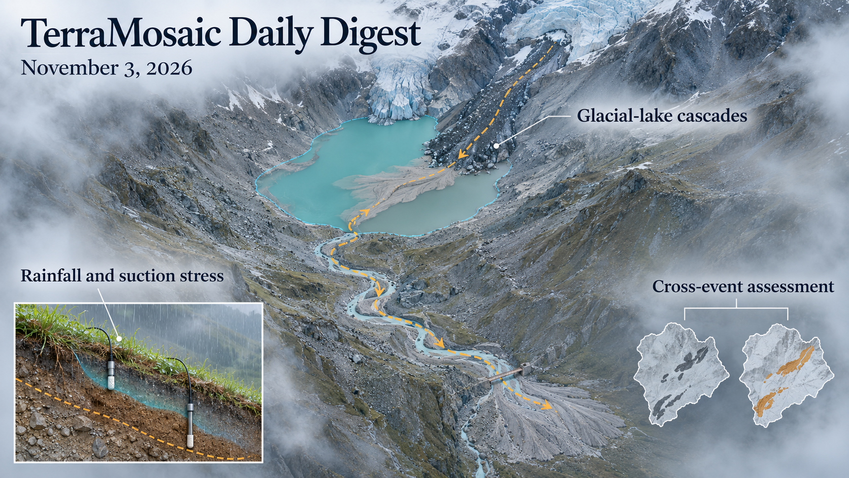
Daily Summary
A slope threshold is meaningful within a defined material state and observation setting. The Pohang study reconstructs three typhoon-triggered failures through suction-stress-based rainfall curves and transient hydromechanical calculations. Granular-flow simulations add a different limit to deterministic prediction: near the critical angle, identical imposed disturbances produce increasingly dispersed transport because the initial particle configurations differ. Together, the studies distinguish a characteristic failure boundary from the range of responses that can occur around it.
Transfer tests show where useful local relationships stop carrying the same information. Chi–Chi and Hualien landslide models perform best under their respective earthquake conditions, while pooling the two inventories improves consistency across those studied events. A field-supervised flood-depth preprint reaches useful error levels on sampled high-water marks but loses nearly all depth-explanation skill on held-out storms. These results make event separation, predictor support and the target quantity central to any claim of rapid hazard prediction.
Water pathways connect the slope to consequences downstream. Warwan's reconstructed mass movements distinguish an avalanche that impacted a lake and triggered an outburst from events that stopped short; sediment infill and later remobilization reshape the cascade. Yigong reconstruction likewise connects flood hydraulics to valley confinement and channel migration. In Wudongde, complementary radar views reveal heterogeneous creep, but three-dimensional motion and sliding volume still depend on kinematic and geometric assumptions.
Observation and simulation timescales also define what can be resolved. SWOT captures transient wave fields after iceberg disintegration, while Etna borehole strain and tilt track changes across closely spaced eruptive phases. The hybrid injection-seismicity solver reproduces overall rupture measures faster than its implicit reference yet retains differences in rapid transients. New sub-daily soil-moisture and pre-rainfall wind-shear products expand temporal support, while their nominal sampling and validation limits remain part of the scientific result.
Key Trends
The selection connects triggering state, event-to-event transfer and the observational or numerical support behind a hazard estimate.
- Thresholds retain their calibration context: Pohang's suction-stress curves concern reconstructed failed slopes, while the granular simulations show broad transport distributions near a critical angle. Neither a matched case history nor a mean response alone defines a transferable operational alarm.
- Event transfer must test the intended quantity: Taiwan's pooled landslide model is assessed across two known earthquake inventories. The high-water-mark study separates flood/rain-free discrimination from depth prediction and exposes a marked loss of the latter on unseen storms. Aggregate skill cannot substitute for the relevant transfer test.
- Storage and pathway change shape cascades: Warwan's lake impact, sediment infill and debris-flow propagation show why whether a mass movement reaches water matters. Yigong adds valley confinement and erodibility, while the pipe-interaction evidence update shows how ground-motion transmission depends on structural flexibility.
- A derived state is distinct from a direct observation: Wudongde's surface-parallel inversion and volume geometry, Kyoto's constrained HVSR inversion and the tunnel ceiling's single-epoch reference plane each define what is being estimated. Their products support assessment without uniquely measuring an unconstrained subsurface state or a time history.
- Numerical stability does not establish dynamic accuracy: The injection-rupture study separates overall slip agreement from transient differences despite a runtime reduction. Terrain preprocessing similarly changes only the slope violations that need adjustment in its tested WRF case; stability, geometric preservation and weather skill remain distinct outcomes.
- More sampling still needs a clear reference: MSM4D adds nominal daily moisture slots, wind profilers resolve short pre-rainfall shear evolution, and satellite/volcanic observations capture otherwise brief events. Coverage, learned estimates, temporal matching and independent validation determine which variations those records can support.
Selected Papers
Rainfall thresholds, cross-earthquake landslide assessment and glacial-lake cascades lead this selection. The papers connect slope and groundwater state to transport, structural interaction and downstream consequences. Supporting observations and methods examine how sparse sensors, model assumptions and changing spatial or temporal support affect the interpretation of hazard estimates.
1. Suitability of Suction Stress–Based Rainfall Intensity–Duration Paradigm for Predicting Tropical Storm–Induced Multiple Slope Failures
Core Problem: Rainfall thresholds should reflect how suction loss and effective stress move a particular slope toward failure.
Key Innovation: Three Hinnamnor-triggered Pohang failures are reconstructed using post-failure field/laboratory information and suction-stress-based intensity–duration curves, with additional transient hydromechanical simulations. Agreement supports the proposed mechanism in these cases. It remains a retrospective failed-site test; the available evidence does not establish prospective regional false-alarm rates or independence from site characterization choices.
2. Seismic landslide controls and cross-event probabilistic assessment modeling in Taiwan: insights from the Chi–Chi and Hualien earthquakes
Core Problem: A susceptibility model fitted to one earthquake may transfer poorly when shaking, terrain and moisture relationships change.
Key Innovation: Taiwan's Chi–Chi and Hualien inventories support event-specific and pooled logistic models. Local models perform best within their own conditions but show transfer bias, while the hybrid is more consistent across the two events. The pooled comparison covers these two events; lithology is omitted from the quantitative LR predictors, and performance on a third unseen earthquake remains untested. SHAP associations do not establish causal controls or failure timing.
3. Unreported mass movement cascades and future Glacial Lake Outburst Flood (GLOF) hazard in Jammu and Kashmir, Western Himalaya
Core Problem: Remote mass movements can leave obscured event histories while changing lake storage, sediment supply and downstream exposure.
Key Innovation: Warwan mapping distinguishes an avalanche that reached a lake and triggered a 2020 outburst from events that stopped short. Sediment infill and subsequent mobilization connect lake evolution to debris-flow consequences. Modelled inundation identifies exposed settlements and infrastructure, but scenario arrival times alone do not validate an installed warning service or one transferable lead time.
4. InSAR-based stability assessment of creep-type landslides: A case study in the Wudongde Reservoir area
Core Problem: Slow surface movement does not uniquely determine three-dimensional displacement, sliding volume or failure imminence.
Key Innovation: The Wudongde workflow maps 69 potential hazards and examines two slopes with surface-parallel-flow inversion, kinematic proxies and geometric volume estimates. North–south motion is relatively uncertain, and volume intervals are conditional on the assumed shape. Rainfall correlations support hydrological investigation; they do not uniquely identify a trigger or turn creep rate into a safety guarantee.
5. Numerical simulation and geomorphic impact of the 2000 Yigong River outburst flood
Core Problem: Valley confinement and sedimentary evidence are needed to reconstruct extreme flood hydraulics and channel migration.
Key Innovation: The Yigong study combines HEC-RAS with field and imagery constraints and reconstructs a peak near 126,000 cubic metres per second. High-water marks constrain water levels, while velocity and shear stress are model outputs. The analysis links major lateral migration to valley geometry and erodibility; tested DEM and discharge perturbations do not encompass all breach, roughness and bank uncertainties.
6. Amplified transport variability in granular slope flows near the critical angle
Core Problem: Identical macroscopic slope conditions and disturbance can produce different transport because particle configurations differ.
Key Innovation: Repeated basal-pulse simulations show transport variability increasing faster than its mean near the critical angle, sometimes with standard deviation exceeding the mean. A stochastic energy-balance description captures distribution broadening. The result motivates ensemble descriptions, while the tested granular layers and forcing do not supply calibrated field runout probabilities.
7. Fusing Earth observation embeddings and spaceborne terrain with meteorological forcing for flood peak depth prediction from high-water marks
Core Problem: Field high-water marks can supervise flood depth directly, but transfer must be tested beyond sampled storms.
Key Innovation: A fusion model uses 5,689 marks from 39 events, terrain, EO embeddings and lead-time-masked weather, reporting 0.39 m MAE six hours before the assigned peak. On eleven held-out events, depth R-squared falls to 0.03. The important boundary is explicit: within-sample depth skill and flood/rain-free discrimination do not establish reliable unseen-event depth forecasts.
8. Iceberg‐Generated Waves From SWOT: Disintegration of Iceberg A‐76A in the Southern Ocean
Core Problem: Iceberg disintegration generates transient surface waves that conventional sampling may miss.
Key Innovation: SWOT observations resolve twelve wave fields associated with A-76A disintegration; wavelet/dispersion analysis estimates scales and time since impact within a linear intermediate/deep-water regime. Preliminary mechanism interpretations remain limited by sampling and model assumptions. These observations do not establish coastal inundation hazard, event frequency or a continuous calving-warning capability.
9. Extracting and Characterizing Near-Fault Effects from Strong Motion Observations of the 2022 Chishang Earthquake Sequence
Core Problem: Baseline correction can erase permanent displacement and directivity-related pulses needed for engineering analysis.
Key Innovation: Synchronous three-component processing of 59 Taiwan sequence records preserves near-fault features with comparisons against nearby GNSS. Pulse classes and spatial patterns inform interpretation of ground-motion demand. Consistency with documented bridge damage is contextual support, not a unique causal attribution of that damage or a forecast of future shaking.
10. Hybrid implicit–explicit XFEM simulation of injection-induced seismicity: resolving multi-scale rupture nucleation and dynamics
Core Problem: Fluid diffusion and rapid rupture require very different time steps, and implicit stability alone does not ensure transient accuracy.
Key Innovation: A hybrid XFEM strategy switches from implicit loading to an explicit mechanical solver, reducing runtime by about 62% in the tested two-dimensional configuration. Overall rupture/slip measures agree with the reference, while peak velocities, rupture speed and particle motion differ. Fixed-mesh temporal convergence and this speed gain do not establish mesh independence or complete dynamic fidelity.
11. Multiple eruptive events at Etna volcano in a short time (Dec 2025 – Jan 2026) captured by high-precision borehole strain and tilt
Core Problem: Closely spaced eruptive phases can change style and source conditions during poor surface-observation weather.
Key Innovation: Etna strain and tilt records track December 2025–January 2026 transitions, including signals preceding and accompanying effusive and fountain activity, and constrain analytical source interpretations. This case supports complementary subsurface monitoring; it does not independently calibrate eruption probabilities, alarm thresholds or a general precursor lead time.
12. Non–stationary VIV response of subsea pipelines under seabed evolution: identification of gap–mediated lock–in
Core Problem: Changing seabed clearance can shift a pipeline's flow-induced vibration regime.
Key Innovation: A Chengdao free-span simulation identifies gap-mediated lock-in while residual seabed interference remains important. The reported gap-ratio window belongs to the tested configuration. Coupled evolution improves the mechanism description, but is not a universal scour limit, fatigue-life prediction or field-validated failure threshold.
13. Structural and non-structural fragility analyses of offshore substation subjected to ground motions
Core Problem: The verified study addresses both structural and non-structural response to ground motion.
Key Innovation: Title-level evidence establishes the fragility topic, but not component damage definitions, site and soil assumptions, record selection, validation or relative fragility. No quantitative seismic risk result is inferred without a matching abstract.
14. Wave Transmission Characteristics of Single-layer Oyster Castles under Irregular Waves
Core Problem: The verified paper examines transmission through single-layer oyster-castle structures under irregular waves.
Key Innovation: The bibliographic scope identifies a coastal wave-mitigation configuration. Without a matching abstract, the geometry, water depths, transmission coefficients, failure resistance and transfer to living reef or field conditions remain unknown.
15. Phase-resolved modeling of vegetation-induced wave attenuation with NH-PINN: A physics-informed neural network constrained by non-hydrostatic wave equations
Core Problem: Phase-resolved attenuation requires propagation, dispersion and vegetation drag to remain consistent.
Key Innovation: NH-PINN is constrained by non-hydrostatic equations and boundary/initial information, with laboratory-scale checks and an inverse example using four gauges. The lack of interior forward supervision does not mean the problem lacks prescribed information. Effective vegetation density and drag assumptions limit identifiability and field transfer.
16. Spatiotemporal evolution and driving mechanisms of disaster resilience in the Wenchuan earthquake-stricken area based on long time-series night-time light data
Core Problem: Regional recovery estimates depend on a counterfactual baseline and the meaning assigned to night-time light changes.
Key Innovation: Wenchuan light records support disturbance, recovery and cumulative-loss proxies with spatially varying regression associations. The phases distinguish environmental/disaster correlates from socioeconomic correlates. Light-based estimated recovery and loss remain proxies; geographically weighted associations do not prove which reconstruction policy caused economic recovery.
17. Applying a Random Forest Modeling Approach for Delineating Flood Susceptibility in WV, USA
Core Problem: Environmental indicators can support continuous flood-proneness screening beyond binary regulatory zones.
Key Innovation: A West Virginia RF uses high-water marks, environmental predictors and pseudo-absences, reporting held-out AUC 0.958. Its output is a relative susceptibility score, with map classes based on Jenks breaks. It is not annual flood probability, a replacement for FEMA mapping or proof of calibration in unsampled river settings.
18. From Multi-Sensor Survey to a Multi-Scale Geospatial Digital Twin Foundation of a Historic Hill Town: Fiumefreddo Bruzio, Southern Italy
Core Problem: Building details and settlement geometry need a common spatial and semantic reference for screening.
Key Innovation: The Fiumefreddo Bruzio workflow registers UAV, terrestrial, SLAM and static-laser products and links them across urban and building entities. It supports vulnerability screening and possible local mechanisms. The delivered survey framework is a foundation for a digital twin, not an operational dynamic twin or validated earthquake-loss forecast.
19. A semi-analytical approach for phreatic line prediction in dry-stack tailings ponds with corrected downstream boundary water depth
Core Problem: Assumed downstream water depth can bias an analytical phreatic line.
Key Innovation: A piecewise solution and symbolic-regression correction improve agreement with numerical references, including the tested minimum burial depth. The sub-percent reported error is against those simulations, not field seepage observations. The boundary correction supports subsequent stability calculations without itself demonstrating a safe dam or validated failure probability.
20. Modeling of static liquefaction instability in granular material using disturbed state concept model with coupled disturbance function
Core Problem: Plastic volumetric change must be represented alongside shear distortion when modelling saturated granular instability.
Key Innovation: A coupled disturbance function extends DSC and is compared with published triaxial responses over pressures and densities. Peak response and work/hardening criteria help identify model instability. These material-level comparisons do not directly establish a field trigger, spatial pore-pressure distribution or warning threshold for a particular slope.
21. Experimental Characterisation of a Double-Helix Hinged Hexagonal Metal Mesh Under Quasi-static and Impact Loading
Core Problem: Mesh layers, overlap and tying affect both load capacity and deformation under impact.
Key Innovation: Static and drop-hammer tests distinguish single, double and overlapped configurations, with nominal-energy failure brackets and configuration-specific overlap guidance. Those energy brackets and a recommended overlap belong to the tested apparatus, mesh size and tying method; they are not universal field energy ratings or proof of system protection under every rockburst.
22. Experimental Study on Energy Release Characteristics and Failure Mechanism of Anchored Jointed Rock Specimens with Different Dip Angles
Core Problem: Joint angle changes load transfer, damage localization and the benefit of reinforcement.
Key Innovation: Matched unanchored/anchored specimens show angle-dependent strength and post-peak differences, supported by DIC, AE and fracture-mechanics interpretation. Reinforcement preserves residual capacity in the tested specimens. Laboratory energy and crack-mode changes do not alone define field support demand or predict a warning signal before roadway failure.
23. C2PD Point Cloud Analysis for Detecting Ceiling Settlement of Box-Type Tunnels Using 3D Laser Scanning
Core Problem: A ceiling's deviation from an internally fitted reference plane needs careful interpretation.
Key Innovation: C2PD estimates spatial relative ceiling deviations from one TLS epoch in an Incheon box tunnel. It provides a geometric screening measure. A single epoch and a plane inferred from the same ceiling do not establish settlement through time or uniquely separate deformation from original construction shape.
24. Shear Mechanical Behavior and Surface Degradation of Granite Joints under Pressure-Controlled Hydraulic Shearing
Core Problem: Pressure-controlled shearing can weaken joints while changing their surface geometry.
Key Innovation: Replicated granite-joint tests connect greater imposed injection pressure with lower peak resistance and progressive asperity damage/smoothing under the tested normal load. These are controlled specimen-scale observations relevant to EGS. They do not calibrate fault-scale seismicity or establish that surface degradation alone explains all field weakening.
25. Ground modeling using microtremor HVSR and diffuse-field assumptions at hard sites: The northern Kyoto Basin
Core Problem: Flat or high-frequency HVSR observations may still inform a ground model when supported by geological constraints.
Key Innovation: Diffuse-field inversion at 21 Kyoto sites yields spatial patterns consistent with basin structure. Model-derived frequencies and amplification retain inversion constraints and non-uniqueness; they are not necessarily peaks directly visible in flat spectra. A model-based shaking level for nonlinear response is not a universal measured onset criterion.
26. Quantifying frequency requirements for physics-based regional coseismic landslide assessment
Core Problem: The verified work asks which shaking frequencies must be represented in regional landslide assessment.
Key Innovation: The title establishes the modelling requirement under study. Without a reliable abstract, cutoff frequencies, slope response models, earthquake cases, computational trade-offs and validation results are not inferred.
27. Spatiotemporal characteristics of vertical erosion-deposition and horizontal migration of dunes along a plateau railway based on ascending and descending InSAR
Core Problem: The verified study combines ascending and descending radar observations of dune change along a plateau railway.
Key Innovation: Its stated scope includes vertical erosion/deposition and horizontal migration. Title-only evidence does not establish component-separation assumptions, displacement accuracy, monitoring interval, transport rates or an operational railway-risk threshold.
28. Human dimensions of vulnerability, resilience and adaptive capacity: A scoping review of concepts and indicators
Core Problem: Human vulnerability, resilience and adaptive capacity use overlapping concepts and indicators.
Key Innovation: A review of 81 articles organizes social, psychological and behavioural dimensions and highlights weak longitudinal standardization. The result informs indicator design and interpretation; shared concepts do not establish causal links or the measured effectiveness of an adaptation intervention.
29. Acceptance of emerging technology for improving disaster preparedness: Comparison between older and younger adults in the United States
Core Problem: Age, perceived preparedness and technology usefulness may relate differently to willingness to adopt training tools.
Key Innovation: A US survey compares older and younger adults using a technology-acceptance framework. Perceived usefulness predicts stated willingness, with hazard-specific differences in reported preparedness. These are survey associations and intentions, not observed training effectiveness, causal age effects or demonstrated protective action during disasters.
30. Physics-informed shield attitude prediction and uncertainty-aware safety regulation: conformal-calibrated robust control barrier functions
Core Problem: The verified title combines attitude prediction, conformal calibration and robust control-barrier functions.
Key Innovation: The available metadata do not establish calibration assumptions, distribution shift, intervention constraints, closed-loop validation or an operational safety guarantee. A named statistical/control framework is not sufficient evidence that actual tunnelling hazards are controlled.
31. The effect of flexural stiffness on the pipe responses to lateral ground movement
Core Problem: Rigid-segment spring parameters may not represent small, flexible distribution pipes under lateral ground motion.
Key Innovation: The new matching abstract describes 3D FE tests of steel and MDPE pipes across sizes and lengths. Lateral force depends on flexural rigidity as well as burial ratio and can be non-uniform, complicating length normalization and use of end displacement as spring yield motion. This refines the earlier title-only scope; it remains a numerical interaction study.
32. Analytical solutions for transversely isotropic poroelasticity with two-phase flow applied to fault reactivation in geological carbon storage
Core Problem: The verified paper treats anisotropy and two-phase flow in a fault-reactivation formulation.
Key Innovation: Title-level evidence establishes an analytical two-phase poroelastic approach. The available record does not determine stress-path assumptions, fluid properties, slip criteria, solution verification or whether a particular injection regime increases or decreases seismic risk.
33. Theoretical and numerical investigation on dynamic response and fracture characteristic of deep tunnel under blasting disturbance
Core Problem: The verified work examines how blasting loads affect deep-tunnel response and fracture.
Key Innovation: The title indicates theoretical and numerical analysis. A matching abstract was unavailable, so blast input, rock structure, dynamic failure criteria, benchmark tests and proposed safe standoff or load levels are not inferred.
34. MPM modelling of impact-loading shallow flow-like landslides in unsaturated slopes
Core Problem: Impact loading and unsaturated conditions can jointly affect shallow slope motion.
Key Innovation: The verified MPM study targets these interactions. Without a matching abstract, its hydraulic coupling, impact representation, initial suction, runout response, validation and transfer to natural triggering cannot be assessed.
35. A calculation method for basal heave stability considering piles within excavations
Core Problem: Piles alter soil flow, shaft transfer and anchorage across a potential basal failure surface.
Key Innovation: A three-dimensional FE-informed upper-bound method includes pile and structural resistance and compares calculated safety factors with numerical references. The reported safety gain and low reference-case errors are model comparisons, conditional on prescribed kinematics and resistance assumptions; they do not independently validate a built excavation.
36. Forecasting land subsidence due to groundwater withdrawal in the San Joaquin Valley, California and in Yunlin, Taiwan
Core Problem: The verified work addresses forecasts in the San Joaquin Valley and Yunlin.
Key Innovation: The title identifies two groundwater-extraction settings. The available metadata do not establish model structure, groundwater scenarios, calibration, temporal holdouts, forecast uncertainty or relative skill between the sites.
37. Progressive shallow deformation of a railway-adjacent loess slope under sequential rainfall and train-induced vibration: field evidence from dynamic and hydraulic monitoring
Core Problem: The verified study observes shallow deformation during sequential rainfall and train vibration.
Key Innovation: The record establishes combined hydraulic and dynamic monitoring in a loess setting. Without a matching abstract, rainfall history, vibration levels, deformation magnitudes and the separable contribution of each load remain unresolved; co-occurrence alone does not identify their causal effects.
38. Stochastic evolution of underlying tunnel deformation driven by inverse consolidation in spatially variable quasi-saturated clay
Core Problem: The verified title links inverse consolidation, quasi-saturation and spatial variability to an underlying tunnel.
Key Innovation: Title-level evidence does not establish pore-pressure paths, random-field assumptions, response direction, exceedance probability or field validation. No site-specific deformation or safety result is inferred.
39. Characterizing the vertical continuity of fuel strata based on TLS point clouds Gaussian decomposition and overlap metrics
Core Problem: Discrete fuel types do not directly describe the vertical connection between understory and canopy.
Key Innovation: TLS height-profile decomposition across 25 plots derives continuous overlap and separation metrics, with scale-dependent results and an intermediate-cell compromise. These geometric descriptors can support ladder-fuel analysis; correlations with profile structure do not independently validate crown-fire transition or fire-spread probabilities.
40. Mapping urban heat from citizen-collected data: a scalable Gaussian process approach to correcting for preferential sampling
Core Problem: Citizen weather stations provide dense coverage but are preferentially located and may bias neighbourhood temperature estimates.
Key Innovation: Two scalable GP approaches adjust for sampling intensity and are compared with independent urban campaigns. Afternoon correlation improves from 0.26 to 0.43 across four cities, showing useful but incomplete agreement. Sampling-model assumptions and sensor errors remain; temperature-field improvement is not a measured reduction in health impacts.
41. Temporal Scaling of Hydrological Signals Reveals Forcing Persistence and Watershed Filtering Across the Contiguous U.S.
Core Problem: Observed streamflow persistence combines the persistence of forcing with catchment filtering.
Key Innovation: Spectral and transfer-function exponents across 671 US watersheds distinguish rapid response, persistent forcing and buffered regimes. The classification helps interpret hydrological memory, but does not by itself predict event peaks or uniquely attribute storage mechanisms; transfer-function interpretation retains the assumptions of the analysed records and formulation.
42. When Latent Dynamics Meet Data Assimilation: A Benchmark of Koopman-Type Representations
Core Problem: Linear evolution in latent space may improve tractability without preserving all nonlinear dynamics.
Key Innovation: Seven representation methods and structural baselines are compared across five systems, separating forecasting, state recovery and assimilation. Closed-form updates often help, while flexible operators remain jointly nonconvex. The contribution is a conditional benchmark comparison, not a general proof that Koopman structure improves hazard forecasts.
43. StreamLTT: Risk Certification for Policy Selection under Stream Dependence
Core Problem: Dependent deployment streams require a risk target that differs from a fixed IID calibration population.
Key Innovation: StreamLTT tests average predictable risk with martingale bounds and multiple-testing control across candidate policies. Its certificate concerns the defined bounded losses, information structure and candidate family. It does not guarantee every future event, arbitrary conditional coverage or physical safety merely because a policy passes the statistical test.
44. OmniST: Topology-Invariant Spatiotemporal Forecasting with Guaranteed-Coverage Uncertainty at Unseen Sensor Locations
Core Problem: A model tied to one sensor count cannot directly handle changed network topology.
Key Innovation: OmniST uses coordinates and local attention to predict at unseen stations and combines forecasts with conformal procedures, including a rolling drift correction. Structural flexibility and empirical dropout performance are distinct from statistical validity. Coverage still depends on the calibration procedure's assumptions and target; adding sensors does not remove distribution shift.
45. Non-Interfering Asymmetric AdamW Updates for Constrained Exploration of Equifinality in Hybrid Models
Core Problem: Matching aggregate observations can leave internal physical partitioning weakly constrained.
Key Innovation: NANO explores alternative evapotranspiration partitions while controlling interference with the main AdamW update. It exposes alternatives that seed-only ensembles can miss. The first-order update property does not identify the true transpiration split or imply unchanged nonlinear fit after arbitrary finite steps; mechanism inference needs independent information.
46. Fault-tolerant shallow recurrent decoders for sparse sensing with missing sensor measurements
Core Problem: Missing and asynchronous sensor data can invalidate reconstruction pipelines trained on complete streams.
Key Innovation: Availability-aware SHRED encoders and multistep decoding improve reconstruction in synthetic and hydrodynamic/ocean examples. The tests support explicit handling of missingness, rather than proof that missing critical sensors can always be compensated or that reconstructed hazard states are operationally reliable.
47. Basin2Vec: Learning Basin-Centric Embeddings for Scalable Hydrological Modeling
Core Problem: General EO embeddings may miss basin-scale hydroclimatic structure important for transfer.
Key Innovation: Basin2Vec pretrains on basin-centred information without observed streamflow and tests temporal and spatial generalization across forecasting models. Reported aggregate gains motivate local assessment, but do not establish calibrated extremes, arbitrary-climate transfer or independence from how basins and predictor histories are partitioned.
48. Visibility-Aware Reference Generation for Benchmarking Visual 3D Reconstruction in Vegetation-Rich Environments
Core Problem: Accumulated LiDAR can contain surfaces not visible in a particular camera view and distort reconstruction evaluation.
Key Innovation: Visibility filtering generates view-consistent depth and point-cloud references, with denser support than a completed-surface baseline in tested datasets. Reference density and scene coherence remain separate from complete ground truth. Vegetation occlusion, pose errors and duplicated structures still matter for actual terrain-change measurement.
49. PALM: Physically-Anchored Latent-timescale Mamba for Stable Representations under Distribution Shift
Core Problem: A state-space model's learned memory may change interpretation when sampling or acquisition conditions change.
Key Innovation: PALM ties latent timescales to physical units and tests representation transfer and held-out weather stations against parameter-matched models. The evidence concerns the evaluated domains and horizons. Better average station errors do not establish extreme-weather calibration, universally identifiable memory timescales or a direct landslide-warning capability.
50. MSM4D: a sub-daily soil moisture dataset with four nominal overpass slots from AMSR2-SMAP fusion (2015–2024)
Core Problem: Daily averages can obscure rapid wetting and drying, but nominal sampling slots need explicit coverage assessment.
Key Innovation: MSM4D fuses SMAP and AMSR2 into four nominal daily slots at 36 km for 2015–2024, increasing the share of days with at least two valid samples. Some slots are SMAP-consistent learned estimates. Four named slots do not mean four independent measurements everywhere each day or slope-scale pore-pressure resolution.
51. A high-resolution dataset of pre-rainfall low-level vertical wind shear derived from radar wind profilers across China
Core Problem: Coarse reanalysis can miss short-lived and vertically localized shear before rainfall.
Key Innovation: A 28-station Chinese dataset resolves six-minute, 120-m wind-shear structure before rainfall and distinguishes heavy-rainfall evolution from steadier non-heavy-event conditions. Radiosonde comparison supports the measurements. Retrospective event contrasts provide a nowcasting research resource, not a prospective rainfall alarm with established false-positive rates.
52. Slope-Constrained Orography (SCO v1.0) for explicit discrete-slope control in terrain preprocessing: a case study with WRF-ARW (v4.6.1)
Core Problem: Domain-wide terrain smoothing can modify elevations where local discrete slopes already satisfy a target bound.
Key Innovation: SCO adjusts violating grid points directly; one Tibetan Plateau WRF case achieves stability with fewer and smaller terrain changes and lower near-surface errors than the compared preprocessing member. This is a case-specific stability/skill comparison. Terrain preservation does not assure stability or precipitation improvement for all grids and physics settings.
53. Continental water storage trends and budgets from the GRACE/GRACE-FO Global Gravity-based Groundwater Product (G3P)
Core Problem: Long gravity-derived storage trends combine persistent change, climate variability, memory and component subtraction errors.
Key Innovation: G3P-based trend analysis separates seasonal and stochastic structure and aggregates significant storage changes. Groundwater is inferred as a residual after subtracting other stores; significance-filtered net and gross changes are different quantities. The framework supports continental diagnosis, rather than a complete local aquifer balance or direct groundwater-extraction attribution.
54. Adaptive denoising of mine microseismic signals by integrating spectral kurtosis estimation and fourier synchrosqueezing transform
Core Problem: Denoising must preserve transient onset and energy as well as reduce background variation.
Key Innovation: Spectral-kurtosis, synchrosqueezing and SURE variants are assessed using a controlled blast waveform, resampled field noise and analytic references. SURE variants are close in global SNR and retain different onset/energy trade-offs. One eight-channel source record is not an independent spontaneous-event population or validation of rockburst prediction.
55. Nonlinear interpretation of fall-cone tests in K0-consolidated clay
Core Problem: Fall-cone penetration depends on cone geometry, soil state and consolidation history.
Key Innovation: Tests of K0-consolidated kaolin support cone-dependent power-law strength–penetration relations against several independent strength measures. This improves interpretation for the tested soils and cones; fitted exponents should not be exported as universal strength calibrations or slope-stability thresholds.
56. A Scanline Keypoint Constraint-Based Method for Correcting Scale-like Errors in UAV-ALB
Core Problem: Pitch errors can produce scale-like distortions that degrade overlapping bathymetric scans.
Key Innovation: Scanline keypoints and forward–backward fusion estimate attitude corrections and improve horizontal/elevation checks in two datasets. The gains support geometric correction, not universal centimetre accuracy across depths, bottom reflectance, turbidity or reference-control conditions.
57. Cross-scale effects of crack propagation in the fracturing processes of rocks with different grain sizes: from microcrack initiation to macroscopic instability
Core Problem: Damage localization and energy release differ across rock fabrics and need multiscale observations.
Key Innovation: Shear-slip tests, DIC, AE and particle modelling compare three sandstones with different grain characteristics. The observations link fabric to distinct fracture and post-peak patterns, but differences between rock types do not isolate grain size as the sole cause or establish field failure precursors.
58. Micro-macro degradation mechanism and damage constitutive model for frozen-thawed embankment soils
Core Problem: The verified study examines freeze–thaw damage from microstructure to macroscopic soil response.
Key Innovation: Title-only evidence identifies a damage constitutive approach for embankment soils. Cycle conditions, degradation rates, validation, hydraulic assumptions and consequences for actual embankment stability remain unresolved without a matching abstract.
59. Sediment starvation and shoreline dynamics in the Indus Delta: Assessing geomorphic regime shifts under coupled human-hydroclimatic pressures
Core Problem: The verified paper links sediment supply and human–hydroclimatic pressures to Indus Delta shoreline regimes.
Key Innovation: Its title establishes a geomorphic change analysis. No matching abstract was available to judge observation dates, shoreline reference, sediment attribution, shift timing or quantitative implications for coastal hazard.
60. Decades of coastal changes in an Arctic Delta, Kugluktuk (NU)
Core Problem: The verified study examines decadal changes around the Kugluktuk delta.
Key Innovation: The available metadata establish the location and long observation perspective. Shoreline accuracy, erosion/deposition direction, forcing attribution, exposure and risk consequences cannot be inferred from the title alone.
61. Geometry-scaled mixed features for strong-form physics-informed modelling of underground cavities
Core Problem: Strong-form modelling must represent geometry and field variations adequately around underground cavities.
Key Innovation: The verified title proposes geometry-scaled mixed features. Without a matching abstract, boundary conditions, stress accuracy, singularity handling, computational benefits and validation are not inferred.
62. Adhesion strength and interfacial mechanisms at the ice–bedrock interface
Core Problem: The verified work addresses adhesion and interface mechanisms between ice and bedrock.
Key Innovation: The title establishes a material-interface investigation relevant to frozen-rock and ice contacts. Available metadata do not establish temperature or roughness dependence, failure mode, measured strength or a transferable instability threshold.
63. End–cloud, collaborative smartphone photogrammetry for automatic tunnel-face point-cloud reconstruction
Core Problem: The verified paper combines smartphone acquisition and cloud processing for tunnel-face point clouds.
Key Innovation: Title-level evidence establishes an automated reconstruction workflow. Geometric precision, control requirements, communications latency, occlusion robustness and improved geological or safety decisions remain unverified from the available record.
64. In-situ stress model development for unlined pressure tunnels using overcoring cell and hydraulic fracturing data
Core Problem: Stress models for unlined tunnels must reconcile measurements with different physical responses.
Key Innovation: The verified study uses overcoring and hydraulic-fracturing data. Without matching abstract evidence, model geometry, disagreement between tests, uncertainty, validation and safe pressure limits cannot be determined.