
TerraMosaic Daily Digest: November 4, 2026
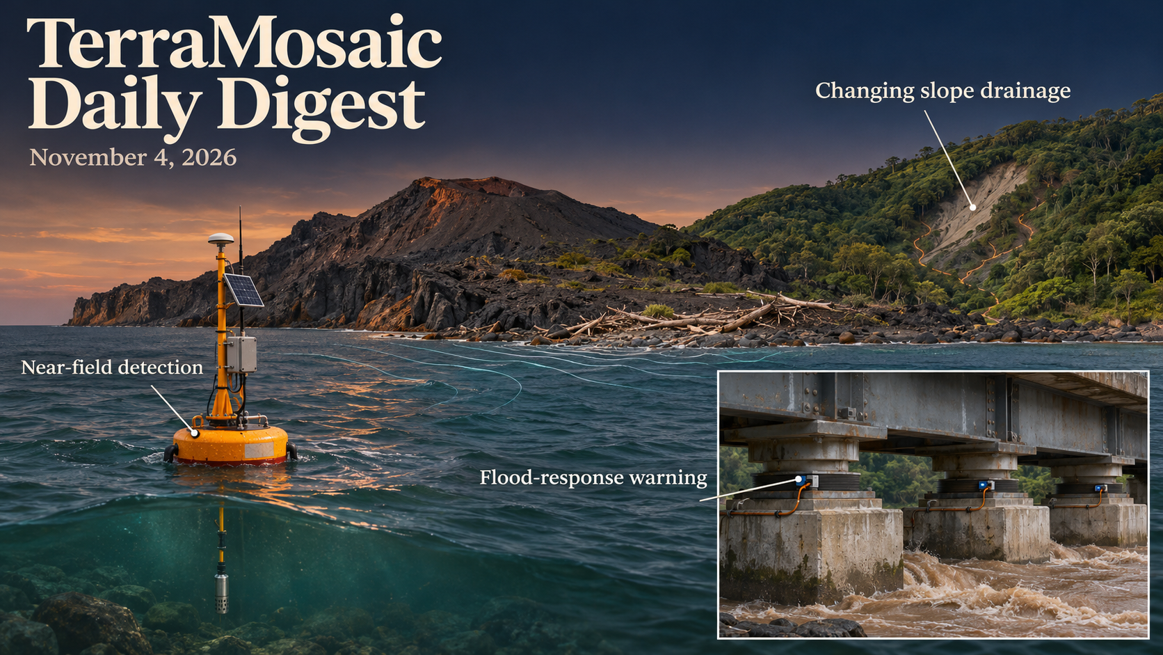
Daily Summary
A landslide can expand the area that becomes saturated while reducing the pressure retained at individual locations. A Taiwanese headwater record spanning a natural failure shows this combination at the soil–bedrock interface, together with faster recession after the slide. Opposing changes within the site leave aggregate rainfall–saturation relationships comparatively similar. The result makes the spatial organization of storage and drainage central to interpreting post-failure conditions, beyond a single catchment-average wetness measure.
Regional observations and mechanical models require equally explicit interpretation. InSAR slope-unit screening produces terrain-constrained candidates rather than exact, independently confirmed active-landslide boundaries. Single-station seismic monitoring finds component-dependent rainfall responses, while mine subsidence fusion separates spatial prediction from retrospective reconstruction. A continuum–limit-equilibrium comparison adds a mechanical counterpart: similar horizontal resultants can coexist with different interslice shear and moments when hydraulic gradients or weak layers change the stress field.
Warning studies span several kinds of evidence. Stromboli combines a long sea-level archive with years of operational near-field detection, whereas the bridge-bearing study measures its short precursor interval in simulations. White Volta forecasts link recent discharge and reservoir state to alert tiers, but their independent test does not include the highest alert flows. Snow-stability comparisons likewise retain a particular site, winter and choice of weak layers. Detection speed, forecast score and decision reliability therefore need their own reference and observation window.
Changes in frequency, severity and spatial support need not move together. German rain-on-snow projections generally reduce event frequency in several basins while increasing the severity of widespread events. Channel roughness strongly changes the Vipava inundation scenarios, and alongshore beach variability can resemble temporal shoreline change at a fixed transect. These studies show how local pathways, model assumptions and sampling geometry alter the hazard picture that reaches planning and warning systems.
Key Trends
The strongest links concern changing internal state, the assumptions behind a derived estimate and the evidence needed to connect a measurement to action.
- Failure reorganizes hydrological function: The headwater observations distinguish the extent of saturation from pressure magnitude and recession. An unchanged aggregate relation can conceal opposing local responses, so expanded wet area alone does not describe storage, drainage or renewed-failure conditions.
- Screening and state estimation need defined targets: Slope-unit polygons, seismic velocity changes and daily LOS deformation reconstructions answer different questions. Terrain support, component sensitivity, projection and smoothing assumptions determine what those products can establish.
- Mechanical agreement extends beyond one safety measure: Stress-resultant comparisons test interslice closures directly, while earthquake-source compilations and regional dv/v analyses distinguish geometric, material and shaking effects. Matching one summary response does not uniquely identify the underlying mechanism.
- Warning timing depends on the evidence chain: Operational tsunami detection, simulated bridge precursors, flood alert cross-validation and snow-metric field comparisons support different claims. Report timing and the availability of information before a decision remain material, as the crowdsourced road-dispatch replay demonstrates.
- Frequency and consequence can diverge: Rain-on-snow projections distinguish event count from widespread severity. Flood scenarios, coastal records and fire-index testing likewise retain the conditioning environment and target, rather than treating one score or trend as a complete risk description.
- Observation support shapes apparent performance: Mine reconstruction separates spatial holdouts from retrospective gaps; shoreline analysis requires alongshore sampling; coastal altimetry shows parameter-dependent biases. Harmonized groundwater records and null-calibrated hydrological benchmarks provide broader reference resources while preserving their coverage limits.
Selected Papers
Post-landslide hydrology, regional slope screening and the interpretation of mechanical and monitoring signals lead this selection. Warning-system studies connect those signals to decisions through field operation, simulations and event-based validation. The wider papers examine earthquake sources, flood and coastal processes, infrastructure consequences, and the observation quality needed to support hazard analysis.
1. Effects of a shallow landslide on headwater storage and drainage functions: A comparison of subsurface saturation before and after a 2016 landslide in northeastern Taiwan
Core Problem: Failure can reorganize soil–bedrock storage and drainage in ways that a catchment average conceals.
Key Innovation: Sixty interface pressure points sampled every ten minutes span multi-year periods before and after a Taiwanese slide. The saturated zone expands, yet frequently saturated locations have lower heads and faster recession; opposing spatial changes leave aggregate rainfall–saturation relations similar. These observations constrain post-failure hydrology, while lower pressures alone do not demonstrate renewed slope stability.
2. Assessing limit-equilibrium closure assumptions in slope stability using implicit-gradient finite-element stress resultants
Core Problem: Force and moment equilibrium do not uniquely determine mechanically representative interslice closure relations.
Key Innovation: Stress resultants from an independently computed regularized FE field test Spencer and Morgenstern–Price closures in three controlled configurations. Horizontal resultants agree relatively well, while shear and moments depart under hydraulic gradients and a weak layer. The diagnostic examines internal force relations; it is not field validation, a universal ranking of safety factors or a replacement closure already proven across slopes.
3. Largely Automated Regional Screening of Candidate Active-Slope Units Integrating InSAR and Topographic Constraints
Core Problem: A regional deformation threshold must separate background variation from candidate moving terrain without implying exact landslide boundaries.
Key Innovation: Terrain-constrained slope units and bootstrap-interval/background comparisons yield 92 and 25 candidates in two alpine river settings. These are screening units, not independently confirmed contemporaneously active landslides. The regional envelope, spatial dependence and activity calibration remain important, and inventory overlap or optical inspection cannot alone validate current motion.
4. Comparative analysis of landslide mobility and spatial distribution patterns based on multi-temporal rainfall-induced landslide inventories in northern Guangdong, China
Core Problem: Similar regional size distributions need not imply the same mobility scaling across successive storms.
Key Innovation: Three Guangdong inventories from 2021, 2022 and 2024 show event-dependent height, area and travel-distance relations despite shared broad patterns. Rainfall, antecedent state and previous disturbance are plausible contributors whose effects cannot be separated by the inventories. The empirical fits are not portable runout laws or causal estimates of rainfall effects.
5. Component-dependent sensitivity in tracking rainfall-related seismic velocity changes with a single-station at a tropical weathered soil site in central Brazil
Core Problem: Different seismic components can respond differently to hydrological changes at the same site.
Key Innovation: A 420-day Brazilian record compares same- and cross-component noise correlations with rainfall; horizontal combinations show stronger wet-period velocity responses than vertical autocorrelations. This supports multi-component hydrological investigation. A single weathered-soil site and rainfall associations do not uniquely recover saturation, mechanical strength or a landslide-warning threshold.
6. Early warning system for non-seismic gravity driven tsunamis
Core Problem: Near-field waves require rapid detection, with performance distinguished from complete community warning and evacuation time.
Key Innovation: Stromboli's evaluation combines a sixteen-year archive with more than seven years of operational experience. The paper reports detection within 22 seconds of onset and no false alerts in its evaluated operation, with sea-state sensitivity and regional filtering analyses. Record duration, tested conditions and wave-onset timing do not guarantee future error rates or equally long usable warning on every coast.
7. A sequential early warning method for flood-induced bridge failure based on bearing group strain responses
Core Problem: Bearing-group response can change differently before substructure and superstructure failure.
Key Innovation: A CFD–structural database supports GRU strain prediction and RF warning classes, with red warnings four to eight simulated seconds before collapse in the reported cases. A damaged-bridge-based case adds context. These are model-time precursor results, not demonstrated sensor-to-public warning latency or prospective field detection rates.
8. From forecast to alert: an open-data AI flood early warning system with reservoir monitoring for the White Volta Basin
Core Problem: Dam operations and recent observed discharge can dominate the skill of short-range flood forecasts.
Key Innovation: The White Volta ensemble combines gauge, rainfall, reanalysis and reservoir-state information. Its independent test stays below the Orange threshold; upper-tier alert skill comes from cross-validation. Persistence is competitive at one day, while longer-horizon and rising-flow gains are clearer. Reservoir fullness supplies context, not a standalone release or flood trigger.
9. Towards improved integration of hydrological uncertainty and hydraulic model sensitivity in flood hazard mapping
Core Problem: Hydrological frequency uncertainty and hydraulic roughness can affect different parts of an inundation map.
Key Innovation: Vipava scenario ensembles show stronger sensitivity to frequency analysis and channel roughness than to floodplain roughness in the tested setup. A weighted inundation-exceedance map identifies sensitivity-prone areas. The weights and selected scenarios define that output; it is not automatically an unconditional flood probability or an exhaustive uncertainty distribution.
10. Comparing and validating modelled snow stability metrics
Core Problem: Snow strength, fracture propagation and slab load can evolve together, complicating interpretation of modelled stability.
Key Innovation: Steintälli field measurements and SNOWPACK-derived metrics are compared during one winter, with local avalanche classification accuracies of 53–68%. Process-based and data-driven metrics show broadly comparable skill with different behaviours. Layer selection, site and winter limit generalization; one accuracy score does not establish a universal operational threshold.
11. Composition, frequency, and severity of future rain-on-snow floods in Germany
Core Problem: A declining number of snow-related floods can coexist with increasing severity of widespread events.
Key Innovation: German climate–LSTM ensembles generally project fewer ROS events in several basins but increasing severity of mean and extreme widespread events, with a different Danube frequency response. Snowmelt attribution declines as rainfall matters more. These are model-chain and scenario-dependent projections; integrated gradients explain model outputs rather than uniquely identify physical causation.
12. NDFI-SC: a robust near-real-time flood-mapping workflow using an SDWI-derived stable reference
Core Problem: Clouds can remove the optical reference used to tune a radar change-detection threshold.
Key Innovation: NDFI-SC builds a stable reference from Sentinel-1 and adds consistency-based thresholding, with complementary China, Vietnam and Australia tests. The China CSI is 0.809. Agreement with another flood product is not independent ground truth, and land-cover overlap describes mapped inundation rather than observed damage or calibrated annual flood risk.
13. A Spatio-Temporal Fusion Method for Mine Subsidence Based on Decoupling the Basic Deformation Field from Residuals Using InSAR-GNSS
Core Problem: Dense spatial radar sampling and dense temporal GNSS sampling do not directly provide a complete daily displacement field.
Key Innovation: BR-STKF separates baseline and residual fields, projecting GNSS into radar LOS and using filtering/smoothing. Spatial leave-one-out and retrospective missing-phase checks report different errors, 6.37 and 2.84 mm. These targets are reconstructed LOS motion; smoothing can use future information and small mean benchmark differences are not yet independently established superiority.
14. Mining-induced subsidence monitoring in vegetated karst coal-mining area of southwest China using LuTan-1 L-band SAR data with cumulative D-InSAR and Stacking-InSAR techniques
Core Problem: Vegetation and steep deformation gradients can limit radar coherence in mining regions.
Key Innovation: LuTan-1 and ALOS-2 support cumulative and stacked InSAR monitoring in Panzhou, with mapped migrating subsidence bowls and a preliminary road-hazard segment. Cross-sensor consistency and qualitative field checks support interpretation, but do not quantify absolute road failure risk without pavement, loading and other engineering information.
15. Differentiated Rift Rupture and Apparent Northward Earthquake Ordering in Southern Tibet Revealed by the 2025 Mw 7.0 Dingri Earthquake and Its Preceding Events
Core Problem: Rift geometry can influence rupture complexity, while local slope motion complicates surface-deformation interpretation.
Key Innovation: SAR-based Dingri modelling identifies segmented rupture and contrasts along-rift slip, with inferred local slope failures and an apparent northward ordering among selected sequences. The ordering is a retrospective spatial pattern, not a migration forecast or proof that rift maturity alone determines rupture behaviour.
16. Variations in dv / v Susceptibility to Earthquake Shaking Along the Alaska Subduction Zone
Core Problem: Large velocity drops can reflect local susceptibility or simply larger imposed shaking.
Key Innovation: Fourteen Alaskan events show heterogeneous dv/v response; normalization by PGV distinguishes volcanic high-susceptibility sites from amplified basin motions. Frequency dependence suggests shallow contributions. These regional associations support physical interpretation, but the ratio does not uniquely diagnose hydrothermal state or predict damage and future failure.
17. Shallow Slip Deficit: An Intrinsic Property of Continental Earthquakes, Slightly Enhanced by Fault Maturity
Core Problem: Apparent shallow slip deficit may depend on source geometry as well as fault maturity.
Key Innovation: A compilation of 1,078 models for 163 continental events finds magnitude–peak-slip-depth relations more influential than maturity and tests a shallow stress-drop interpretation. Models for one event are not independent earthquakes. Coverage, inversion and depth-resolution choices remain relevant; the fitted mechanism is not uniquely established for every fault.
18. Post‐Fire Surface Energy Partitioning and Thermal Responses in Arctic Boreal Forests and Tundra
Core Problem: Similar surface warming can accompany different post-fire energy redistribution in forests and tundra.
Key Innovation: Satellite and energy-balance diagnostics find first-summer warming in both ecosystems with contrasting component changes. Residual sensible-plus-ground heat is not an independent separation of its two terms. The case describes post-fire surface response, not a direct measure of thaw, future fire probability or a unique causal feedback strength.
19. The Overlooked Role of Alongshore Beach Non‐Uniformity in Short‐Term Shoreline Variability
Core Problem: Alongshore features moving past a fixed transect can resemble forcing-driven cross-shore change.
Key Innovation: Thirty years of Hasaki monitoring with multiple-transect surveys show that many single-transect positions fall within the alongshore range. That range is a non-uniformity proxy, not proof that a specified fraction of temporal variance is caused by megacusps. Spatial sampling therefore matters when validating satellite shorelines or calibrating wave-response models.
20. Mountains Modulate the Response of Precipitation Flashiness to Warming in High‐Resolution Simulations Over the Western US
Core Problem: Mountains can alter the projected temporal concentration of rain beyond what coarse models or statistical downscaling represent.
Key Innovation: High-resolution western-US simulations show reduced flashiness in some rain shadows despite widespread increases in coarse-model results. The comparison implicates changing orographic influence within the model experiments. A daily Gini response is not itself flood frequency, local peak intensity or a universal forecast under warming.
21. Saltwater Intrusion Seasonality Under Climate Change: Interacting Effects of River Discharge, Sea‐Level Rise, and Bathymetry
Core Problem: Sea-level rise and changing river seasonality can alter both salt-front position and its range of movement.
Key Innovation: Pamlico observations and coupled models show that landward topography can limit seasonal expansion under high sea levels. Intrusion magnitude and seasonal migration are different outcomes. The response depends on local geometry and scenarios; it does not establish one monotonic climate effect or a portable threshold for another estuary.
22. A generalized mode-superposition framework for seismic response analysis of underwater pile groups considering hydrodynamic interaction effects
Core Problem: The verified study combines mode superposition and hydrodynamic interaction in seismic pile-group response.
Key Innovation: The supplied abstract is an unrelated dynamic-response committee overview and is not used. Title-level evidence does not establish damping, soil assumptions, interaction magnitude, model accuracy or fragility improvements.
23. The impact of wind–wave interaction regimes on rogue wave statistics: Insights from field measurements
Core Problem: The verified paper examines the relation between wind–wave regimes and rogue-wave statistics.
Key Innovation: Available metadata establish field measurements as the stated basis. Wave definitions, sampling support, regime effects, uncertainty and predictive warning skill cannot be inferred without a matching abstract.
24. Experimental and CFD investigation of extreme wave loads on continuous rigid-frame bridges: The critical role of semi-submerged conditions
Core Problem: The verified work examines semi-submergence in continuous rigid-frame bridge loading.
Key Innovation: Its title identifies experimental and CFD comparisons. A matching abstract was unavailable, so force amplification, geometry, model agreement and design limits are not inferred.
25. Large-amplitude internal waves near a wharf: Observations and implications for navigation
Core Problem: Calm surface weather can coexist with rapid subsurface-current changes near a wharf.
Key Innovation: Saguenay field campaigns document tide-related wavetrains, up to about 10 m amplitude and minute-scale current changes approaching 1 m/s. These observations identify a navigation-relevant current source. They do not uniquely explain the earlier docking incident or define the same conditions in other stratified ports.
26. Monthly fire probability prediction integrating lightning and multivariate predictors across China using machine learning
Core Problem: A monthly fire score must be assessed for calibration and spatial fidelity as well as discrimination.
Key Innovation: China's RF/XGBoost study separates fitting, selection and a 2025 test, with one-month-lag predictors. RF ranks better in the reported comparisons, but calibration error remains substantial and spatial correlation modest. Seasonal pattern agreement does not turn the index into an ignition forecast or demonstrate calibrated probabilities at every location.
27. A Multiscale Remote-Sensing Assessment of Root-Zone Soil Moisture, Evapotranspiration and Canopy Moisture Stress Across Uruguay During the 2020–2023 Drought
Core Problem: Meteorological deficit, root-zone moisture and vegetation response are measured on different supports.
Key Innovation: Uruguay analysis preserves SMAP parent-cell support while aggregating finer ET and moisture-stress indicators. Product-dependent and prewhitened associations help distinguish what is shared across timescales. Coarser moisture retrievals do not become independent fine-resolution measurements, and correlated indicators do not isolate causal ecosystem controls.
28. Likelihood-robust fusion of crowdsourced road-passability reports for flood relief dispatch and UAV inspection targeting
Core Problem: Road reports may be stale, misplaced or unavailable when a dispatch decision is made.
Key Innovation: Synthetic tests favour consequence-based inspection and bounded fusion under tested corruptions. In the Zhengzhou replay, the estimated gain largely vanishes when restricted to five pre-decision event reports, whose posting times are unknown. The study exposes timing and credibility sensitivity, rather than validating a deployed relief benefit.
29. Multi-hazard assessment of the eastern slope of the Sistema de Famatina, La Rioja province (Argentina)
Core Problem: The eastern Famatina slope faces interacting natural processes and human pressures.
Key Innovation: Field observations, imagery and historical/environmental data organize regional hazards and mitigation considerations. This is a regional synthesis and screening basis. Documented co-occurrence and plausible scenarios are not calibrated joint-event probabilities or measured effectiveness of proposed interventions.
30. Chemical weathering progress and whole-rock mineral assemblage changes associated with slope geo-hazards in Guangdong, China
Core Problem: Lithology-specific alteration can provide background conditions associated with slope hazards.
Key Innovation: Guangdong hazard mapping is paired with mineral and geochemical samples from eleven sites. Parent-normalized alteration distinguishes sampled products more clearly than some raw indices, while inherited minerals complicate sedimentary materials. Site/lithology dependence and observational design prevent attribution of independent failure causes or direct conversion to a stability threshold.
31. Integrating social vulnerability and landslide susceptibility for spatial risk assessment in the Langat basin, Malaysia
Core Problem: Susceptible terrain and socially vulnerable populations can overlap without defining absolute loss probability.
Key Innovation: Langat combines frequency-ratio susceptibility with demographic indices over fourteen units. Its AUC uses the same inventory that defined the weights, so it is not independent predictive validation. The combined map is a relative planning index, not annual failure probability, expected casualties or proof of risk reduction.
32. Investigating the origin of a thermal anomaly in volcanic agricultural soils of Uruapan, Mexico: geochemical, mineralogical, and seismic evidence for subsurface combustion
Core Problem: A localized hot-soil anomaly requires multiple observations before assigning a volcanic source.
Key Innovation: Uruapan gas, soil, mineral and seismic observations are most consistent with shallow combustion rather than detected unrest. Water cooling preceded the survey, and isotopic/temporal confirmation is absent. The interpretation supports bounded risk communication; it does not physically prove the combustion mechanism or exclude all future volcanic activity.
33. A practical closed-form framework for estimating period, drift and buckling capacity of coupled shear wall buildings including local wall shear deformation
Core Problem: Ignoring local wall shear flexibility can bias simplified period, drift and buckling estimates.
Key Innovation: Closed-form corrections are checked against 312 symmetric single-bay configurations and mesh-verified shell references. Improvements apply within that structural family and numerical support. They are not field accuracy, collapse probability or validated formulas for irregular multibay systems and additional stiffening layouts.
34. Thermal fatigue, water-weakening spalling, and structural instability of Nabataean rock-cut façades
Core Problem: The verified paper links thermal fatigue and water weakening to Nabataean rock-cut façades.
Key Innovation: Title-level evidence identifies the deterioration and structural-stability problem. Without matching abstract evidence, monitored conditions, material parameters, attribution, damage rates and stabilization benefits are not inferred.
35. Structural State Identification and Reliability Assessment of Fault-Crossing Subsea Tunnels Using Fourier Neural Operators under Geological Uncertainty
Core Problem: The verified title combines neural operators and geological uncertainty for tunnel assessment.
Key Innovation: The supplied abstract is a generic AI–DAS overview unrelated to the stated FNO study and is excluded from interpretation. The record does not establish observation inputs, probabilistic calibration, reliability estimates or validation of actual tunnel state.
36. Simulating dynamic transport-economic interdependencies for post-earthquake regional economic recovery
Core Problem: The verified work addresses transport–economy interdependence after earthquakes.
Key Innovation: The title establishes dynamic simulation of regional recovery. Available metadata do not establish network assumptions, damage inputs, economic feedback strength, recovery predictions or intervention benefits.
37. Beyond static risk: An estuarine zoning method aligning dynamic flood-source diagnostics with grassroots governance boundaries
Core Problem: Physical flood-source patterns need translation into workable administrative priorities.
Key Innovation: Jiulong HEC-RAS scenarios use equivalent-depth differences and exposure/governance layers to define zones. The resulting source attribution depends on selected scenarios and difference thresholds. A zone's higher composite risk index is not an annual loss probability, a unique causal decomposition or measured governance effectiveness.
38. Natural gravel beaches and dynamic gravel structures: A systematic review of classifications, cross-shore processes, transferability and knowledge gaps
Core Problem: Grain composition, permeability and sediment exchange jointly influence gravel-beach response.
Key Innovation: The review distinguishes natural and constructed gravel systems and organizes wave, swash and groundwater processes. Evidence of protection remains coupled to site and material conditions. A shared classification does not provide one universal design permeability, nourishment geometry or guaranteed storm performance.
39. Hierarchical optimization of acoustic emission sensor placement for cross-fault tunnel linings: A physics-constrained and damage-probability-driven approach
Core Problem: The verified study optimizes AE sensor placement with physical and damage-probability constraints.
Key Innovation: No matching abstract was available to establish probability definitions, forward model, localization error, sensor failure robustness, experimental checks or field-warning performance.
40. Interaction mechanism between a T-shaped cross tunnel and a nearby fault zone under blasting load: a case study from the Bedretto Lab, Switzerland
Core Problem: The verified Bedretto study examines a T-shaped tunnel interacting with a nearby fault under blasting.
Key Innovation: The title establishes a case-based interaction investigation. Fault properties, load levels, response trends, validation and safe excavation limits remain unknown from the available metadata.
41. An analytical study incorporating non-hydrostatic stress unloading: Dynamic response of an existing tunnel to adjacent blast excavation
Core Problem: The verified work includes non-hydrostatic unloading in the response of an existing tunnel to nearby blast excavation.
Key Innovation: Title-level evidence does not determine unloading paths, blast inputs, stress anisotropy, predicted damage or agreement with field observations. No design or safety threshold is inferred.
42. Cropland and population exposure to extreme precipitation events in Central Asia under future climate change
Core Problem: The verified study considers population and cropland exposure in Central Asia under future climate change.
Key Innovation: The record establishes a scenario-based exposure topic. Without a matching abstract, climate pathways, population assumptions, extreme-event definition, uncertainty and loss implications are not inferred; exposure is not itself damage or vulnerability.
43. A bidirectional simulation approach for cross-sectional enlargement of backward erosion pipes involving deepening and widening
Core Problem: Backward erosion requires representation of both deepening and widening of a conduit.
Key Innovation: The verified title proposes a bidirectional cross-sectional simulation. Matching abstract evidence was unavailable to assess hydraulics, grain transport, validation, progression rates or implications for an embankment's breach probability.
44. Seismically induced seawater–seabed–tunnel interactions of large-diameter subsea shield tunnels in mixed-ground conditions
Core Problem: The verified study combines seawater, seabed and a large tunnel in mixed ground under earthquake loading.
Key Innovation: Title-only evidence does not establish coupling assumptions, ground properties, response amplification, damage criteria, numerical verification or a preferred protective design.
45. Vibration response and rebound-derived strength changes in cracked shield tunnels under train-induced loading: A multi-scale experimental study
Core Problem: The verified paper examines vibration and rebound-derived strength changes under train loading.
Key Innovation: The title identifies experimental scales and a strength proxy. Without a matching abstract, crack geometry, cyclic history, proxy calibration, observed degradation and transfer to actual tunnel safety are not inferred.
46. A Low-Cost Tool for Communicating the Time-Critical Feasibility of Near-Field Tsunami Evacuation: A Proof of Concept in Viña del Mar, Chile
Core Problem: Static evacuation maps omit how departure time interacts with the arrival of moving inundation.
Key Innovation: The Viña del Mar proof of concept overlays 119 drill GPS tracks with simulated inundation. Feasibility falls with delayed departures. These scenario-specific trajectories support risk communication; drill movement and modelled wave arrival do not predict population-wide survival.
47. Beyond Coastal Validation: Resolving Storm-Time Sea Surface Height Variability with SWOT High-Resolution Observations
Core Problem: Point-gauge agreement does not establish the physical origin of every two-dimensional coastal SSH anomaly.
Key Innovation: SWOT comparisons at five gauges are followed by spatial analyses of three coastal domains and two storms, resolving sub-kilometre variability. Tide, waves, currents and bathymetry can contribute differently. Strong local gauge correlation does not validate every spatial feature or uniquely attribute storm-surge and wave components.
48. Historical Groundwater Memory Predicts Site‐Specific Persistence Horizons Across Germany
Core Problem: An aquifer's historical memory may constrain later persistence differently from nearby sites.
Key Innovation: German well records separate an earlier memory-estimation period from a later persistence period and find strong site-specific agreement. This supports investigation of persistence horizons. It is not direct validation of a forecast at every horizon, nor a unique causal determination of aquifer storage, resilience or drought duration.
49. Revealing the Mechanism of Solute Anomalous Transport Within Discrete Fracture Networks: Insight From Differences in Flow Pathways
Core Problem: Early breakthrough and late tailing can arise from different connected pathways within one fracture network.
Key Innovation: A measured-geometry network and particle tracing attribute breakthrough features across 200 realizations to path travel-time structure. Aperture variability strengthens flow focusing in the tested formulation. The path decomposition clarifies model behaviour; it does not uniquely recover real subsurface pathways or independently predict field contaminant risk.
50. Learning Implicit Solves for Dynamic Simulations
Core Problem: Static operator learning may be reused inside a time integrator rather than requiring dynamic trajectory supervision.
Key Innovation: INOS combines a learned equilibrium solve with Newmark integration and reports fast elastodynamic rollouts under changed discretizations and conditions. The large speedups and long stable example are benchmark-specific. Stability does not establish universal accuracy, conservation, contact/failure fidelity or validated seismic response.
51. ChangeJEPA: Predict Before You Compare for Remote Sensing Change Detection
Core Problem: Bitemporal comparison must separate meaningful change from nuisance appearance variation.
Key Innovation: ChangeJEPA predicts post-state representations using pre-change imagery and partial post-change context, improving matched change-detection benchmarks. This is a bitemporal representation task: access to post-change evidence distinguishes it from forecasting an unseen disaster, and generic change skill does not establish landslide-detection accuracy.
52. Self-Supervised Learning of Universal Latent Spaces for Operator Learning
Core Problem: Rebuilding a representation for each PDE task can consume labels, memory and training time.
Key Innovation: A functional autoencoder trained on synthesized functions supplies frozen representations across multiple operator tasks and geometries. The tested equivariances and efficiency gains support reuse. They do not guarantee that latent edits preserve every physical law, that rollouts remain stable under arbitrary forcing or that a hazard simulator transfers without validation.
53. ReTailor: A Residual Feature Tailoring Framework for Real-Time Cross-Sensor Pansharpening Adaptation
Core Problem: Pansharpening priors can degrade when a new sensor changes the image distribution.
Key Innovation: ReTailor optimizes a small residual module with self-supervised constraints and shares adaptation across a stream. It is lightweight target adaptation, rather than no optimization or no target data. Image-fidelity gains do not establish geometric accuracy, preserved rare changes or displacement measurement under a new sensor.
54. METRIC-GS: Selective Metric-Scale Estimation for 3D Gaussian Splatting
Core Problem: A reconstructed scene can remain metrically uncertain even when it appears geometrically plausible.
Key Innovation: METRIC-GS combines scale estimation, refusal and selective routing, separating standalone accuracy from the cost/accuracy of a hybrid. Public and small phone/drone tests support the tested operating points. Selective success and benchmark scale error are not universal metric accuracy or a complete terrain-change uncertainty estimate.
55. XuanJian-DINOSAR: A SAR Foundation Model Based on Global and Local Semantic Consistency
Core Problem: Optical pretraining and SAR speckle can produce different representation instabilities.
Key Innovation: XuanJian-DINOSAR adapts DINO-style global/local objectives with aligned views and intensity/speckle perturbations over a large SAR collection. Classification/detection results support representation transfer. They do not establish disruptive hazard capability, complex-phase preservation or reliable InSAR displacement inference.
56. From hydrological laws to catchment models: A process-based model matches deep-learning accuracy on three continents
Core Problem: A physical storage-network formulation should be compared fairly with neural models, including calibration and ensemble choices.
Key Innovation: CaRT+ is tested across British, US and Australian gauged catchments and is competitive with individual LSTMs, while some ensemble advantages remain. Each catchment retains fitted parameters. The result supports a useful constitutive family, not zero-shot ungauged skill, universal catchment laws or calibrated flood extremes.
57. FA-Agent: An extensible multimodal agent framework for first-arrival picking in mountainous seismic data
Core Problem: Weak first arrivals may require rejection or local review rather than a confidently wrong pick.
Key Innovation: FA-Agent combines multimodal inspection, processing tools and expert-reviewed experience, with semi-synthetic and mountainous-survey examples. The evidence supports the evaluated picking workflow. Automatic skill accumulation is not independent proof of continual improvement, and better picks do not by themselves validate a velocity model or hazard forecast.
58. CARM: Conformal Adaptive Risk Masking for Reliable Scientific Super-Resolution
Core Problem: A mask calibrated once can lose its intended risk behaviour as EO data change over time.
Key Innovation: CARM adapts thresholds with delayed feedback and tests chlorophyll, wind and SST super-resolution streams. Its defined time-average mask-conditioned risk target differs from guaranteed coverage at each pixel, date or event. Mask quality depends on the risk definition, feedback availability and retained spatial support.
59. FlowReconBench: Accuracy, calibration and cost of learned and classical flow reconstruction from sparse sensors
Core Problem: Classical and learned reconstructions can excel under different sensing and observability conditions.
Key Innovation: FlowReconBench compares errors, spectra, ensembles, calibration and cost under controlled splits. Classical estimators remain competitive in several regimes, and point-error and probabilistic rankings differ. A plausible unobserved field or visually similar structure is not unique physical recovery or proof that an underconstrained state is identified.
60. Backward-Consistent Diffusion Sampling for Sparsely Observed PDE Inverse Problems
Core Problem: Physics-consistent reconstruction can still leave large error away from sparse sensors.
Key Innovation: FunBCS optimizes diffusion inputs and studies a failure mode of output-space optimization, with discontinuous Darcy and other PDE tests. The reported improvements are conditional on the studied priors and theorem setting. They do not establish universal posterior calibration, uniqueness or field-validated permeability recovery.
61. Using Waste Marine Clay as an Alternative to Bentonite for Coastal Seepage Cutoff Wall Construction: Engineering and Physicochemical Properties in Seawater
Core Problem: Seawater can change the workability, strength and permeability of cutoff-wall mixtures.
Key Innovation: Marine-clay and bentonite mixtures are compared in fresh and saline water, showing different material trade-offs and dosage dependence. The tests support further coastal barrier design. Mixture-scale stability does not demonstrate full-wall durability, field seepage performance or prevention of flood-induced failure.
62. Analysis-ready European Groundwater Monitoring (EUGM) database
Core Problem: National groundwater records require harmonized information before cross-country analysis.
Key Innovation: EUGM consolidates records from 27 partners in 24 European countries, with more than 15,000 monitoring sites. The resource supports reproducible comparison, while uneven records, local datums and observation histories still need attention. Analysis-ready packaging does not make every record complete or every country equally represented.
63. A benchmark dataset of null-calibrated streamflow spectral-memory diagnostics for five CAMELS-family archives, with open rainfall-runoff model outputs for CAMELS-GB v2
Core Problem: A rescaled spectrum can align partly because of serial correlation rather than a unique storage mechanism.
Key Innovation: The release provides five CAMELS-family archives with matched stochastic references and an open-model reuse example. Alignment gains vary by archive, and the example does not support one universal spectral model-selection rule. Release-defined coordinates and reference products remain diagnostic tools, not validated physical laws.
64. An open-source Python framework for the flexible deployment and advanced applications of the Variable Infiltration Capacity (VIC) model
Core Problem: Preparing data and parameters can impede reproducible deployment of VIC.
Key Innovation: Easy VIC Build organizes model setup through a modular Python framework and demonstrates applications in two basins. This is a deployment and experimentation contribution; workflow convenience and successful examples do not establish universally transferable parameters, improved flood skill or a new physical model.
65. Cross-Configuration 4D DAS-VSP Monitoring for Long-Term CO2 Storage
Core Problem: Hardware and optical-path changes can complicate interpretation of long-term time-lapse monitoring.
Key Innovation: The Otway field comparison retains a localized injection-related DAS-VSP anomaly despite greater non-repeatability after combined configuration changes. The design cannot isolate each hardware contribution. A detectable anomaly under favourable conditions is not a complete containment proof or validated leakage-warning capability.
66. Consistency of HY-2B/C/D Altimeter Sea State Products in Chinese Coastal Seas: Wave Height, Wind Speed, and Parameter-Dependent Inter-Satellite Bias
Core Problem: Inter-satellite consistency can differ between wave height and wind even within one constellation.
Key Innovation: Common-buoy/period comparisons and collocation distinguish HY-2B/C/D product and parameter biases. A simple wind offset can help in the tested setting, while low sea states influence apparent near-coast degradation. Shared-reference comparisons do not supply error-free truth or a correction transferable to every sea state and region.
67. Multi-timescale evaluation of satellite precipitation products using 15-minute gauge observations in complex terrain, Ethiopia
Core Problem: Temporal aggregation and complex terrain can change which satellite rainfall product appears most reliable.
Key Innovation: Ethiopian 15-minute gauges are aggregated for point-to-pixel comparisons across hourly to daily scales, revealing product and seasonal differences. Gauge support, reporting latency and aggregated metrics need to accompany selection. A stray editorial instruction in the supplied abstract is excluded; no missing hourly statistic is invented.
68. Recognizing Froude supercritical flow in the sedimentary record: processes, bedforms, and uncertainties
Core Problem: Similar preserved deposits can arise from different supercritical bedforms.
Key Innovation: The review integrates experiments, models and field evidence into multiple-hypothesis interpretation, with cyclic steps generally more diagnostic than stable antidunes. Confidence in a flow regime need not identify the exact formative bedform. Sedimentary interpretation alone does not uniquely recover a flood hydrograph or return period.
69. Landscape controls on late-thaw active-layer thickness in alpine permafrost: 30 m mapping from GPR and temporally matched environmental predictors
Core Problem: The verified study maps late-thaw active-layer thickness with GPR and temporally matched environmental predictors.
Key Innovation: The title establishes 30-m mapping and a landscape-controls analysis. Without a matching abstract, field support, prediction error, seasonal transfer, ice-content implications and relation to slope instability are not inferred.