
TerraMosaic Daily Digest: November 5, 2026
Daily Summary
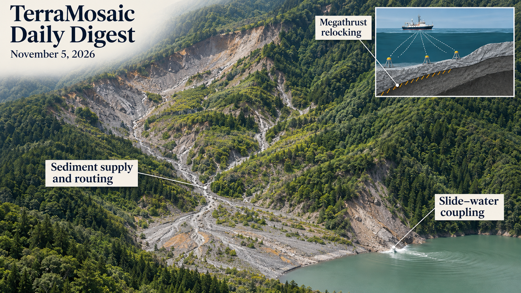
Fault locking can recover while other parts of the postseismic system continue to evolve. Fourteen years of offshore Tohoku observations, combined with onshore geodesy, repeating earthquakes and modelling, constrain a locking pattern inferred to resemble the pre-2011 state despite continuing mantle relaxation. The contribution is a long observational view of how afterslip, relocking and viscoelastic response overlap. It does not place every mechanical property on one recovery clock.
The surface landscape retains a different earthquake legacy. Across 44 Wenchuan catchments, active landslide area and a sediment–rainfall activity index decline over the observed 2008–2019 period, while sediment-supply potential remains above the pre-earthquake reference. Pathway connection and rainfall help explain why a smaller active area need not mean an inactive debris-flow system. The fitted transition toward relatively stable conditions in the late 2040s is an extrapolated reference timescale, with limited independent temporal validation.
Process representation changes the consequences a model produces. Huangtian's three-dimensional MPM couples a phase-transition material description to slide–water interaction and separates the timing of slide and water kinetic energy. Mine fault-slip simulations likewise produce different wall motions under different friction laws. Laboratory quartz–coesite deformation and particle-laden jet acoustics add more controlled examples of how reaction kinetics and dispersed material alter localization or signals, while their transfer to natural events remains a separate task.
Observation products also retain their acquisition and target definitions. Daguan's L-band mission offers many more coherent radar points in vegetated terrain, but the comparison does not isolate wavelength from other configuration changes. Seasonal rebound can coexist with a continuing deformation trend. Fire-code estimation, historical orthophotos and VHR representation benchmarks provide related reminders: the target, positional reference, training data and transfer protocol determine which interpretation an apparent accuracy gain can support.
Key Trends
The selection follows recovery, connectivity and process representation, with validation matched to the particular state or consequence being estimated.
- Recovery is specific to the state measured: Tohoku relocking and Wenchuan debris-flow recession concern different physical systems and observables. A similar locking pattern, lower active area or declining index does not alone establish a complete return to pre-event conditions.
- Pathways matter alongside material quantity: The Wenchuan framework includes sediment location relative to transfer routes. Huangtian modelling follows energy transfer into water, while groundwater-induced slope analysis separates translation, rotation and spatial strain before assessing possible building consequences.
- Constitutive choices alter predicted response: Rate-and-state and slip-weakening rupture laws produce different mine-wall motions. Mineral reaction kinetics affect experimental localization, and particles change jet-noise spectra. These are conditional mechanism tests, rather than interchangeable calibrations of natural hazard intensity.
- A proxy needs its own interpretation: Fire moisture codes are weather-derived indices; a fine orthophoto pixel is distinct from positional accuracy; phase-separated radar trends differ from the raw series. Each product requires a reference appropriate to the intended physical claim.
- Transfer testing extends beyond a local fit: Beijing mapping separates random-tile segmentation from spatial environmental validation. Fire-code errors increase at unseen stations, while VHR benchmarking and series-wise forecast tests expose the role of pretraining scale and deployment splits.
- A certificate specifies a quantity: The water-wave computation certifies a residual for a frozen representation. Time-dependent conformal analysis defines when coverage can fail or be recovered. These mathematical results improve verification without automatically establishing physical uniqueness, dynamic stability or field forecasting skill.
Selected Papers
Megathrust relocking and the long-lived surface consequences of earthquakes lead this selection. Numerical and laboratory studies examine how material transitions, fault friction and water coupling affect response. Related radar, field-survey and learning studies test which measurements and comparisons support transferable hazard assessment.
1. Seafloor geodesy delineates fast megathrust relocking after the giant 2011 Tohoku earthquake
Core Problem: Offshore observations are needed to distinguish recovering fault locking from afterslip and continuing mantle relaxation.
Key Innovation: Fourteen years of Tohoku seafloor geodesy, onshore observations, repeating earthquakes and modelling constrain a locking pattern inferred to resemble the pre-2011 state while viscoelastic relaxation continues. The long offshore record closes an important observational gap. Similar locking does not imply complete recovery of every mechanical property or determine the timing and size of the next earthquake.
2. Three-dimensional material point method modeling of the full-scale Huangtian landslide-tsunami with a phase-transition model
Core Problem: Full-scale slide–water modelling must accommodate changing solid-like and fluid-like material response.
Key Innovation: A GPU-accelerated two-phase MPM with phase transition is checked against experiments and existing solutions and applied to Huangtian. Reported outputs include roughly 25 m/s slide speed and 31 m maximum free-surface elevation, with delayed water-energy peaks. Those quantities retain the model reference and geometry; free-surface elevation is not automatically shoreline runup or a transferable warning time.
3. Quantifying the long-term evolution of post-earthquake debris-flow activity in the epicentral area of the 2008 Wenchuan earthquake, China
Core Problem: Declining active landslide area does not uniquely describe residual sediment connectivity and rainfall-driven debris-flow activity.
Key Innovation: A framework for 44 Wenchuan catchments combines sediment-supply potential and representative rainfall using 2008–2019 inventories. The index declines overall yet remains above the pre-earthquake reference. The six-year regional rank check has p=0.058, and the late-2040s transition is curve extrapolation. It is a reference timescale, not a deterministic recovery forecast or independently validated cessation date.
4. Multi-Track MT-InSAR Combining L-Band LuTan-1 and C-Band Sentinel-1 for Geological Hazard Identification and Assessment of Candidate Deformation Drivers in Daguan County, Southwest China
Core Problem: More coherent radar targets do not uniquely identify a physical trigger or prove a slope is stabilizing.
Key Innovation: Daguan analysis combines LT-1/Sentinel-1 tracks with directional and temporal decomposition. LT-1 has a large operational point-density advantage, but wavelength is confounded with acquisition and processing differences. Seasonal rebound can coexist with a continuing trend; unresolved north–south motion and coincident construction/seismic timing limit causal interpretation and complete 3D recovery.
5. Three-dimensional numerical analysis of excavation-induced deformation in an asymmetric irregular deep excavation in coastal soft soil and comparison with monitoring data
Core Problem: An irregular, asymmetric excavation can produce different deformation histories on opposite sides.
Key Innovation: A staged 3D Sanya model uses laboratory soil parameters and comparisons at selected field/InSAR locations, reproducing cumulative and stage-dependent trends with asymmetric wall movement. Small final differences at those locations do not establish accuracy everywhere or across all construction stages, and local heave/settlement remain conditional on geometry and model assumptions.
6. Transformational Faulting: The Case of Quartz‐Coesite
Core Problem: Reaction kinetics and mineral volume change may alter whether deformation localizes into fault-like failure.
Key Innovation: Quartz–coesite experiments combine acoustic emissions and microstructures, with slow-reaction localization contrasting with distributed fast-reaction deformation. The observations support a volume-change route in this mineral system. They do not uniquely establish the mechanism of natural deep earthquakes or make laboratory b-values direct earthquake-warning thresholds.
7. Tree Rings Indicate Potential for Severe Soil Moisture Drought in California Is Much Greater Than Observations Suggest
Core Problem: An instrumental record can undersample drought severities admitted by longer proxy reconstructions.
Key Innovation: A California tree-ring reconstruction to CE 1100 changes estimated extreme-drought probabilities relative to instrumental-only fitting. The severe 1579–1580 pair illustrates the influence of record length. Probabilities remain conditional on proxy reconstruction and extreme-value assumptions; historical fitted exceedance is not a stationary guarantee for future climate.
8. An Experimental Study of Particle‐Laden Jet Noise as an Analogue to Tephra‐Laden Volcanic Eruptions
Core Problem: Gas-only noise templates may miss the acoustic effects of particles in eruption-like jets.
Key Innovation: Millimetre-nozzle experiments show angle-dependent departures from single-phase turbulence spectra. Particle disruption and reduced exit speed remain competing contributors. The analogue informs acoustic interpretation, but laboratory frequencies, scaling and accessible viewing angles differ from actual volcanic infrasound monitoring.
9. Enhanced Surface Coupling but Suppressed Convective Triggering During Humid–Hot Extremes in the Yangtze River Basin, a Major Humid‐Heat Hotspot in China
Core Problem: Stronger near-surface coupling need not translate into greater convective cloud development.
Key Innovation: Yangtze observational/reanalysis comparisons associate humid-heat persistence with changing surface, pressure and cloud conditions, including inhibited cloud formation. The diagnostic separates surface coupling from convective response. Correlated event composites do not independently identify every feedback contribution or validate a forecast system.
10. Record‐Shattering Winter “Heatwave” Over the Antarctic Peninsula in 2026, Associated Primarily With Tropical East Indian Ocean Surface Temperature Anomalies
Core Problem: Unusual winter warming can be associated with remote ocean conditions and regional atmospheric transport.
Key Innovation: Stations and circulation analysis link the 2026 Antarctic Peninsula episode to atmospheric rivers and pressure anomalies, with tropical Indian Ocean involvement. The quoted large anomaly is relative to a baseline, not the absolute temperature. Event attribution does not by itself quantify ice-shelf damage or supply a calibrated precursor for future episodes.
11. Finite Element Greenfield Modelling for building damage assessment under groundwater-induced slope movements
Core Problem: Ground displacement and strain need interpretation before they can support preliminary building-damage screening.
Key Innovation: Idealized drained, steady-seepage FE slopes are coupled to a limiting-tensile-strain interpretation of greenfield deformation. Crest, middle and toe kinematics differ. These are preliminary deformation proxies; a greenfield analysis does not capture every building–soil feedback or independently validate actual damage to a particular structure.
12. Influence of wave forcing and beach morphology on coastal cliff erosion hotspots
Core Problem: The verified paper examines how wave forcing and beach morphology relate to coastal cliff erosion.
Key Innovation: A matching abstract was unavailable. Field coverage, erosion measurements, causal attribution, model skill and future hotspot predictions are not inferred from the title.
13. Spatiotemporal environmental impact assessment of soil erosion using RUSLE, GIS, and remote sensing
Core Problem: Spatial erosion screening needs explicit interpretation of what an empirical soil-loss model represents.
Key Innovation: Kabul River Basin endpoint maps compare 1994 and 2024, with mean modelled loss declining from 4.70 to 3.04 tonnes per hectare per year alongside persistent steep hotspots. Two endpoints do not establish a continuous decline or the causal effect of forest change. RUSLE soil loss is not observed channel sediment delivery or landslide probability.
14. Observations of Biomass Burning Smoke Transported from Southeast Asia Using a Multi-Wavelength Polarization Raman Lidar
Core Problem: Elevated transported smoke needs vertical observations beyond surface imagery and hotspot maps.
Key Innovation: A year of Mengzi lidar data identifies eight transboundary episodes, with optical-property and trajectory evidence consistent with Southeast Asian sources. Depolarization alone does not determine particle shape or smoke age. Layer observations and trajectory association do not establish near-ground exposure or uniquely attribute every sampled particle.
15. Predicting Fuel Moisture Codes Across Mountainous Forests of British Columbia Using L-Band ALOS-2 PALSAR-2 Imagery
Core Problem: Weather-derived fuel-moisture codes and directly measured fuel water content are different targets.
Key Innovation: ALOS-2 RF estimates of DC and DMC show fuel-type-dependent performance and poorer results at unseen weather-station locations. Day-of-year information improves some fits. Out-of-bag agreement with computed codes is not independent validation of fuel moisture or ignition probability, and limited spatial transfer remains central to application.
16. Machine Learning-Based Bias Correction Scheme for FY-4A AGRI Radiance Assimilation and Its Impact on Typhoon Forecasting
Core Problem: Improved radiance departures need to be tested for their downstream forecast effect.
Key Innovation: Four ML bias corrections are compared with VarBC for Typhoon In-Fa; the tested KAN correction improves track results and single-channel assimilation can outperform using both channels. The result depends on this case, channels and assimilation setup. More inputs or a better departure distribution do not universally guarantee better typhoon forecasts.
17. Spatiotemporal variability of droughts across Sudan (1991–2023) under a changing climate
Core Problem: Short- and long-accumulation drought indices can yield different persistence and spatial patterns.
Key Innovation: Sudan SPEI3/SPEI12 analysis maps severity, duration and centroid behaviour during 1991–2023. These are descriptive index-dependent results. Centroid paths depend partly on spatial-domain geometry and disconnected affected areas; they are not necessarily a physically travelling front or a prospective warning with demonstrated lead time.
18. Improved Mask R-CNN inventory mapping and multivariable geo-environmental assessment of rainfall-induced shallow landslides in mountainous Beijing, China
Core Problem: Mapping accuracy, within-event spatial association and rainfall triggering require distinct evaluation.
Key Innovation: The Beijing workflow maps 8,298 slides and reports in-scene segmentation scores, with variable spatial-block performance in environmental modelling. Adjusted rainfall associations are weak in this event's spatial model. That does not refute rainfall triggering; random-tile metrics also do not establish transfer to a new region or storm.
19. A Highly Interpretable Rockburst Intensity Prediction Model Integrating ASHA Optimization with an Attention-Enhanced Broad Learning System
Core Problem: An accurate intensity class needs validation beyond the pooled training-case distribution.
Key Innovation: ASHA–Attention–BLS uses 410 cases and a small external check of 17 samples from four projects. Perfect classification in that small set is preliminary cross-project evidence, not a guarantee. SHAP and attention describe model attribution rather than physical causal controls, and intensity classification is distinct from predicting event time or occurrence probability.
20. 3D Physics-Based Simulation of Dynamic Fault-Slip Models and the Radiated Seismic Waves Impact on Near-Field Stope
Core Problem: A rupture law changes nucleation and radiated motion as well as the final slip.
Key Innovation: A 3D comparison finds different tunnel-wall velocities and rise times for rate-and-state and linear slip-weakening models. Those differences quantify sensitivity within the adopted fault/geometry parameters. They do not independently prove that one law is correct for every mine fault or calibrate a universal damage threshold from simulated PPV.
21. Equity-centered disaster risk assessment among formal and non-formal workers and willingness to pay for flood risk insurance in Bali, Indonesia
Core Problem: The verified study compares formal and non-formal workers in Bali's flood-risk and insurance context.
Key Innovation: Title-level evidence does not establish survey design, vulnerability differences, willingness-to-pay values, causal explanations or the effectiveness of an insurance intervention.
22. Coordinating distributed knowledge to design a multi-hazard microinsurance product for low-income households in South Africa
Core Problem: The verified study examines coordination of distributed knowledge for low-income household microinsurance.
Key Innovation: Without a matching abstract, stakeholder selection, hazard definitions, product terms, uptake and demonstrated risk-reduction outcomes remain unresolved.
23. Probabilistic assessment of segmental shield tunnels under random high-speed train loads using an advanced periodic analysis framework and response reconstruction technique
Core Problem: The verified paper addresses segmental tunnels under random high-speed train loads.
Key Innovation: The title identifies periodic analysis and response reconstruction. Available metadata do not establish load distributions, damage criteria, response probabilities, model accuracy or field safety performance.
24. A simplified numerical framework for seismic assessment of concrete buildings with equivalent linear soil structure interaction
Core Problem: Equivalent-linear SSI comparisons can alter several demands while retaining strong representation assumptions.
Key Innovation: The framework reports period, drift and foundation responses over selected configurations, with a separate elastic frequency benchmark. The multistorey predictions lack independent accuracy confirmation; the cited experimental frequency discrepancy is larger than the continuum-reference discrepancy. Simultaneous soil/foundation changes also prevent isolating their individual effects.
25. Fundamental evaluation of distributed optical fiber sensing method for excavation damaged zone during underground cavern excavation
Core Problem: Fiber configuration and installation affect whether acoustic emissions can be detected and located.
Key Innovation: Laboratory and in-situ DAS checks examine sensitivity, fixation and source location, with a feasible detection range around 40 m in the tested setting. That extends observation support compared with the cited local optical AE range. It does not uniquely map all damage or establish a cavern-wide stability or warning guarantee.
26. Nowcasting of Tropical Cyclone Wind Fields and Intensity from Geostationary Imagery
Core Problem: Cloud-top imagery must be related indirectly to sparse surface-wind observations.
Key Innovation: Joint prediction of 2D wind fields and storm-scale metrics is tested through ablations, including rapid-intensification cases. The brief available abstract does not establish future lead time, calibrated extremes or independent operational skill; image-conditioned wind retrieval is not automatically a validated forecast.
27. Novel Data‐Driven Receiver Function Clustering and Analysis Along the Alaska‐Aleutian Volcanic Arc
Core Problem: Complex receiver functions need a comparative representation without implying a unique velocity model.
Key Innovation: Clustering and classification organize RF variability at sixteen Aleutian volcanoes and relate patterns to existing structural interpretations. Spatial organization provides a first-order comparison, not direct recovery of a complete magma system or prediction of volcanic unrest.
28. Quantifying Posterior Uncertainty in Array‐Based Surface Wave Tomography: A Hybrid Strategy Combining Bootstrap and Resolution Matrix
Core Problem: Regularization can make sparse-data bootstrap uncertainty appear unrealistically small.
Key Innovation: A resolution-based correction is combined with resampling and tested on array data and semi-synthetic gaps/conflicts. The result is a first-order validity diagnostic, not automatically a fully calibrated posterior or proof that every retained structural anomaly is real.
29. Experimental Observations of Surf Zone Megaripple Formation, Migration, and Contribution to Breaker Bar Volumetric Change
Core Problem: Migrating bedforms can contribute to bar-volume change differently as wave breaking evolves.
Key Innovation: A large 2D flume records changes in megaripple migration and estimates a form-related contribution during active periods. The reported fraction applies to experimental bar growth, not all sediment flux or annual field change; three-dimensional and natural-site transfer require additional evidence.
30. Linking shrinkage and water retention to the evolution of pore size distribution and connectivity in peat upon drying
Core Problem: Drying changes peat geometry and pore connectivity together with water retention.
Key Innovation: Experiments and a PSD-based framework combine capillarity, adsorption, osmosis and percolation. The tests clarify coupled shrinkage/retention under isothermal drying. A suggested wilting/degradation threshold is not a universal engineering failure limit, and the observations do not alone predict field settlement or slope instability.
31. Dam-regulated flow fragmentation and sand-mining-driven threshold shifts shorten the Mekong–Tonle Sap reverse-flow season
Core Problem: Flow timing, channel geometry and head relationships jointly govern the Tonle Sap reversal.
Key Innovation: Observations and response-time scenarios separate mainstream hydrological changes from added incision, yielding a shorter reverse-flow season under the tested assumptions. The discharge-onset proxy is not a universal confluence threshold. Scenario differences and historical associations do not independently quantify every dam or sand-mining causal contribution.
32. From Archive to Orthophoto: Georeferencing Slovenia’s Aerial Photography (1953–2005)
Core Problem: Old aerial imagery needs geometric control before its fine pixels can support change analysis.
Key Innovation: A Slovenian workflow produces 45 annual mosaics from more than 83,000 photographs. The 0.5 m pixel spacing is distinct from reported mean positional RMSEs of roughly 1.5–3.3 m. Manual input, camera metadata and temporal coverage limit what small landscape changes can be resolved.
33. Bathymetric imaging of rivers subject to ice cover: The Lena case
Core Problem: The verified Lena study examines river bathymetric imaging under ice cover.
Key Innovation: Without a matching abstract, sensor modality, depth errors, bottom visibility, ice corrections and transfer to flood modelling are not inferred from the title.
34. Degree-Equalized View-Graph Selection under Tight Pair Budgets
Core Problem: A nearly connected image graph can still be poorly distributed for successful reconstruction.
Key Innovation: DEAL reallocates a fixed pair budget away from already well-covered images and improves registration in the reported collections. Registered-image ratios depend on the shared backend and do not establish metric terrain accuracy, robust occlusion handling or reliable displacement detection.
35. MetricTrail: Revisiting the Power of Metric Depth and Local Optimization for Long-Sequence Streaming 3D Reconstruction
Core Problem: Long monocular sequences need both pose consistency and a defensible scale reference.
Key Innovation: MetricTrail uses depth priors and local optimization, with learned matching adapters and several trajectory benchmarks. Supplied intrinsics, priors and sensor protocols remain part of the result. Low trajectory error or visually coherent geometry does not guarantee absolute surface accuracy on an unseen moving slope.
36. Georeferenced Cross-View 3D Reconstruction from Ground and Satellite Images
Core Problem: A locally consistent reconstruction need not be accurately located in a geographic frame.
Key Innovation: X-VGGT combines ground and georeferenced satellite images to estimate geometry and a global transform. Tests support the joint task under their reference data. Satellite alignment, scale, elevation reference and scene changes still affect field use; georeferencing does not by itself validate deformation accuracy.
37. WaSP: Wasserstein Data Synthesis Pipeline for Solver-Free Operator Learning
Core Problem: Manufactured training pairs can obey an equation yet poorly represent the target input distribution.
Key Innovation: WaSP gradually adapts synthesized data across intermediate distributions, with error bounds and PDE benchmarks. Solver-free training still uses a specified PDE operator and learned surrogate assumptions. Benchmark gains do not establish universal physical fidelity, posterior uncertainty or hazard-solver transfer.
38. When GeoFMs Meet VHR: Benchmarking Foundation Models on Very High Resolution Earth Observation Imagery
Core Problem: Pretraining scale, image channels and label availability affect transfer to fine-resolution imagery.
Key Innovation: VHR-Bench compares frozen encoders and a continuation-pretrained model across ten datasets. Broad natural-image and VHR-specific pretraining show complementary strengths under RGB protocols. Those rankings are not universal across spectral inputs, full fine-tuning, geographical shifts or rare hazard targets.
39. TerraMesh-Masks: Open-Vocabulary Segmentation for Earth Observation
Core Problem: General image-language models transfer imperfectly to EO semantics and acquisition scales.
Key Innovation: TerraMesh-Masks supplies 16 million map-derived masks with an expert-reviewed evaluation set and an open-vocabulary TerraMind example. It is a substantial reusable resource, while source-map completeness, label timing and benchmark composition remain relevant. Generic segmentation gains do not independently establish disaster-class performance or annotation-free ground truth.
40. Detecting Weather Fronts from Satellite Observations: What Does Reanalysis Add?
Core Problem: Cloud imagery may not encode the low-level fields that improve front placement.
Key Innovation: Matched configurations show an ERA5-related CSI gain at 150 km tolerance, with wind/moisture ablations and limited wind predictability from imagery. This diagnoses information support rather than proving future hazard skill. Reanalysis availability and tolerance matter, and the related SATFRONT task was covered previously without making this an independent weather-event replication.
41. Conformal Prediction for Time-Dependent PDEs
Core Problem: Conformal validity can fail when the target distribution changes with physical time.
Key Innovation: The paper studies function-space singularity, grid-resolution effects and weighted alternatives under stated settings. The theoretical boundaries help define valid calibration targets. They do not imply that every PDE forecast is impossible to calibrate or that the proposed coverage applies under arbitrary time evolution.
42. Rigorously Certified Neural-Network Computation of Nonlinear Water Waves at Near-Machine Precision
Core Problem: A small sampled PDE residual needs control of discretization and floating-point errors before it becomes a mathematical certificate.
Key Innovation: A neural wave candidate is frozen, interval-bounded and checked through a Lean residual theorem. The certified quantity is the governing-equation residual for that representation. It is not automatically a uniqueness/existence theorem for an exact physical wave, dynamic stability proof or real coastal-event forecast.
43. Series-wise Cross-validation for Global Time Series Forecasting
Core Problem: Holding out later times and holding out entire series test different kinds of generalization.
Key Innovation: Series-wise CV is compared with time-wise protocols under emergence of unseen series. Model-selection and error-estimation rankings differ. The result motivates matching validation to deployment, rather than replacing chronological tests universally or proving transfer to every new catchment or sensor network.
44. Unraveling Groundwater Stress: A Model Generalizable Across Space and Time Reveals Co-Declining Water Tables and Recharge Across Bangladesh
Core Problem: Sparse measured depths and coarse storage products leave water-table reconstruction and recharge inference indirect.
Key Innovation: A Bangladesh teacher–student framework tests held-out years and districts and infers declining heads/recharge. Teacher-generated targets, depth/storage conversion and recharge assumptions remain part of the evidence. A fine map is not an independent dense observation, and estimated recharge change does not uniquely attribute pumping or forecast local subsidence.