
TerraMosaic Daily Digest: November 6, 2026
Daily Summary
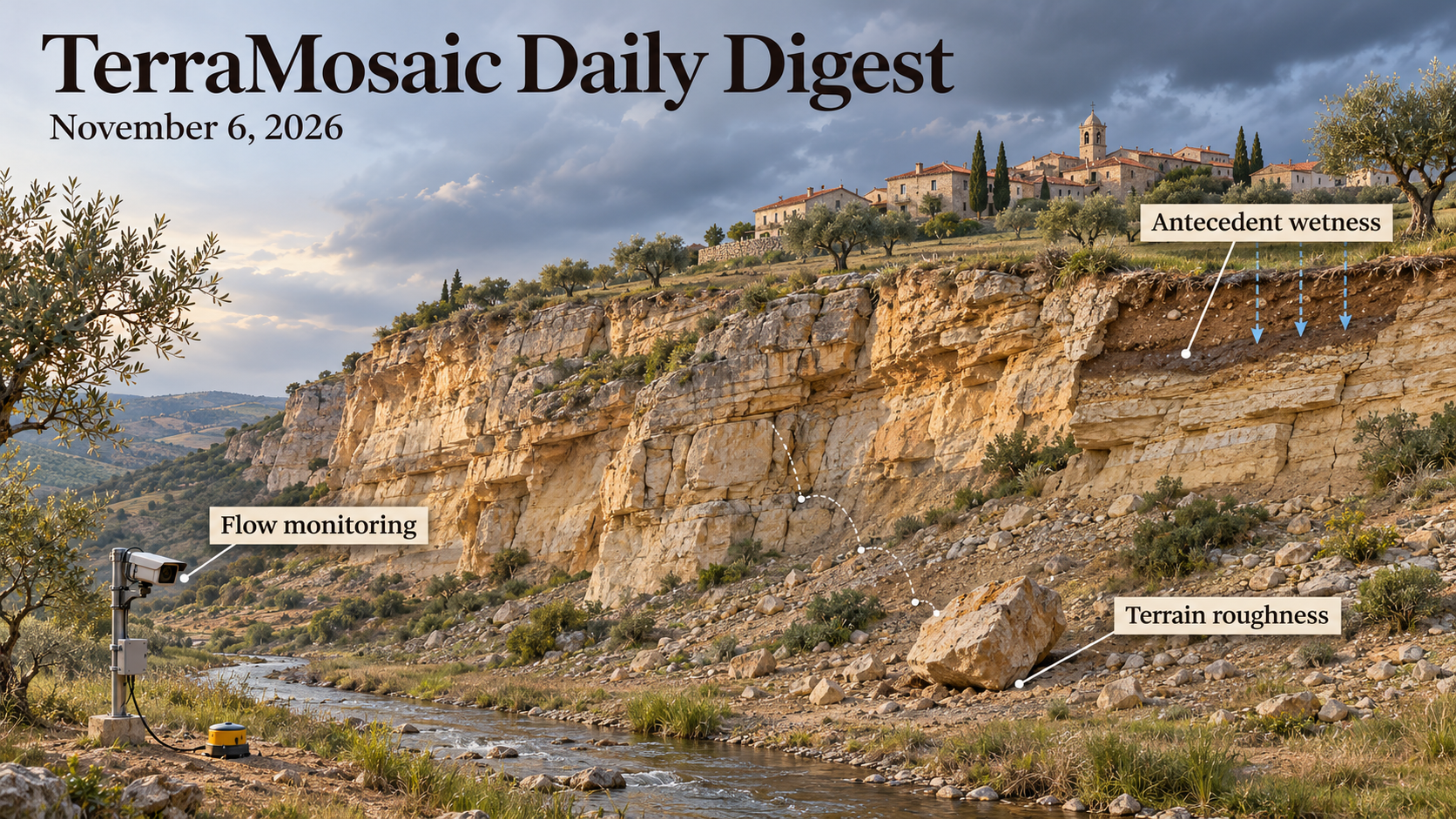
Antecedent wetness is central to this issue’s landslide evidence. The Niscemi comparison examines two damaging episodes that followed different rainfall sequences but both occurred after wet conditions. Its historical series distinguishes rainfall intensity from cumulative totals, while scenario-conditioned projections concern future intensity rather than a direct change in landslide probability. Coral-sand shaking tests provide a complementary result at laboratory scale: higher groundwater can reduce acceleration response while changing stiffness and deformation. A smaller acceleration is not, on its own, a larger safety margin.
Geometry matters at both terrain and material scales. A rockfall formulation separates unresolved contact roughness from the macroscopic DEM and reduces resolution sensitivity at the Chant Sura test slope. It cannot recover large terrain features removed by extreme coarsening. At Lawa, geological reconstruction and three-dimensional stability analysis distinguish local flood erosion at the toe from overall colluvial-slope failure. Together, these studies show why a stability interpretation needs the relevant geometry and state, rather than one bulk indicator.
New observations and calibration methods address different parts of the hazard problem. Central-Chile offshore DAS resolves sedimentary and fault-related contrasts using earthquake recordings and ambient noise. In a small alpine watershed, imagery corrects changing flow width before seismic data support discharge inversion. A separate earthquake-cycle study calibrates timing and slip statistics in synthetic noisy experiments instead of reproducing an exact event sequence. Structural imaging, retrospective flow estimation and model calibration are useful advances with distinct validation targets.
The wider selection examines coastal flooding, ground deformation and extreme heat, alongside methods that improve environmental observations. The heat-wave analysis identifies a three-way circulation–moisture–temperature interaction that is weaker in the evaluated climate simulations. Terrain-error correction, land-cover compositing and hard-constrained water-transport learning address different measurement or modelling limitations. Their value for hazard work depends on retaining those task definitions when interpreting apparent gains.
Key Trends
The common thread is how a measured or modelled quantity is connected to the hazard decision it is intended to support.
- Wetness precedes response: Niscemi’s event histories emphasise antecedent conditions, while coral-sand and monitored loess-slope studies examine where water changes mechanical response. Neither annual rainfall totals nor acceleration amplitude alone describes the full state relevant to instability.
- Resolved scale sets the geometric question: The rockfall model represents unresolved contact roughness without replacing the underlying landform. Lawa’s colluvial case adds three-dimensional geometry and geological constraints before interpreting a local toe disturbance.
- A proxy requires an observation model: Offshore DAS contrasts, seismic discharge signals and aquifer motion are different observables. Interpretation needs the acquisition geometry, auxiliary measurements and physical assumptions that connect each signal to the target process.
- Validation must match the claim: The alpine workflow reports independent-test discharge skill, while earthquake-cycle calibration is assessed in synthetic experiments. The heat-wave study diagnoses interactions and model bias. None of these evaluation designs supplies every kind of operational forecasting evidence.
- Better input products do not eliminate target uncertainty: Stereo-image compensation evaluates directional error profiles; Dynamic World composites balance coverage against class stability; radio-occultation quality depends on retrieval and sampling as well as SNR. Each improvement serves a particular downstream use.
- Risk includes the information people can use: Coastal defence, urban ground-motion screening, emergency-communication accessibility and perceived community resilience concern different steps from physical exposure to response. A design framework, a screening product and an observed reduction in losses require different evidence.
Selected Papers
Rainfall history, groundwater state and terrain geometry lead the landslide studies in this selection. Offshore and mountain-stream observations add constraints at different spatial scales, while earthquake-cycle calibration and heat-wave diagnosis test how process assumptions shape inference. Coastal flooding, ground-motion screening and emergency communication extend the selection from physical response to exposure and preparedness.
1. A geometric terrain roughness model for rockfall simulation in a hard-contact framework
Core Problem: DEM coarsening removes small-scale contact geometry and can distort simulated rock trajectories.
Key Innovation: A hard-contact model adds geometric roughness during contact detection, separately from the macroscopic DEM. Chant Sura comparisons span centimetre-scale terrain and 0.5–20 m grids. Resolution dependence is reduced, but lost large landforms remain a limitation; added roughness should not duplicate scales already resolved by the DEM.
2. Effects of climate change on hydrogeological hazard: the case of the Niscemi landslides (Southern Sicily, Italy)
Core Problem: Similar landslide consequences can follow different rainfall sequences and antecedent moisture states.
Key Innovation: Niscemi's 1997 and 2026 events are examined alongside historical rainfall, ERA5 and scenario-conditioned intensity projections. Both events follow wet antecedent conditions, while rainfall totals and intensity have different trends. The projected increase of up to about 40% concerns scenario-dependent rainfall intensity, not a measured increase in landslide probability or attribution of each event to climate change.
3. Seismic response of slopes in coral sand under groundwater fluctuations: shaking table tests and numerical simulations
Core Problem: Groundwater can change slope stiffness and deformation without increasing every acceleration measure.
Key Innovation: Coral-sand tests and simulations compare groundwater conditions, excess pore pressure and slope response. Higher groundwater is associated with lower acceleration amplification and stiffness, while horizontal and vertical displacement respond differently. Lower acceleration is therefore not evidence of greater slope stability; the findings retain the tested material and loading conditions.
4. Geological evolution and engineering stability of a complex colluvial deposit: a case study from the lawa hydropower station, upper Jinsha River
Core Problem: Back-analysis of heterogeneous colluvium needs geological constraints when direct strength testing is limited.
Key Innovation: Lawa's field stratigraphy, chronological evidence and 2D/3D stability calculations support site-specific strength selection and reinforcement assessment. Preserved sediments constrain formation before 2.55 ka BP; an approximately 4 ka emplacement remains a tentative regional correlation. Baige-flood toe erosion reduces local margins in the model without implying overall failure, and calculated pile safety factors are design checks rather than long-term performance observations.
5. Analysis of internal hydro-thermal evolution and instability risk of loess fill slope under seasonal precipitation and freeze-thaw environment
Core Problem: Seasonal water and temperature changes can concentrate deformation at particular parts of a filled slope.
Key Innovation: Monitoring along the G85 Guyuan section identifies the toe and shoulder as sensitive locations, with wetting, cracking and staged settlement evolution. The supplied abstract reports a positive minimum temperature of about 0.9°C while discussing shallow freezing; that value alone cannot demonstrate freezing. The defensible contribution is the observed hydrothermal and settlement pattern, not a resolved freeze-depth estimate or a universal settlement threshold.
6. Bayesian Calibration of Dynamic Models of Earthquake Sequences Using Observations From Past Large Earthquakes
Core Problem: Sparse earthquake histories constrain model statistics more readily than an exact sequence of event times.
Key Innovation: A Bayesian framework calibrates heterogeneous cycle-model parameters against stationary timing and slip summaries using ensemble Kalman inversion and Gaussian-process-assisted sampling. Synthetic tests include observation noise and detection thresholds. Ergodicity is an assumption supporting this strategy; parameter recovery in those tests is not prospective prediction of the next earthquake.
7. Marine Sediment Imaging With Distributed Acoustic Sensing Offshore Central Chile
Core Problem: Offshore sediment geometry and fault-related contrasts are difficult to resolve with sparse seismic observations.
Key Innovation: More than two years of central-Chile telecom-cable DAS combine earthquake scattering, ambient-noise correlations and resonance analysis, with numerical interpretation checks. The results constrain basin accumulations and fault-related contrasts at sub-kilometre scales. These structural and site-effect constraints do not directly measure submarine-slope failure probability or earthquake recurrence.
8. Fluid‐Controlled Tidal Modulation of Aftershocks Following the 2022 M6.8 Luding Earthquake
Core Problem: Aftershock clustering can conceal weak tidal sensitivity that may constrain fault-zone conditions.
Key Innovation: Bootstrap-based spatial spectral analysis of the 2022 Luding sequence finds tidal sensitivity shifting toward high-slip-zone margins. Stress heterogeneity and fluid redistribution provide a coupled interpretation. Tidal sensitivity is an indirect proxy for near-failure conditions, not a direct pore-pressure measurement, unique proof of fluid pathways or an operational aftershock alarm.
9. A Physically Based Storage‐Runoff Relationship for Steep Hillslopes and Its Application to Distributed Flood Modeling
Core Problem: Simplified hillslope runoff formulations can prevent calibration from using measured hydraulic properties effectively.
Key Innovation: An approximate quasi-steady Darcy solution includes wet-soil percolation and rapid pipe drainage in a storage–runoff relation. Tests in a mountainous Japanese dam basin use observed hydraulic reference values and leave-one-event-out validation. Reduced equifinality and uncertainty apply to that evaluation; the formulation does not establish universal parameters for other hillslopes.
10. High‐Resolution Discharge Inversion in a Small Alpine Watershed: Combining Monitoring Images and Triaxial Seismic Data
Core Problem: Changing flow width over an uneven channel bed complicates discharge monitoring in small alpine catchments.
Key Innovation: Image-based width correction is combined with triaxial seismic data in a Yarlung Tsangpo-region watershed. Independent-test hourly estimates reach mean R² 0.66 and KGE 0.75. The 179 minute-scale detections are suspected flood events; they are not all independently confirmed floods or a demonstrated warning lead time.
11. The November 2023 extreme storm in the Black Sea: metocean drivers, wave modelling, and coastal flooding impacts in the Sochi region
Core Problem: Extreme wavelength, beach width and elevated water level jointly affect coastal flooding consequences.
Key Innovation: The November 2023 Black Sea storm is reconstructed using WAVEWATCH III and empirical run-up relations. Sochi's local significant wave height and the larger central-basin peak are distinct quantities. Narrow beaches and long waves support the overtopping interpretation; the reported roughly $2 million loss is a documented local infrastructure estimate, not the total Black Sea disaster cost.
12. Three-way circulation–soil moisture–temperature feedbacks amplify the most extreme mid-latitudinal heat waves
Core Problem: Interactions among circulation, soil moisture and temperature may become important only in the upper tail of heat extremes.
Key Innovation: An explainable-learning analysis associates three-way interactions with about 10% of peak anomalies across roughly 28% of humid mid-latitude regions, and identifies weaker activation in CMIP6 and CESM2 simulations. The percentages have different denominators. The diagnostic supports a model-bias hypothesis, not an independently isolated intervention effect or a universal temperature threshold.
13. Landslides during extreme rainfall and runoff in a dryland sedimentary landscape: The 2017 Comodoro Rivadavia event, Patagonia
Core Problem: The verified study examines landslides associated with extreme rainfall and runoff during the 2017 Comodoro Rivadavia event.
Key Innovation: The citation establishes a dryland sedimentary-landscape case in Patagonia. A reliable matching abstract was unavailable; failure inventory size, material mechanisms, rainfall thresholds and validation results are not inferred from the title.
14. Effect of soil power law index on submarine slide-pipeline flow mechanisms and forces
Core Problem: Slide rheology can influence the forces exerted on subsea infrastructure.
Key Innovation: The verified title examines the soil power-law index in submarine slide–pipeline flow. A matching abstract was unavailable, so force trends, parameter ranges, experimental validation and design reductions are not reported as established results.
15. Mitigation of tsunami-like solitary wave run-up by submerged trapezoidal dikes: A combined experimental, computational, and data-driven study
Core Problem: Submerged dike geometry is relevant to the run-up of long waves.
Key Innovation: The verified paper combines experimental, computational and data-driven approaches to trapezoidal dikes and tsunami-like solitary waves. Available metadata do not establish attenuation magnitudes or optimal dimensions. Solitary-wave analogues alone would not validate performance for every tsunami waveform or field coastline.
16. Global route freak-wave exposure from physics-guided deep learning correction of ERA5 wave reanalysis maximum wave height
Core Problem: Reanalysis correction can alter estimates of route exposure to extreme waves.
Key Innovation: The verified title describes physics-guided learning applied to ERA5 maximum wave height and global route exposure. A matching abstract was unavailable; independent extreme-event skill, forecast horizon and exceedance probabilities are not inferred from the framework label.
17. Numerical investigation of nonlinear regular wave forces on a wave-facing standing human in shallow water
Core Problem: Wave loading on a standing person is a physical component of coastal exposure.
Key Innovation: The verified study models nonlinear regular-wave forces on a wave-facing standing human in shallow water. Metadata do not establish a safe depth, injury threshold or transfer to irregular storm seas, mobile people or varied body postures.
18. Influence of IG waves on rock armour stability in shallow water
Core Problem: Infragravity waves may matter when evaluating rock-armour stability in shallow water.
Key Innovation: Publisher and DOI metadata confirm the paper and its authors. The available record does not provide a matching abstract, so armour-damage rates, wave conditions and revised design coefficients remain unreported here.
19. Spatiotemporal Evolution and Driving Factors of Desertification in Northern China and Mongolia from 2000 to 2024
Core Problem: Consistent cross-border assessment is needed to compare desertification classes and their associated conditions.
Key Innovation: Six indicators and classification comparisons map northern China and Mongolia during 2000–2024, with overall recovery alongside regional differences. Random-forest OA is reported as 87.79%. XGBoost–SHAP identifies predictive associations with precipitation and livestock density; it does not isolate their causal contributions or directly validate dust-storm forecasts.
20. Flood depth estimation using images of vehicles: A new image retrieval framework with annotated datasets
Core Problem: Visible vehicles can provide reference information for estimating water depth from images.
Key Innovation: The verified citation concerns image retrieval and annotated datasets for flood-depth estimation. A matching abstract was unavailable; dataset size, depth error, vehicle-geometry assumptions and independent deployment performance are not inferred from the title.
21. Tsunami Damage Model Transferability Between Pacific Island Countries
Core Problem: Damage models may change performance when transferred between island countries.
Key Innovation: The verified paper explicitly addresses Pacific-island tsunami damage-model transferability. Without a reliable matching abstract, the supported countries, building classes, direction of transfer bias and recommended correction factors are not stated as findings.
22. A regional screening workflow for urban differential land subsidence risk using the European Ground Motion Service: the Emilia-Romagna region case study (Italy)
Core Problem: Spatially uneven subsidence is relevant to urban screening beyond the mean motion at individual points.
Key Innovation: The verified Emilia-Romagna study uses the European Ground Motion Service in a regional workflow. A matching abstract was unavailable; deformation thresholds, building losses and validation accuracy are not inferred. Motion screening is distinct from a complete damage-risk estimate.
23. Positioning road-level flood sensing for disruption assessment under uncertainties using Bayesian networks
Core Problem: A sensor's value depends on how information changes disruption estimates across connected roads.
Key Innovation: This update to the September 28 title-only entry adds a matching abstract describing a two-layer flood–traffic Bayesian network, value-of-information scoring and greedy placement in a New York expressway case. It outperforms stated placement heuristics on the model's information objective. That objective is not itself observed reduction in flood damage, travel delay or emergency response time.
24. A multi-layer coupled hydrodynamic-agent framework for analysing evacuation-function degradation in flooded metro stations
Core Problem: Flood hydraulics and human movement jointly affect evacuation function.
Key Innovation: The verified title describes a layered hydrodynamic–agent framework for flooded metro stations. A matching abstract was unavailable; evacuation times, behavioural calibration, intervention effectiveness and operational thresholds are not inferred from the coupling description.
25. Unlocking sediment connectivity by the SEDD model and sediment yield measurements at the small experimental SPA2 basin in Sicily (Italy)
Core Problem: Modelled catchment connectivity needs comparison with measured sediment delivery.
Key Innovation: The verified SPA2 Sicily study combines SEDD modelling and sediment-yield measurements. The available metadata do not specify observation duration, model agreement or which connectivity controls were supported, so no quantitative improvement or causal attribution is asserted.
26. Spatial heterogeneity of gully erosion and its differentiated driving factors in the Northeast China black soil region: Insights from gully density and gully area density
Core Problem: Gully density and gully area density describe different aspects of erosional form.
Key Innovation: The verified Northeast China study examines spatial heterogeneity and associated drivers using both measures. A matching abstract was unavailable; driver rankings, erosion rates and the direction of metric contrasts are not inferred from the title.
27. Three-dimensional kinematic limit analysis of finite-width Hoek–Brown rock slopes with distance-dependent excavation disturbance
Core Problem: Finite slope width and spatially varying excavation disturbance affect the domain of a stability calculation.
Key Innovation: The verified paper applies three-dimensional kinematic limit analysis to Hoek–Brown slopes with distance-dependent disturbance. Available metadata do not establish critical factors of safety, disturbance laws or field validation. A limit-analysis result would retain its mechanism and constitutive assumptions.
28. Seasonal and long-term aquifer deformation reveal groundwater stress and incomplete annual recovery in an arid oasis
Core Problem: Seasonal rebound and longer-term aquifer deformation need separate interpretation.
Key Innovation: The verified title reports an arid-oasis study of groundwater stress and incomplete annual recovery. A reliable matching abstract was unavailable; site-specific deformation rates, irreversible compaction and pumping causation are not inferred from that wording alone.
29. Tidal-creek topography regulates storm-driven sediment redistribution and geomorphic change on a macrotidal flat
Core Problem: Tidal-creek topography provides pathways for storm-driven sediment transport.
Key Innovation: The verified study addresses sediment redistribution on a macrotidal flat. A matching abstract was unavailable, so erosion/deposition magnitudes, the sign of individual creek effects and a transferable coastal-protection benefit are not asserted.
30. Analytical method for the 3-D seismic response of a circular tunnel with a non-uniformly imperfect interface
Core Problem: Non-uniform interface conditions can affect three-dimensional seismic response of a circular tunnel.
Key Innovation: The title and DOI are independently matched. The supplied abstract instead describes a rectangular, rigid tunnel under a two-dimensional incident-wave formulation and is not used as evidence for this paper. No numerical findings or validation claims from that mismatched abstract are transferred to this entry.
31. Analytical solution to the scattering of cylindrical SH waves by a semi-circular canyon with an internal circular-arc protrusion
Core Problem: Local protrusions can change the geometry governing seismic-wave scattering.
Key Innovation: The verified title treats cylindrical SH waves at a semi-circular canyon with an internal circular-arc protrusion. Without a matching abstract, amplification factors, frequency dependence and comparisons to field observations remain unreported.
32. A centrifuge-validated numerical investigation of the seismic response of buried nuclear structures on soft soil sites
Core Problem: Soft-soil interaction is relevant to seismic response of buried safety-critical structures.
Key Innovation: The verified title identifies a centrifuge-validated numerical investigation. A matching abstract was unavailable; validation conditions, response errors, constitutive assumptions and design margins cannot be established from the title alone.
33. Designing Accessible Emergency Communication for Human Variation: The Human Variation and Communication Environment (HV-CE) Model
Core Problem: Emergency information must be perceivable, understandable and usable across changing functional needs.
Key Innovation: Eight focus groups with 60 disability-serving participants across Canada inform the HV-CE conceptual model, separating technical from communicative accessibility. This provides a design framework derived from qualitative evidence, not an experimental demonstration of improved evacuation or reduced casualties.
34. Development and validation of the Perceived Community Disaster Resilience Scale
Core Problem: Perceived community resilience needs multidimensional measurement rather than one undifferentiated score.
Key Innovation: A 23-item, five-dimension scale is developed using 1,628 adults in disaster-prone Australian regions. The reported 48.3% variance explained concerns individual resilience within the study. Associations involving empowerment and wellbeing do not demonstrate that one intervention outperforms another or that perceived resilience equals objective disaster performance.
35. Community involvement in wildfire risk reduction through a social contract lens: a case study in Yellowknife, Northwest Territories, Canada
Core Problem: Community participation is part of the social organisation of wildfire-risk reduction.
Key Innovation: The verified Yellowknife paper adopts a social-contract lens. A matching abstract was unavailable; participation outcomes, causal effects on fire losses and preferred governance arrangements are not inferred from the title.
36. Temperature Effects on the Rheological Behavior of Sandy Loessunder Steady and Oscillatory Shear
Core Problem: Temperature and sand fraction may affect loess differently under steady and oscillatory shear.
Key Innovation: Rotational, temperature-scan and oscillatory tests distinguish shear thinning and strain-dependent responses, with peak stress at about 35–40% sand in the tested mixtures. Possible ice bridging remains an interpretation. These rheological observations do not independently validate natural debris-flow initiation or runout.
37. Copula-based probabilistic analysis of soil–water characteristic curve for Korean residual soil deposits
Core Problem: Suction–water-content dependence affects uncertainty in soil-retention representations.
Key Innovation: Copula and marginal-distribution comparisons distinguish Korean SW, SP and SM residual soils, with Frank or Gaussian dependence preferred by group. This supports preliminary SWCC characterisation in the dataset; selection of a dependence model is not field validation of slope failure probability.
38. From Soil Moisture Observations to Governing Flow Equations: What Data‐Driven Equation Discovery Reveals
Core Problem: Sparse moisture measurements may identify equation structure more reliably than every constitutive coefficient.
Key Innovation: Spline-regularised sparse regression recovers a Richards-like three-term structure in numerical experiments and sand/loamy-sand column data. Coefficient functions remain sensitive to forcing and observational coverage. Structural recovery in these tests does not establish unique constitutive laws for heterogeneous field slopes.
39. Incorporating physical guidance into deep learning through hard constraints for water transport modeling in unsaturated zone
Core Problem: Competing soft penalties can leave neural water-transport predictions inconsistent with boundary conditions.
Key Innovation: Transformation functions impose initial and boundary conditions by construction while the Richards equation remains a residual constraint. Numerical tests and a lysimeter evaluation report improved predictions. Hard satisfaction of those conditions is distinct from exact PDE conservation, universal extrapolation or validated landslide forecasting.
40. A Demonstrated Workflow to Efficiently Identify Better Performing Process‐Based Model Configurations
Core Problem: Comparing many process-model configurations after full calibration can be expensive.
Key Innovation: Prior-output distribution comparisons rank 96 PRMS configurations in Colorado, with prior ensembles as small as 25 related to subsequent calibrated performance. Discretisation and forcing choices are influential in that basin. The workflow is a configuration-screening aid, not proof that prior agreement guarantees future flood skill elsewhere.
41. Reconstructing and Understanding Pre‐GRACE Terrestrial Water Storage Changes in a Large Himalayan River Basin via Dual‐Constraint Hydrological Calibration
Core Problem: Streamflow-only calibration may poorly constrain long-term water-storage components.
Key Innovation: A Yarlung Tsangpo–Brahmaputra VIC calibration combines discharge and GRACE storage, then reconstructs monthly anomalies for 1965–2015. Reported trends and glacier contributions are model-derived reconstructions; GRACE-era agreement does not turn pre-GRACE storage or component attribution into direct observations.
42. Desert Lakes Nasser–Toshka: A Novel Site for Satellite Gravimetry Validation
Core Problem: Leakage and auxiliary-model errors limit independent validation of satellite mass changes.
Key Innovation: Lakes Nasser–Toshka provide an altimetry–imagery reference for 2002–2025 gravity comparisons, with reported measurement uncertainties of 7.76, 5.46 and 4.35 Gt across ranging systems. These are benchmark-specific mass uncertainties, not universal spatial accuracy or proof of equal performance over complex groundwater basins.
43. A data-space inversion framework for uncertainty-informed monitoring network design in a regional coupled SWAT–MODFLOW model
Core Problem: Observation value depends on which uncertain groundwater predictions a monitoring network should constrain.
Key Innovation: A coupled SWAT–MODFLOW ensemble supports data-space evaluation of candidate observations in the Great Miami watershed. Streamflow provides broad constraints and head observations add local information. Data-worth rankings retain the conditioned model and ensemble; they are not measured aquifer recovery or guaranteed value under a changed model structure.
44. Exposing spatial data leakage in subsurface machine learning: Establishing spatial validation as a missing standard in fracture porosity prediction
Core Problem: Spatially related training and testing samples can distort apparent subsurface prediction skill.
Key Innovation: The verified fracture-porosity paper explicitly examines spatial leakage and validation. A matching abstract was unavailable; the size of accuracy inflation, preferred split distance and implications for a particular landslide dataset are not inferred from its title.
45. High-Frequency Error Compensation for High-Resolution Satellite Stereo Images with Rough InSAR DSMs
Core Problem: Attitude-related high-frequency distortions can remain after conventional optical stereo adjustment.
Key Innovation: A single ZY-3 02 stereo pair is corrected using directional differences from a coarse InSAR DSM, with an additional AW3D30 comparison. The approximately halved directional profile errors are relative to those reference products and processing choices; they are not centimetric absolute terrain accuracy or measured ground deformation.
46. Wavelet-Constrained Prior-Guided Flow Matching for Remote Sensing Spatiotemporal Fusion
Core Problem: Iterative image generation can be costly when fine spatial and temporal information must be fused.
Key Innovation: A learned prior, flow matching and wavelet-detail constraint reduce reconstruction steps on CIA, LGC and Daxing benchmarks. This is a reconstruction efficiency result under the tested inputs, not independently observed rapid landscape change or a demonstrated disruptive hazard-monitoring system.
47. Compositing Strategies for the Dynamic World Land-Cover Product
Core Problem: Longer observation windows improve coverage but can mix seasonal class changes.
Key Innovation: China-wide 2020 Dynamic World tests compare three compositing rules using 14,042 reference samples. Growing-season mode and cumulative-probability approaches lead different metrics, and annual coverage adds little over the growing season. Stable annual land-cover accuracy does not establish suitability for mapping short-lived disaster changes.
48. Multi-Mission GNSS Radio Occultation at NOAA/STAR: A Review of Commercial Data Quality, Weather and Climate Applications, and an Outlook on Future Priorities
Core Problem: Signal strength, retrieval accuracy, usable coverage and downstream forecast impact are different criteria.
Key Innovation: The NOAA/STAR synthesis compares commercial and public missions along an application-specific quality pathway. Better SNR can improve tracking and penetration without removing multipath, super-refraction or processing biases. Operational weather value and long-term climate-record stability require separate evaluation.
49. Daily global sea surface ageostrophic current dataset from 1993–2023 via physics-informed deep learning
Core Problem: Geostrophic products omit ageostrophic contributions to near-surface transport.
Key Innovation: A 1993–2023 daily 0.25° reconstruction uses momentum constraints and independent mooring comparisons, reporting median velocity error of 0.07 m/s in the stated tropical samples. Grid spacing is not effective feature resolution, and regional validation does not establish basin-wide coastal-current or tsunami prediction skill.
50. Grain-boundary weakening characteristics and its influence on the anisotropic mechanical behavior of columnar ice under thermal degradation
Core Problem: Intergranular weakening can change strength and cracking differently by loading direction.
Key Innovation: A grain-based DEM uses 33 porous-ice specimens for parameter identification and three additional specimens for peak-strength checks. Small reported errors concern those checks; inferred grain-boundary parameters are non-unique model equivalents. River-ice results do not automatically transfer to saline sea ice or field breakup timing.
51. Dynamic Behavior and Microstructural Deterioration of Fissured Sandstone Exposed to Tailings Water
Core Problem: Prolonged water–rock interaction may change strength while an existing fissure still controls failure geometry.
Key Innovation: SHPB, DIC, NMR and microscopy track sandstone after 1–6 months of tailings-water immersion. Dynamic peak stress decreases while porosity increases in the tested specimens. These laboratory changes do not establish slope-scale failure rates or uniquely identify every mineral reaction.
52. A unified hypoplastic model for sands and clays under thermal and mechanical cyclic loading
Core Problem: Thermal and mechanical cycles can generate strain accumulation that one constitutive framework must distinguish.
Key Innovation: Hypo-UTC combines intergranular strain, temperature-dependent stiffness and a thermal stabilisation line for sands and clays, compared against seven literature element tests. Long-term strain accumulation and low-effective-stress response retain quantitative limitations. Element-test agreement is distinct from validated field settlement or slope-failure prediction.